
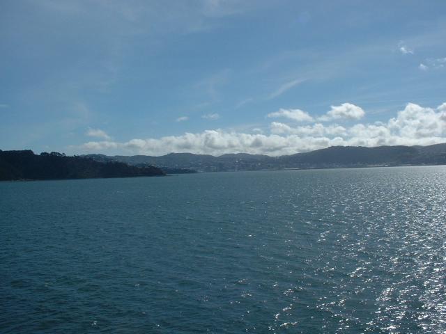
Jen and Ken visited New Zealand from 12 October 2002 to 29 October 2002 on our honeymoon. October is early spring in New Zealand, a couple of weeks before the start of the summer tourist season. We arrived in Auckland at the end of a twelve hour flight from Los Angeles. Our first meal in New Zealand, after a morning nap at the hotel, was in a wonderful place called Food Alley. If I worked in Auckland, I would eat lunch there every day. We rented a car to go visit the Bay of Plenty and the Bay of Islands regions on the north island. We then flew to Christchurch on the south island and rented another car. On the south island, we visited the Canterbury, Otago, Central Otago, Westland, and Marlborough regions. We crossed the Cook Strait on the ferry, rented a third car in Wellington, and drove through the Wanganui-Manawatu, Taranaki, and Waikato regions on the way back to Auckland. If we go back to New Zealand, we will have to visit Southland and Hawke's Bay, Milford Sound, and more of the south island mountains.
Aotearoa is the Maori name for the country. It means "Land of the Long White Cloud."
These photos are copyright © 2002-2003 Kenneth E. Harker and Jennifer Harker. All rights reserved.
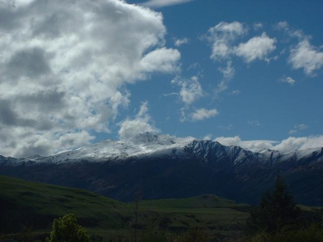
Rotorua is sometimes referred to as the birthplace of New Zealand tourism. Bath houses were built over the natural hot springs near Lake Rotorua, and the town became famous for "taking the cure" in the waters. There are still several spas for bathing in the hot springs. The entire town smells of sulfur.
|
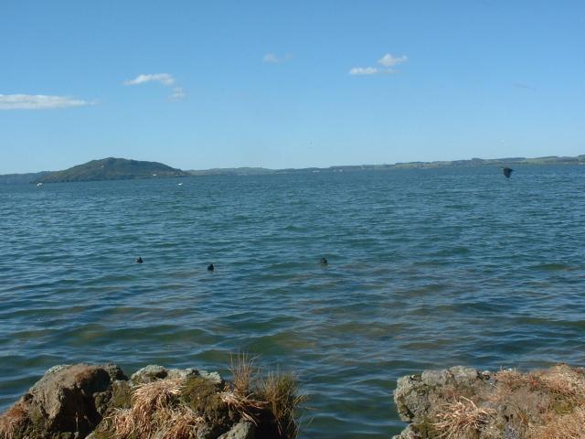
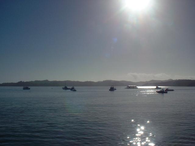
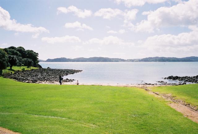
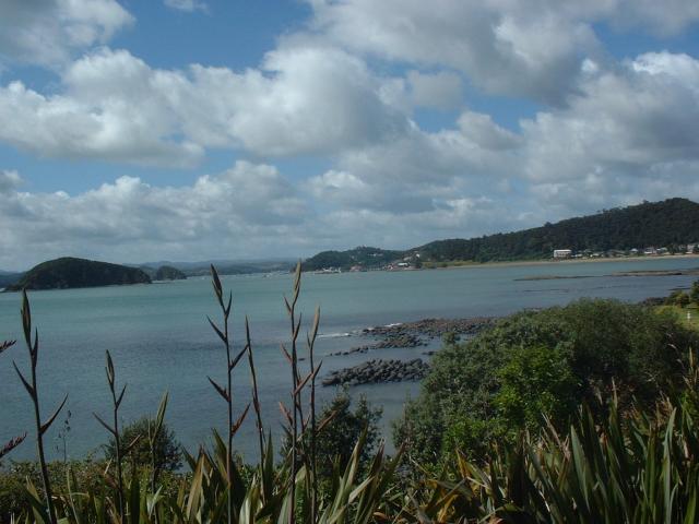
Lake Rotorua in the Bay of Plenty region of the north island. Much of the area around the town of Rotorua is volcanically active. |
|
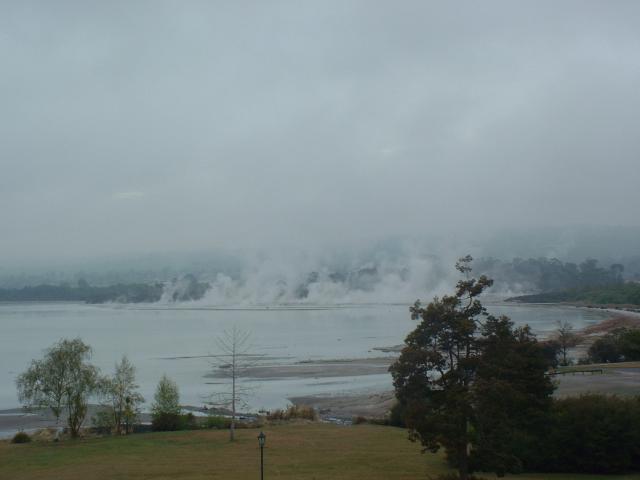
This was the view from our hotel room in Rotorua. The lake and much of the surrounding hills are full of natural hot springs. |
|
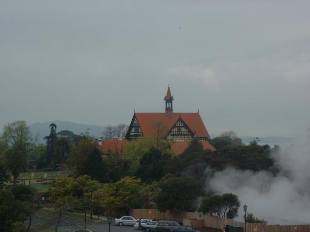
This is the old Rotorua Bath House, used for much of the late 19th and early 20th centuries as a medical facility and tourist destination. There are still several hot spring spas in Rotorua, but the old Bath House is now a museum. |
|
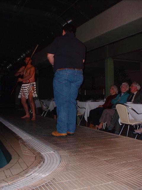
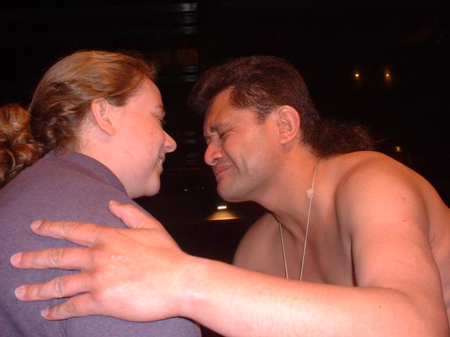
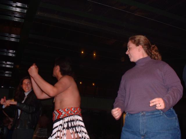
We attended a Maori cultural dance performance in Rotorua. Ken was chosen to represent the guests in accepting the greeting of the chief warrior. |
|
There was a lot of audience participation in the performance. A traditional Maori greeting is the touching of noses. |
|
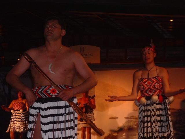
This was one of the dances performed by the troupe. |
|
Jen got to be one of the audience members who joined the dancers in one of their dances. |
|
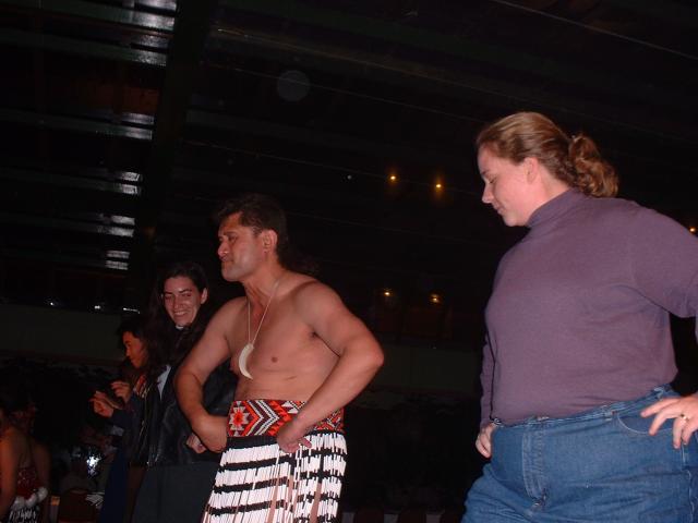
Several other audience members joined in the fun as well. |
|
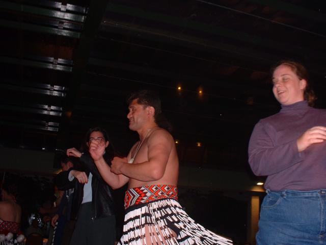
Jen decided to improvise and do her own thing. |
|
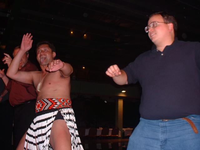
Ken was one of the audience members who got to try out the haka dance. The Haka is a traditional Maori dance of challenge, used both in battle and in ceremonial greeting. |
|
Part of the haka is sticking out the tongue. This is seen as a gesture of intimidation. |
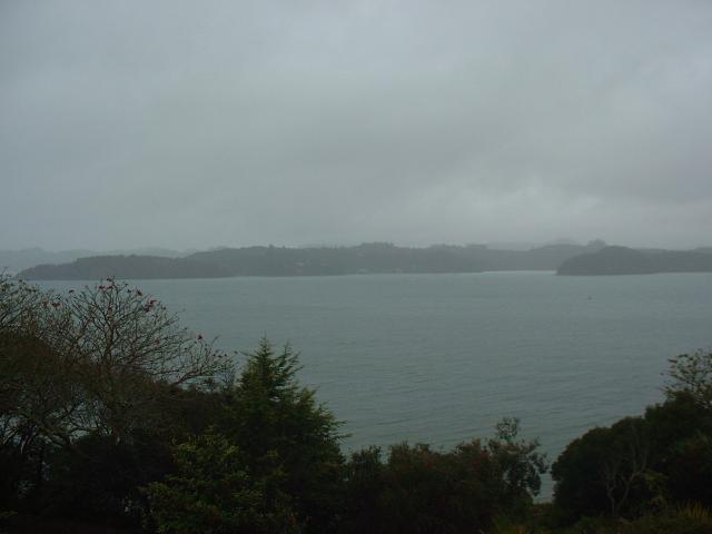
We arrived at Paihia in the rain and checked into our hotel. On the way, we experienced the novelty of driving across a one-lane bridge that traversed one of the many creeks and rivers that flow into the Bay of Islands. Little did we know that later on in our vacation, while traveling in the south island, we would be going over one-lane bridges all the time on major highways!
 |
The view from our hotel room in Paihia, in the Bay of Islands in the Northland region. It was raining. |
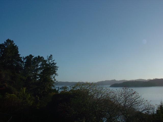 |
The view from our balcony in a slightly different direction. This was taken the next morning, when the weather had cleared up. You cannot see it from either of these photos, but our hotel did have a path through the brush down to the beach. |
 |
This was the view from the deck of Hansen's Cafe, a small restaurant near the Paihia waterfront, at which we ate breakfast. |
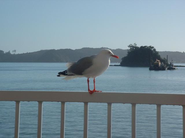 |
One of the local sea gulls. This one seemed to be the dominant gull in the area, as it chased off several interlopers that got too close to our table and food. |
The Waitangi National Trust was one of Ken's favorite places to visit in New Zealand. The day we visited was very bright and sunny, which was a pleasant change from the rain of the day before.
 |
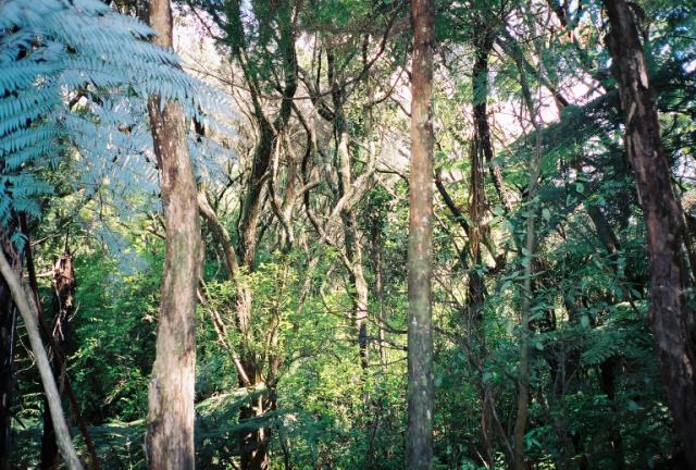
We visited the Waitangi National Trust in the Bay of Islands. Waitangi is the site where Maori and British leaders signed the Treaty of Waitangi in 1840, which established the Maori as British subjects and the islands as a British crown colony. Parts of the site are maintained as natural forest with walking paths. |
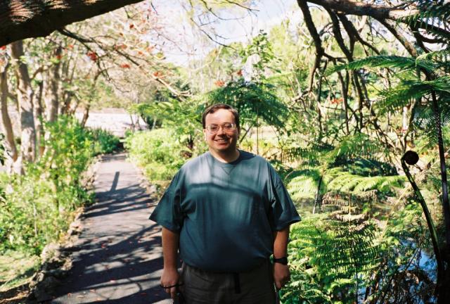 |
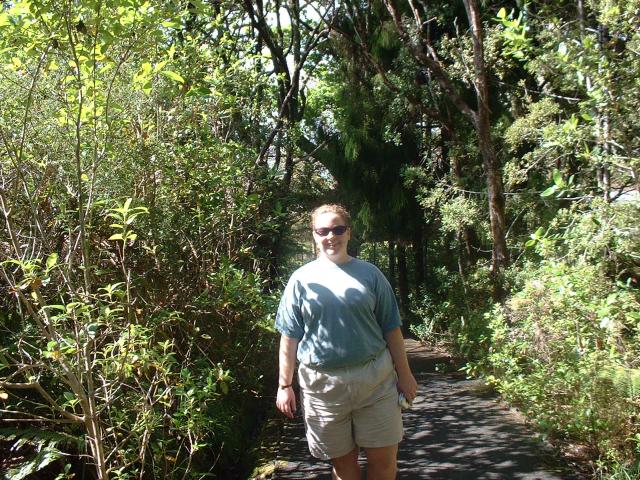
Ken, along one of the paths at the Waitangi National Trust in Northland. |
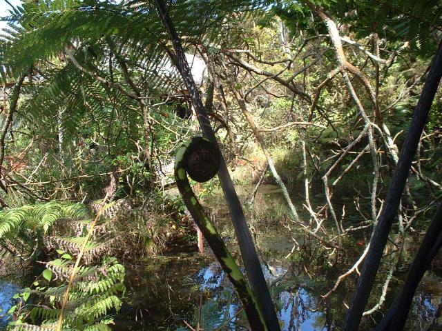 |
New Zealand is covered in ferns, which grow in all parts of the north and south islands. This particular fern had a head with about the same diameter as a basketball. You can also see ferns behind it that grow into small trees. Fern root was once a staple of the Maori diet. |
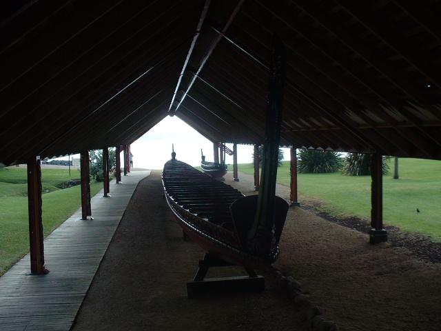 |
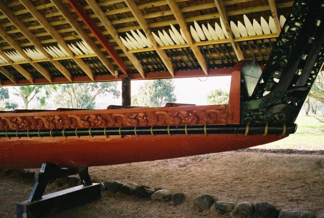
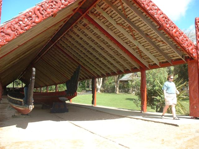
This is a ceremonial waka taua, or dugout canoe, that was built to celebrate the centenary of the Waitangi Treaty. It can hold 135 people at a time. |
 |
Behind where Jen was taking this photograph of the waka taua, the stump of one of the kauri trees used for its construction was on display. It was eight meters in diameter. |
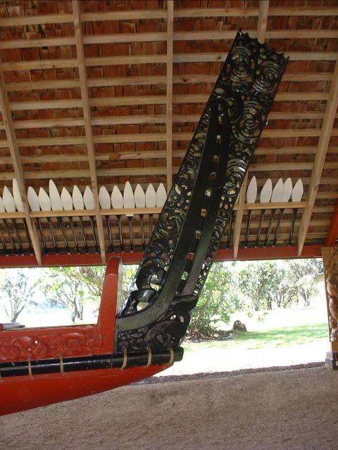 |
The rear of the canoe is decorated in traditional Maori wood carvings. You can see some of the paddles made for use with this canoe stored overhead. |
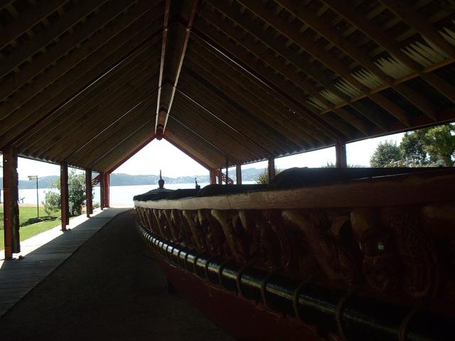 |
The waka itself is made from the trunks of three large kauri trees, a hardwood tree native to New Zealand. The gunwales of the canoe are also made from kauri wood, attached to the main hull. The largest kauri trees can have straight trunks seven meters in diameter or larger, and often their lowest branches are twenty meters or more off the ground. |
 |
The roof over the waka taua was fairly simple in construction, wooden shingles over a simple wooden frame. The wooden supports on which the canoe rests are actually capable of rolling on a track down to the water's edge. |
 |
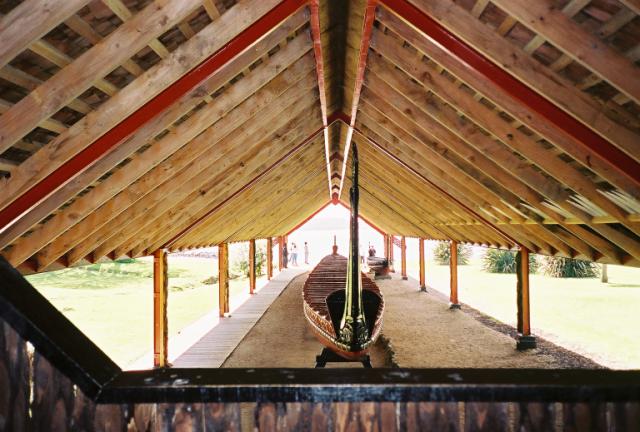
The front of the waka is also decorated with traditional Maori wood carvings. To the left of the main canoe is a smaller waka made from a single kauri trunk. |
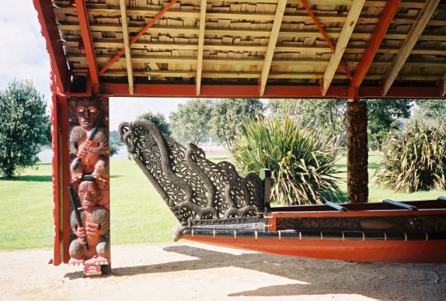 |
The figures carved into the support post for the protective roof were of the same style as the carved figures in Maori meeting houses. |
 |
You can see the track that the waka taua can be rolled down to the beach. It hasn't been used much and one of the rails is mostly overgrown. |
 |
A view across the lawn at Waitangi. On the other side of this cove is the town of Paihia. |
 |
Jen, on the beach at Waitangi. This is the beach on which the first British Resident of the islands, James Busby, came ashore to represent the official interests of Great Britain in 1832. |
 |
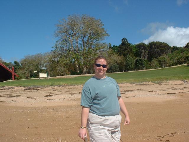
Ken, at the beach at Waitangi. It was a nice sunny day. |
 |
A view of Paihia and the Bay of Islands from atop a small bluff at Waitangi. |
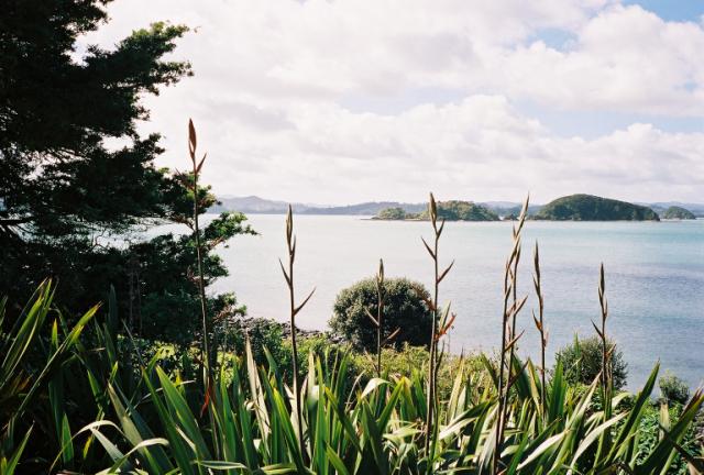 |
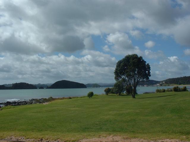
The Bay of Islands region was already lush and green even in early spring. |
 |
A Norfolk pine that was planted by Mrs. Busby, well over 150 years ago. This species of pine is native to Norfolk Island, a small island in the Tasman Sea between New Zealand and Australia. |
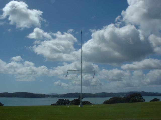 |
This large mast was erected in the middle of the lawn in front of the house of the British Resident, to mark the site where the Treaty of Waitangi was signed in 1840. |
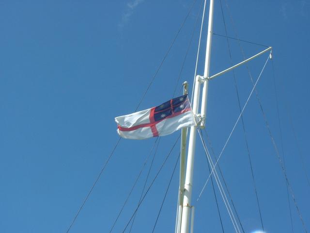 |
The design of this flag was the one used by the Maori at the Treaty of Waitangi deliberation and signing. The Flag of the United Tribes of New Zealand was designed by the Church Missionary Society, but was ratified by a majority vote of Maori chiefs in 1834. |
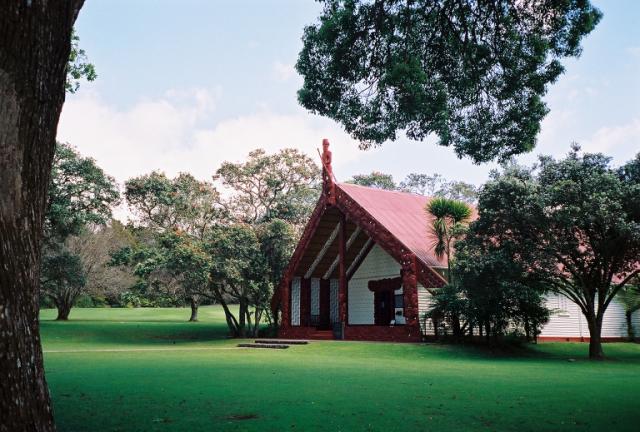 |
This is Whare Runanga, a carved Maori meeting house that represents all the tribes of Aotearoa. It was built to help celebrate the centenary of the Treaty of Waitangi. |
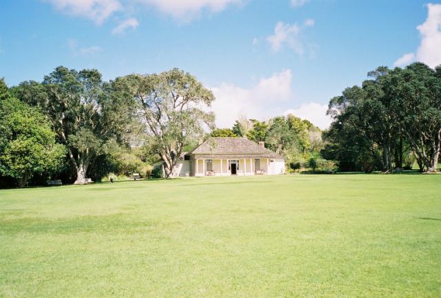 |
The Treaty House at Waitangi. Originally called The Residency, this was the home of British Resident James Busby and his family from 1833 to 1844. Originally a three-room cottage, the house had been expanded several times. |
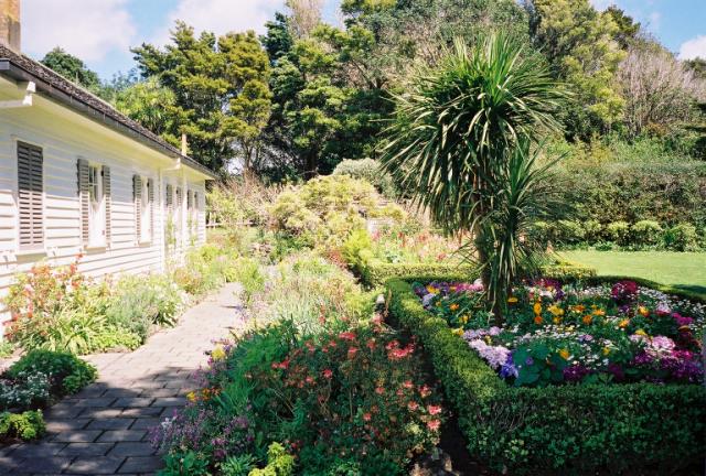 |
Some of the gardens around the Treaty House. These are flower gardens. In the 1830's and 1840's, there would have been vegetable gardens as well. |
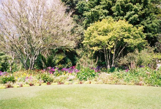 |
The gardens and lawn behind the Treaty House. |
 |
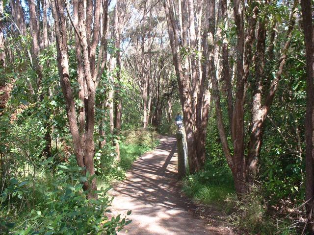
Several acres of land between the Treaty House and the Visitor's Center are now maintained as native forest, with several walking paths. |
Most of our photos from around the Kerikeri region are of Rainbow Falls. The actual town of Kerikeri itself wasn't that interesting, photographically at least, but the shopping around it was worth the trip. We found a nice pottery factory/store called Keriblue where Jen got a bowl with a penguin design on it, we found a specialty liqueur store called Bishops Wood Estate Boutique Distillery that made macadamia nut liqueur, and we visited several artists' galleries. We purchased a small print by a local Kerikeri artist, Cecilia Russell.
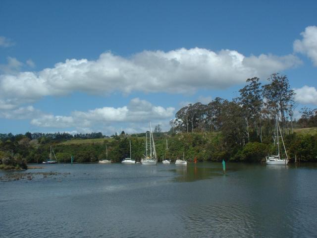 |
Several sailboats at anchor in the Kerikeri Inlet. Ken was standing on a small one-lane bridge atop a dam in the river when he took this photo. There are a lot of sailboats in New Zealand. |
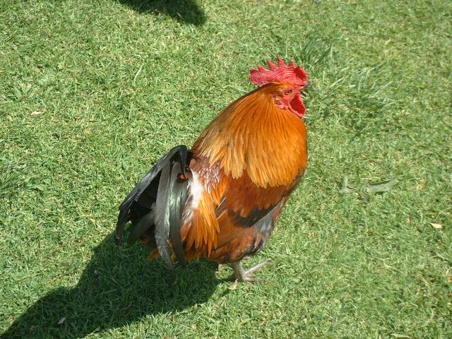 |
A free-range chicken we happened to spot near the Kerikeri Inlet. |
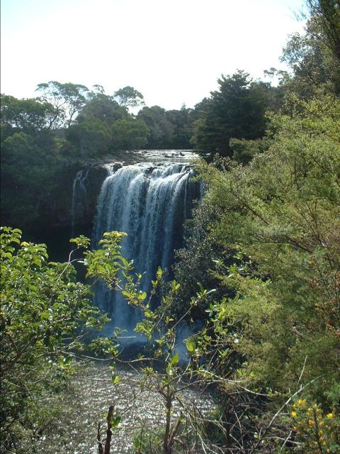 |
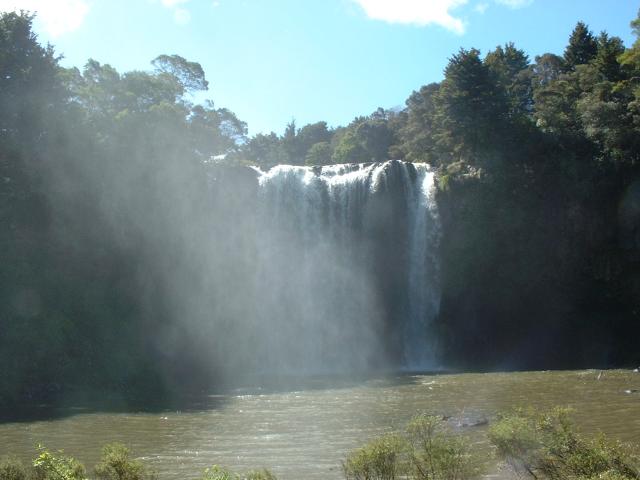
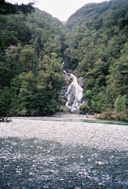
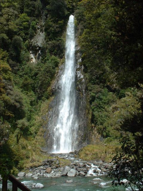
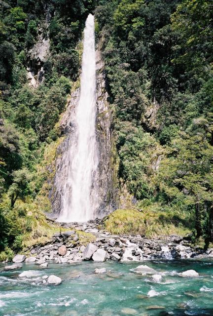
Rainbow Falls, near Kerikeri. These falls were upstream from where the sailboats were anchored. |
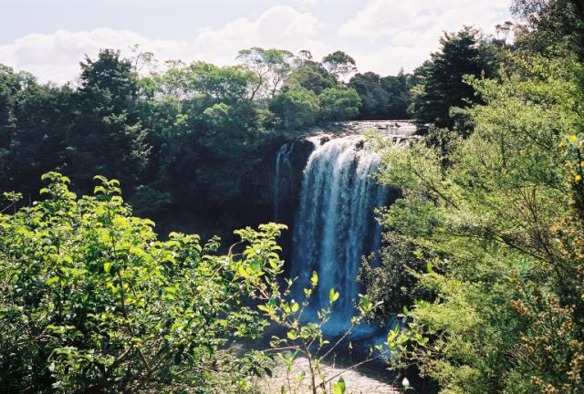 |
The first view of Rainbow Falls that you get from the nature trail. |
 |
The roar of the falls was almost too loud to talk with one another at this viewpoint. |
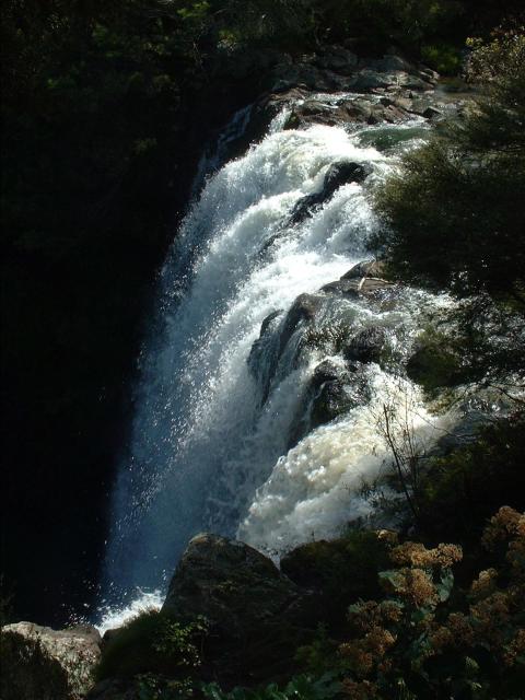 |
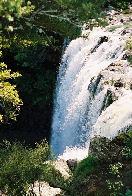
The falls are 27 meters high, and were fairly impressive when seen up close. |
 |
Jen, walking on ahead down the forest path between two of the viewpoints over the falls. |
 |
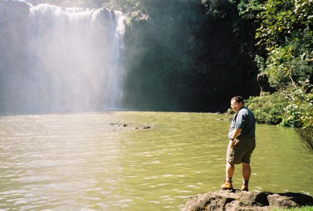
Rainbow Falls from the path that goes by the pool below. We were over 100 meters away, and the spray was still soaking us. |
 |
Jen, admiring the falls. From here, the path followed the river to the Pacific Ocean, about a two-hour walk, according to the signs. |
 |
The water in the pool below the falls was really churned up, very green and dark, and looked to have lots of sizable tree branches and other junk in it. While there were no signs forbidding swimming, It probably would not be enjoyable. |
 |
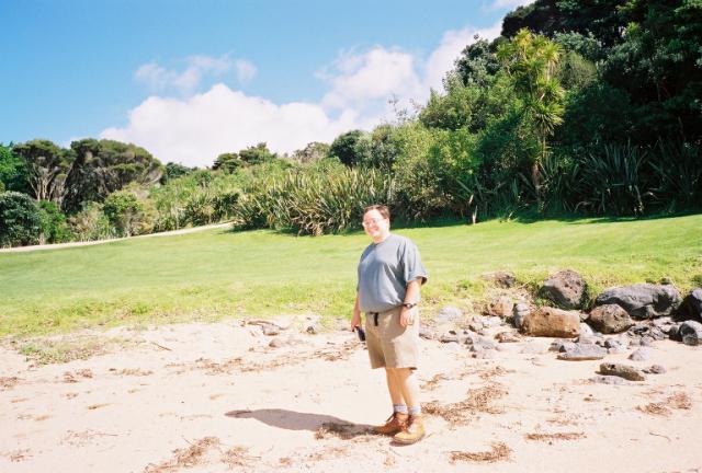
Ken, getting a closer look at the pool below the falls. |
Christchurch, on the south island, was our favorite city in New Zealand. To get there, we took a domestic plane flight from Auckland. It took about an hour and a half on a Boeing 737, and would have been fantastic scenery if there had not been solid cloud cover the entire way. Christchurch's downtown is very neat and seems very cosmopolitan for a city its size, with lots of ethnic restaurants and pedestrian shopping and such. We went to a rugby match: Canterbury vs. Auckland in the NPC semifinals (the National Provincial Championship - the domestic professional rugby union in New Zealand.) Unfortunately, the home team lost (Auckland went on the next weekend to beat Waikato for the championship.) Jade Stadium was only about two-thirds full, but it had by far the most efficient food vendors of any stadium we have ever been to before. Half-time in NPC rugby matches is only ten minutes long, so people need to get their beer and snacks in a hurry. The next morning, we visited the International Antarctic Center, near the airport, which was a nice small museum/attraction right across the street from the campuses of the U.S. Antarctic Program and the New Zealand Antarctic Program.
 |
In Christchurch, in the Canterbury region of the south island, we visited the International Antarctic Center, near the airport. The Christchurch Airport is the air travel gateway to McMurdo Base (U.S.) and Scott Base (N.Z.) on the Antarctic coastline. One of the attractions at the International Antarctic Center is a ride in a Hägglund tracked vehicle over terrain that simulates Antarctic conditions. |
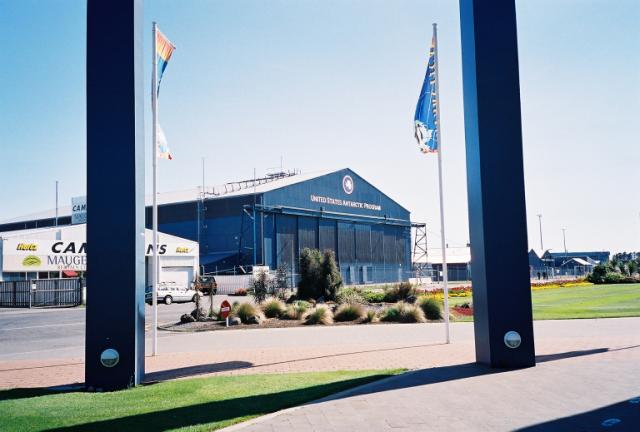 |
The United States Antarctic Program base at Christchurch Airport. We ate lunch at a small cafe across the street, along with several U.S. servicemen and civilian personnel. |
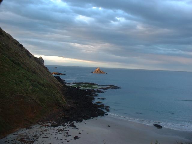
Dunedin is the fourth largest city in New Zealand, and evidently has a strong Scottish heritage. The town hall flies three flags: the flag of New Zealand, the flag of Great Britain, and the flag of Scotland. We stayed in a small bed and breakfast, and got up very early to go see penguins.
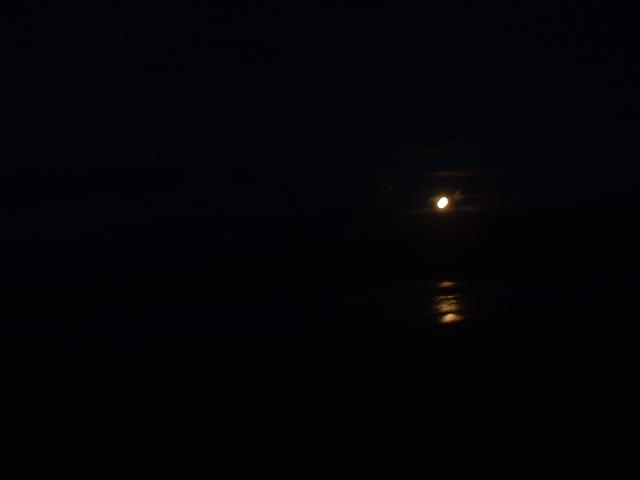 |
This is the moon rising over Sandfly Beach on the Pacific Ocean side of the Otago Peninsula, near Dunedin, just before dawn. We took a sunrise penguin walk with a penguin expert from Nature Guides Otago. |
 |
Our guide brought us to a bird-watching blind in one of the dunes that overlooked this hill. Yellow-eyed penguins nest near the top of the hill and walk down to the beach each morning to go fishing. Our guide visits the beach about 200 mornings a year. |
 |
We watched twenty or so penguins slowly wander down the hill over the course of an hour. Some jumped into the ocean early. The rest had to wait for a while after two sea lions showed up and began to play in the surf just by the rocks. Eventually, the sea lions crawled onto the beach to sleep, and all the penguins but this one made a mad dash to the water, about an hour later than normal. This one was still unsure about the situation. |
 |
A view of the same penguin from the same place without the camera zoom. |
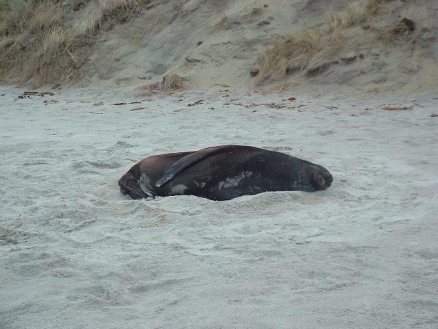 |
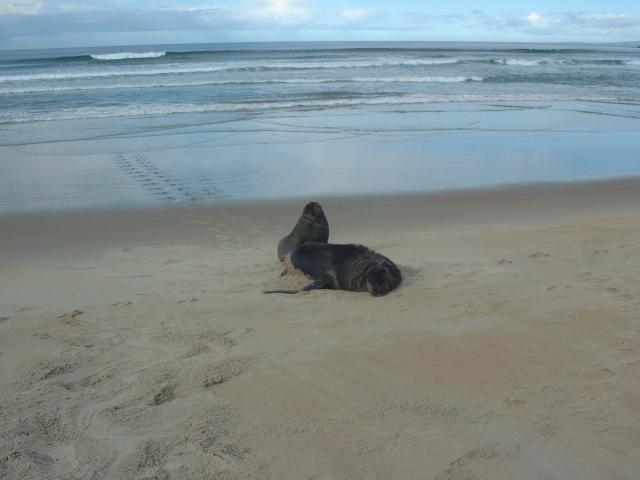
An adult juvenile sea lion, resting on the beach. This was one of the pair that we saw playing in the surf. |
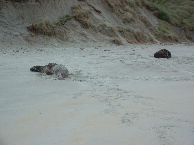 |
The two sea lions that caused the penguins so much concern. We also saw a fur seal out on the rocks, far too far away to photograph. The penguins don't mind fur seals, but adult female sea lions on the Otago Peninsula eat about one penguin a month. |
 |
As we walked along the beach back to the van, we discovered another pair of sea lions sleeping in the sand. We couldn't see them from our blind. No wonder the penguins were upset! |
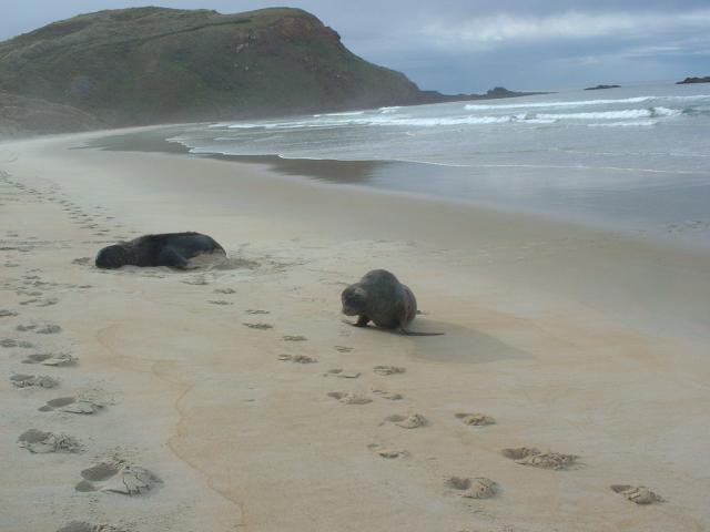 |
This one began to chase us for a few meters before it decided we had been run off. |
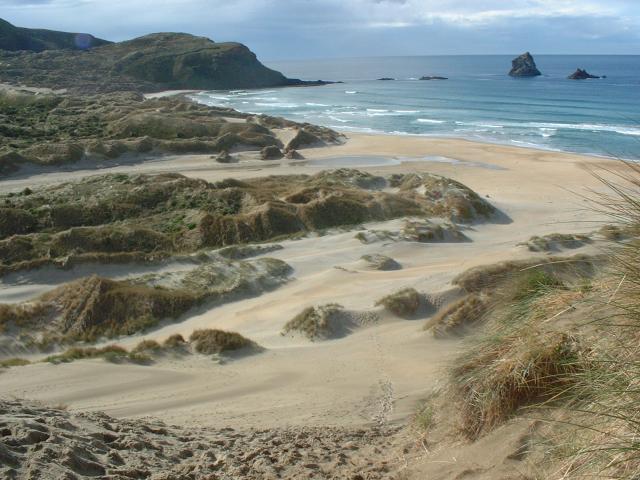 |
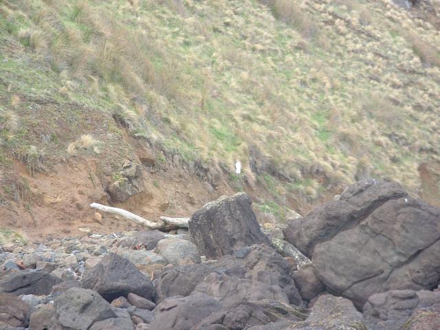
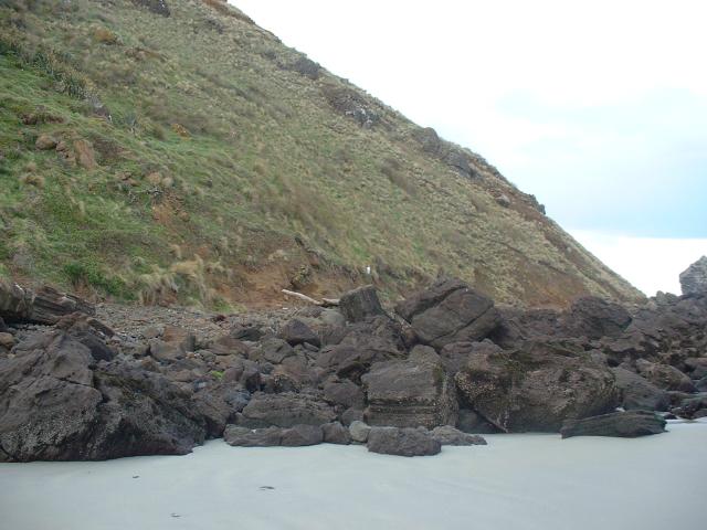
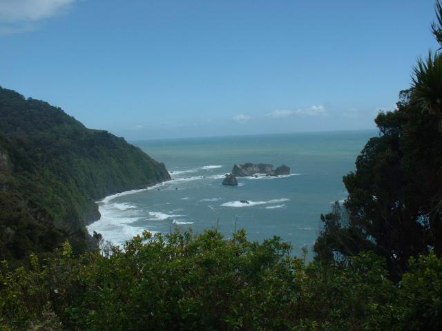
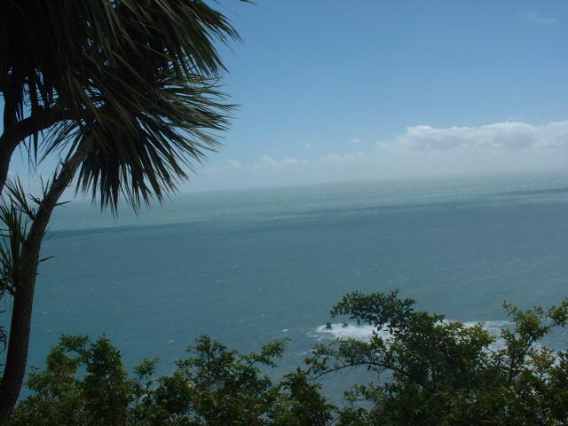
A view of Sandfly Beach from the trail that heads back to the car-park. To get to the beach, you have to walk down the 30 meter high face of the sand dune, which is easy. Getting back up the dune, on the other hand, is less easy. |
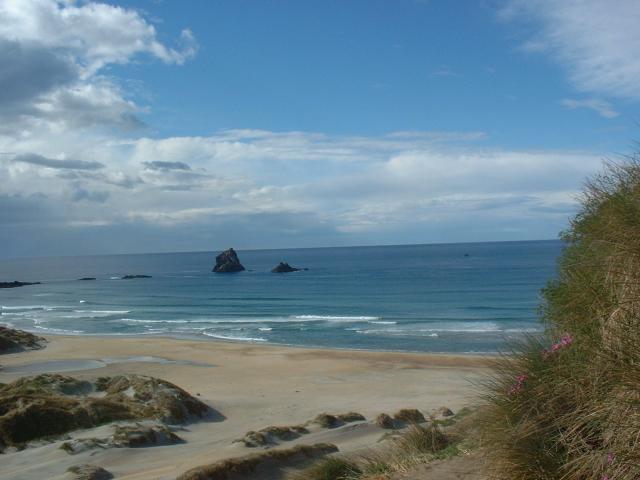 |
Another view of the Pacific Ocean at Sandfly Beach on the Otago Peninsula of the south island of New Zealand. |
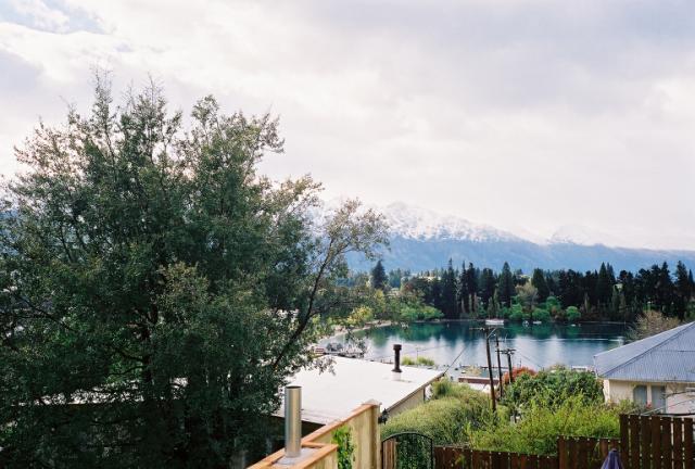
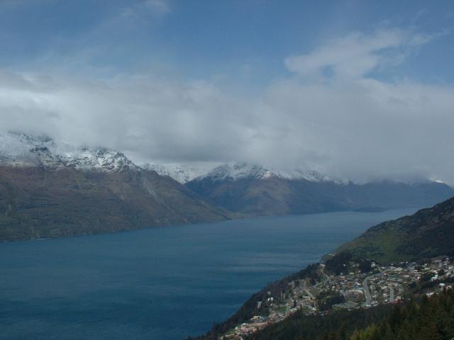
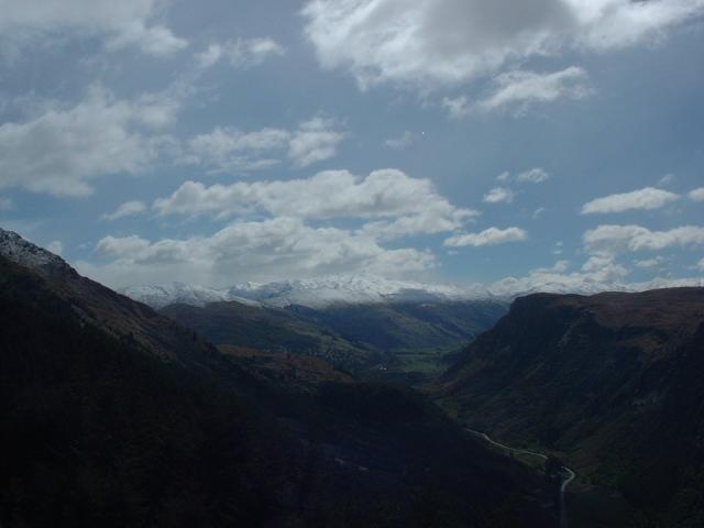
We visited Queenstown, which is in the center of the south island. It's just east of the Southern Alps, so it's kind of a dry alpine semi-desert environment. It's on a huge glacial lake, though. We were going to take a small plane - boat - small plane tour of Milford Sound from there, but the weather in Milford was too bad for the plane flight into the small airport in the rain forest there. Instead, we visited the Kiwi house, took in the scenery from a nearby mountaintop, and went on a winery tour. The region seems to make very good Pinot Noir. One of the best meals we had in New Zealand was at a restaurant on the wharf in Queenstown called The 19th. Their sirloin steak and rack of lamb were excellent. The service, like much of New Zealand dining, was a little less spectacular.
 |
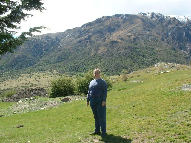
Jen, on the road near our hotel in Queenstown in Central Otago, south island. The mountain range behind her is known as The Remarkables. |
 |
The street our hotel was on was about a five minute walk from the waterfront. |
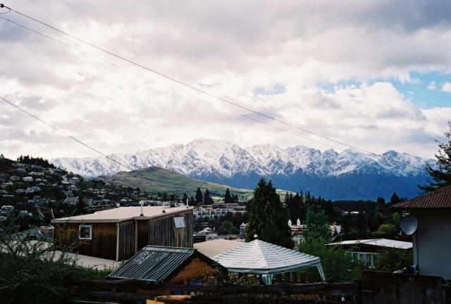 |
The town of Queenstown is surrounded by gorgeous snow-capped mountains. |
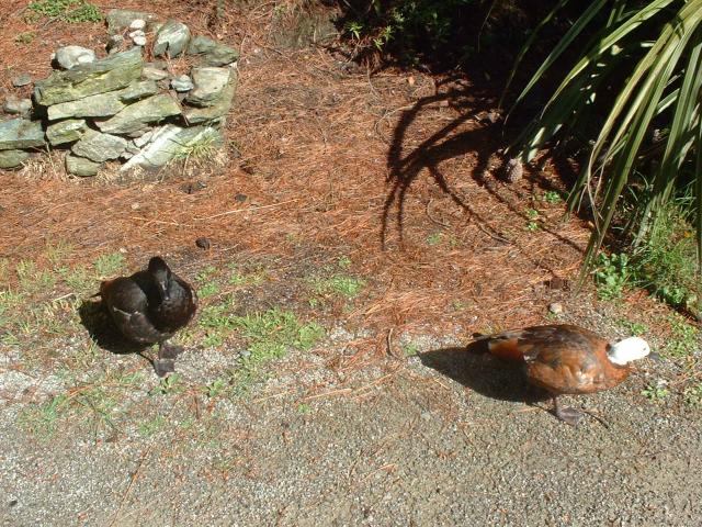 |
We visited the Kiwi and Birdlife Park in Queenstown. The kiwi is a nocturnal bird, and rare in the wild, so most visitors to New Zealand see kiwis in zoos and bird sanctuaries. Because the kiwis are in a dark building, taking photos of them is too hard. Plus, there were all these signs that said "No Photos!" These are some native New Zealand species of ducks. |
 |
We took a ride up the Skyline Gondola to a small mountaintop behind the town. |
 |
This is a view of Lake Wakatipu and the Cecil and Walter Peaks from the viewing platform at the top of Skyline Gondola in Queenstown. |
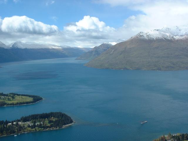 |
Lake Wakatipu is a glacial lake, and is a little over 50 kilometers long, but no more than a couple of kilometers wide, at most. You can see the TSS Earnslaw leaving Queenstown. |
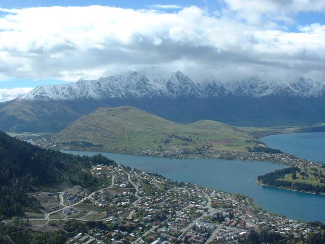 |
The town of Queenstown, with The Remarkables in the background. |
 |
Lake Wakatipu was very blue and clean-looking. |
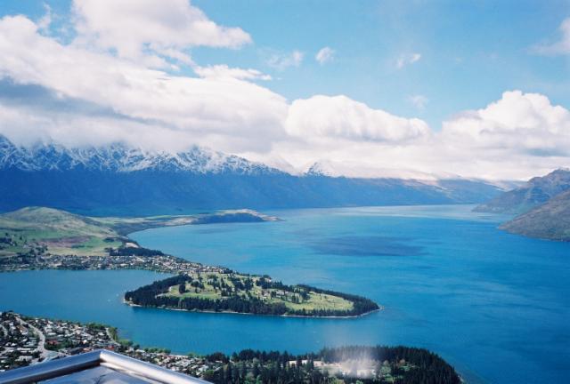 |
The peninsula across from the center of Queenstown is a public park. We never had the time to visit it. |
 |
Jen, on the viewing platform above Queenstown. It was raining a little bit in the morning. |
 |
A view of the Harris Mountains from the Skyline viewing platform above Queenstown. |
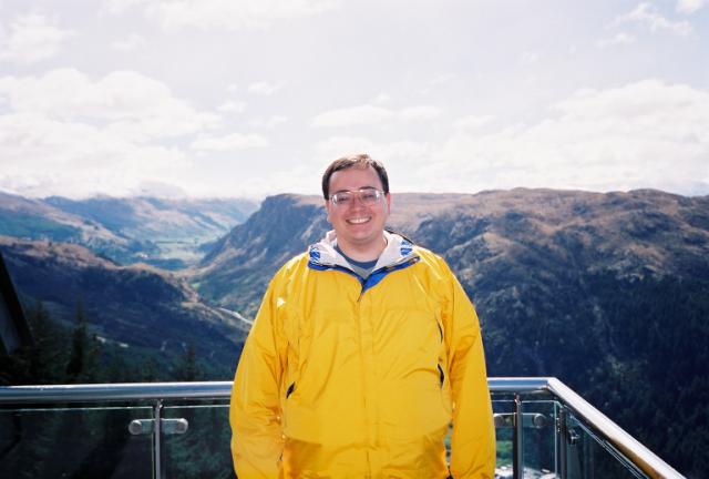 |
Ken, on the observation deck. |
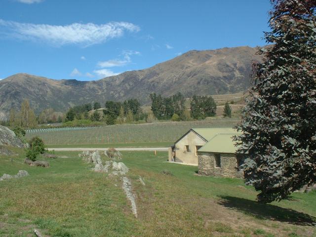
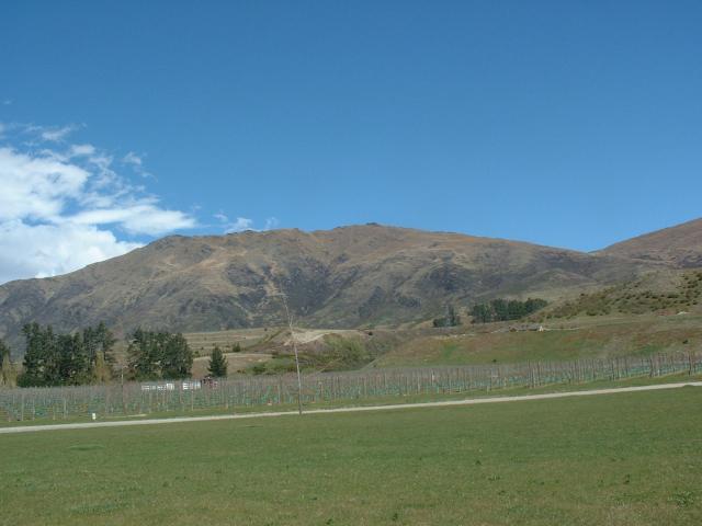
We visited four wineries in the Gibbston Valley, and had lunch after our first tasting. All of these wineries are established on land that used to be exclusively used for sheep grazing. Central Otago is the last region in New Zealand to develop a wine industry, and all of these vineyards are less than ten years old.
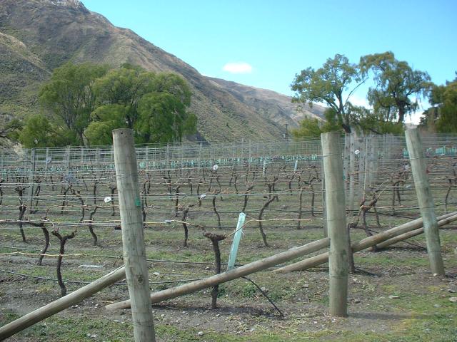 |
We took a winery tour instead of our planned tour of Milford Sound, as weather conditions on the west coast canceled our small plane flight. The grapevines aren't very far along yet in early spring. This was a field at Gibbston Valley Winery, located in the Gibbston Valley, about half an hour drive east of Queenstown. Central Otago is becoming known for Pinot Noir, and Gibbston Valley's 2001 Reserve Pinot Noir was named "Champion Pinot Noir of the World" at the 2001 International Wine Challenge in London. |
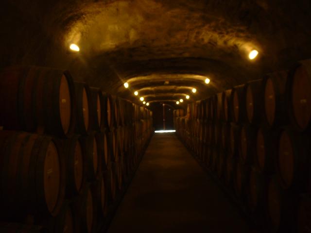 |
Gibbston Valley Winery has built their own wine cave into the hillside behind their compound. We had all our wine tasting in the cave, where we learned that Gibbston Valley has been using screw tops instead of corks, for all its wines, including the Reserve Pinot Noir. |
 |
A view of some of the wine making hardware at Gibbston Valley. This winery has embraced the tourist trade, recently building a "cheesery" and accompanying store, and a full (and quite good, we ate lunch there) restaurant on site. |
 |
A view of the Central Otago landscape behind the Peregrine Wines tasting house. A new venture has been established between Peregrine and Wentworth Estates to sell large lots of land for private estate homes. For thirty years, each landowner is required to maintain half of their land as a vineyard. Wentworth Estates plants and harvests the grapes, Peregrine Wines makes wine out of them, and the owners get to keep a certain percentage of the bottles produced for themselves. |
 |
The tasting house at Peregrine Wines is a restored sheep station, and well over 100 years old. Until recently, the valley had been almost exclusively sheep pasture. |
 |
A view of the vineyards at Peregrine Wines. |
 |
Another fantastic view from the Peregrine Wines estate. |
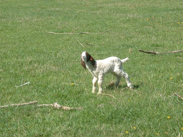 |
This was a small baby goat in a field next door to Waitiri Creek Wines. It decided to greet our tour bus. We were told that the goats were raised for their meat. They did not belong to the winery. |
 |
Waitiri Creek Wines bought a 112 year old church, transported it to their site in the Gibbston Valley, and refurbished it for use as a wine tasting facility. They were also in the process of building a small cafe for serving lunch on the site, which was probably open the week after we visited. What was most interesting about Waitiri Creek is that their Chardonnays, while all good, were strikingly different from vintage to vintage. We tasted the 1999, 2000, and 2001 vintages. |
 |
A view near Hay's Lake Wines, a very new enterprise with what appears to be enormous investment behind it. Jen really liked their sparkling Pinot Gris. Just a week after we visited, the winery changed its name to Rockburn Wines. |
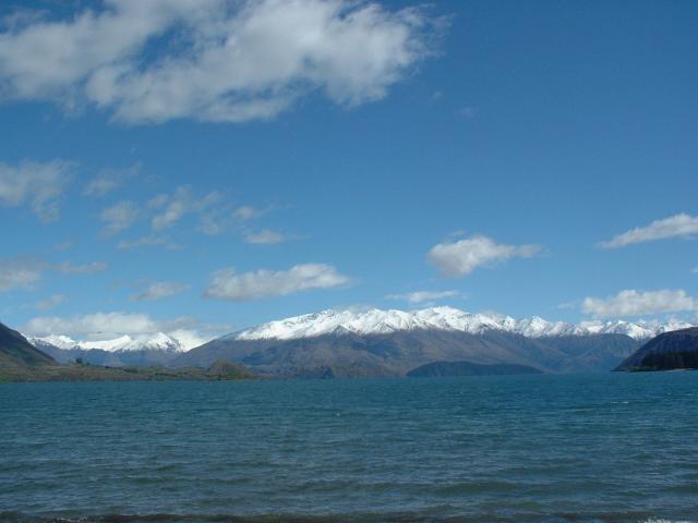
We didn't actually stop and spend any time at the glacial lakes between Lake Wakatipu and the Haast Pass over the Southern Alps. Our road took us by Lake Wanaka and Lake Hawea. The views were spectacular, and surprisingly there were very few boats on the water.
 |
This photo was taken from a pebble beach on Lake Wanaka, near the outskirts of the town of Wanaka, in Central Otago. Lake Wanaka is another long, skinny glacial lake with really blue water. |
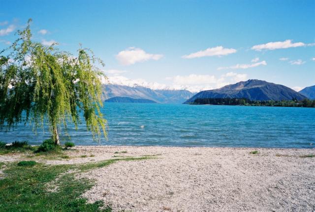 |
This beach, on Lake Wanaka, was mostly pebbles. The water looked very cold. |
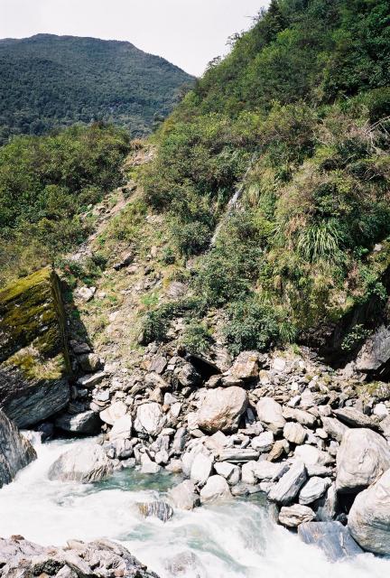
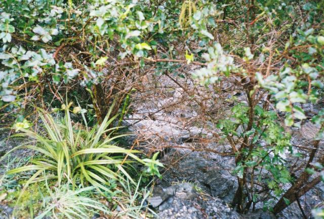
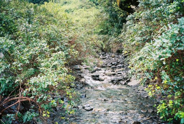
The whole west coast of the southern island is rain forest. Cold, wet rain forest. The drive from Haast Pass to the Tasman Sea was very picturesque, with lots of waterfalls.
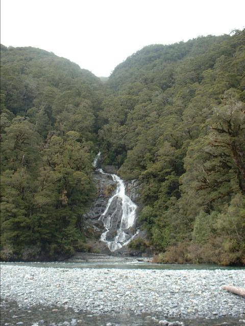 |
Fantail Falls, a small waterfall near the highway, just west of Haast Pass. Haast Pass crosses the Southern Alps, which separate Otago and Canterbury regions from the Westland region. Westland is a temperate rain forest, and quite a contrast from the dry alpine climate of Central Otago. Most of the trees are kamahi. |
 |
The river bed is mostly gravel. The river's exact course within the gravel bed probably changes with each spring flood. |
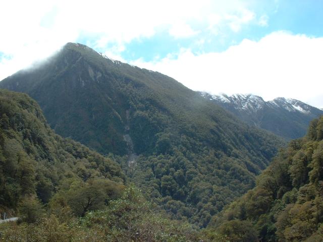 |
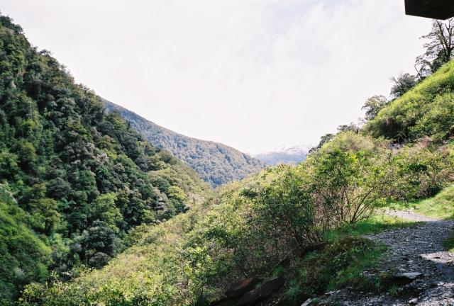
Rain forest-covered mountains near the Haast Pass. Haast Pass was named after a German explorer, Julius von Haast, the second European to traverse it. It is the lowest altitude pass in the Southern Alps. |
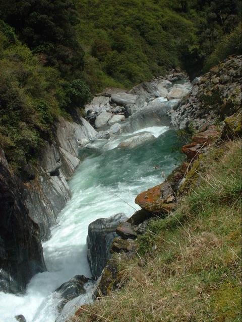 |
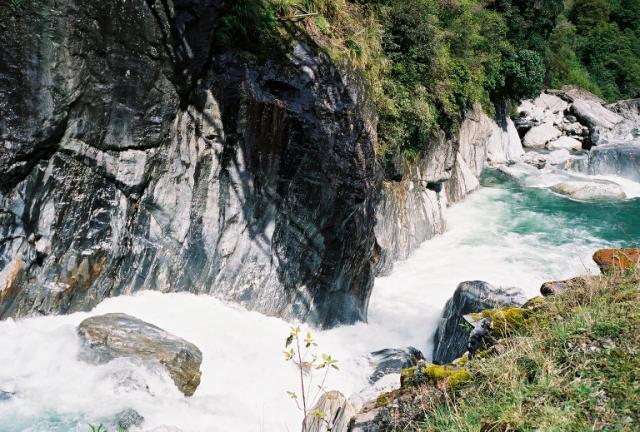
Rapids at the Gates of Haast, where the Haast River valley narrows dramatically. The highway actually bridges directly over the most intense portion of the rapids, and was among the last kilometers of the roadway to be constructed. |
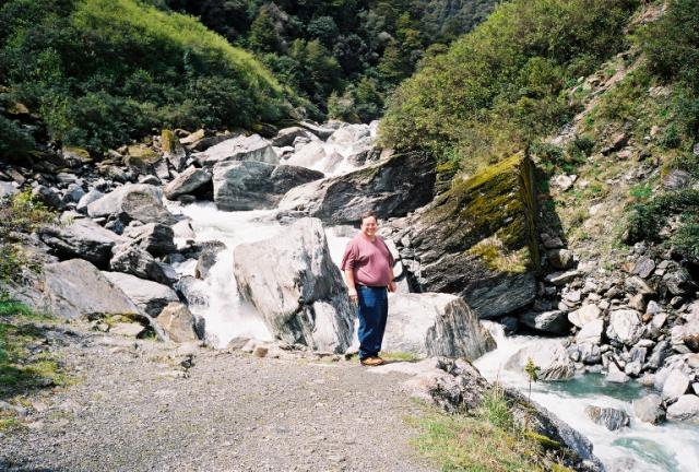 |
Ken, at the Gates of Haast. |
 |
Notice how some of the vegetation grows almost horizontally out from the gorge's sheer walls. |
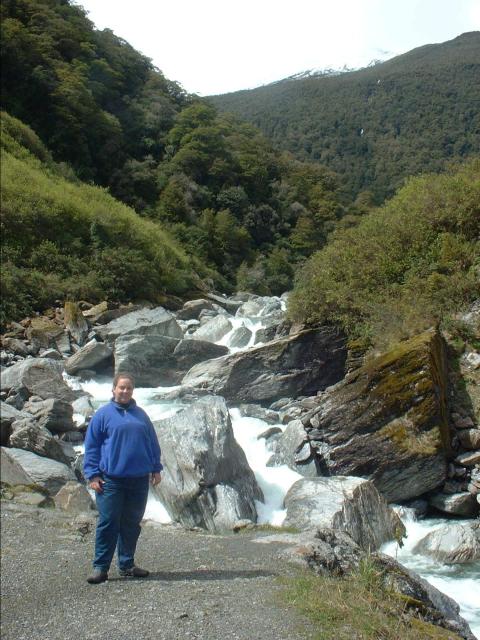 |
Jen, standing in front of the Gates of Haast rapids. |
 |
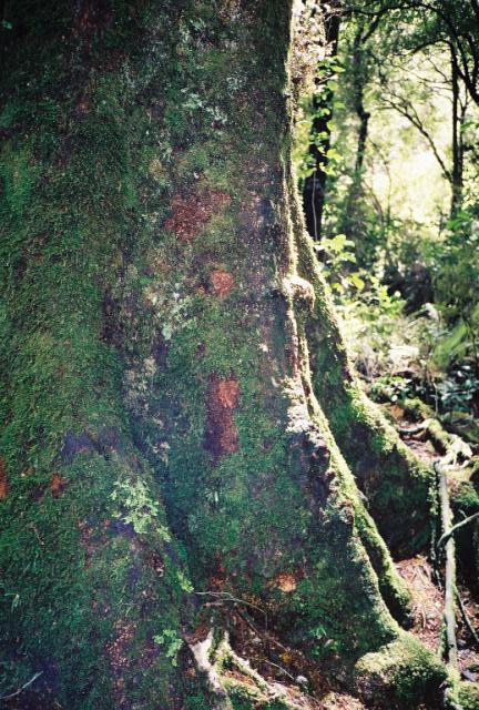
Some lichen and moss on the rocks in the rain forest. |
 |
A view up the Haast River valley. |
 |
A view downstream, with a view of one of the Southern Alps to the south of the Haast Pass. |
 |
Another waterfall near the highway from Haast Pass down to the town of Haast on the west coast. |
 |
The Haast River looks very clean and clear this far up in the mountains. |
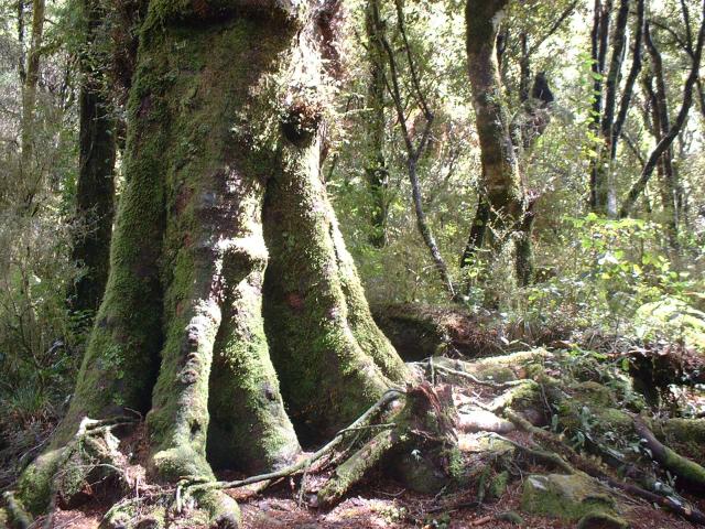 |
The forests of Westland are filled with gigantic trees, huge ferns, and moss everywhere. |
 |
Typical undergrowth of the Haast River valley. There were ferns everywhere. |
 |
The trunk of a giant tree, covered in moss. |
 |
Knight's Point offers spectacular views of the Tasman Sea on the west coast of New Zealand's south island. It is also the place where the highway connecting Westland with Otago was completed. |
 |
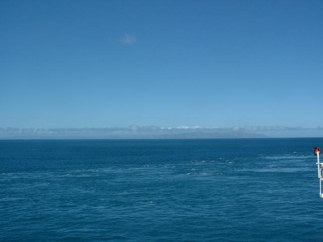
The Tasman Sea was much heavier than the Pacific Ocean was any of the times we saw it on our trip. |
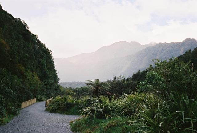
The drive into Franz Josef township went through a construction zone. Apparently, the southern end of town, and the highway, are both below flood plain level, and the highway was being raised several meters. A few days after we had left, some government official in Westland made national news by declaring that the southern end of the town was in such imminent danger from flash flooding that it would have to be vacated in six months for safety reasons. We actually stayed in a hotel on the north edge of town. Not that the town is all that big. One other street parallels the highway for about four blocks. One of our best meals we had in New Zealand was at a restaurant in Franz Josef township called Beeches. Ken had a west coast venison dish, and Jen had roast lamb shank.
 |
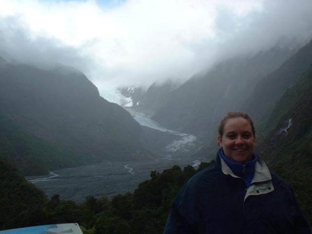
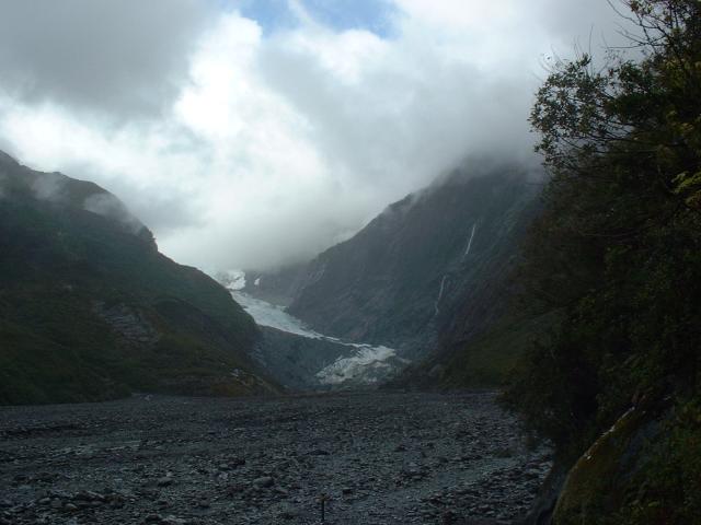
Up this valley is the Franz Josef Glacier, one of two well-known glaciers on the western side of the Southern Alps. It was raining the day we visited it, which meant we couldn't take a helicopter tour. |
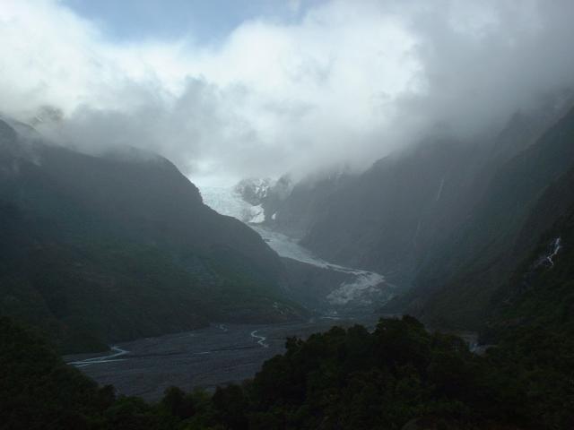 |
The Franz Josef Glacier. 300 years ago, the hill we were standing on was covered in glacial ice. The glacier has retreated extensively, but has begun advancing in recent years. Just 30 years ago, the front end of the glacier couldn't even be seen from this location. |
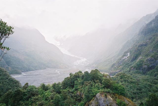 |
We were standing on an observation platform atop a small hill that overlooked the Waiho River valley. The head of the Waiho River is the melt-water coming from the Franz Josef Glacier. |
 |
Jen, getting moderately wet in the rain. Of course, it is a rain forest. |
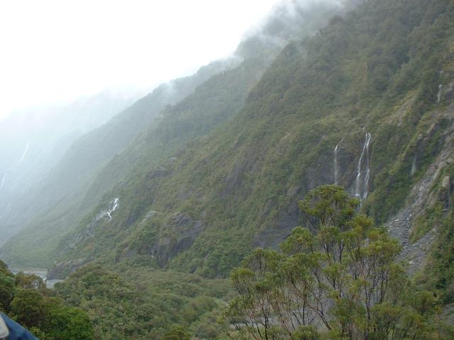 |
One of the hillsides in the valley. It rains so much that tiny waterfalls and springs are just everywhere. You can still tell how the glacier carved the sides of the valley only a couple of centuries ago. |
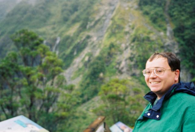 |
Ken, getting a little bit wet near the Franz Josef Glacier. |
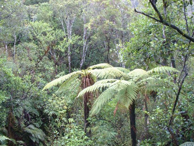 |
Some fern trees along one of the nature paths in the park at the Franz Josef Glacier. |
 |
A view of the glacier from the edge of the Waiho River stream-bed below it. This rubble strewn field floods regularly, and is generally hazardous. This was as close as we got to the glacier. |
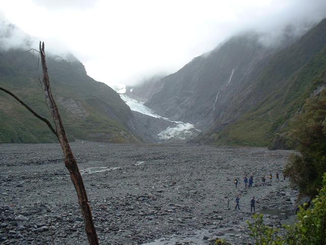 |
The line of people on the river bed are returning from a guided hike up the glacier. They all carried hand axes, dry bags, food, water, and other necessary gear. They were all very, very wet. |
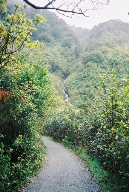 |
The path that led from the car-park to the glacier. |
 |
The path crossed a small tributary stream that flowed directly into the Waiho River. |
 |
Some of the rain forest vegetation near the Franz Josef Glacier. |
 |
A small creek in the Waiho River valley. |
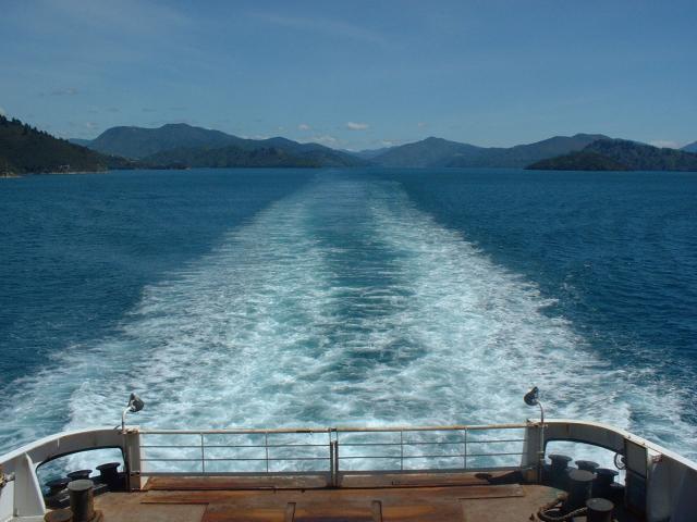
We spent the morning before the ferry ride in the Marlborough Region, visiting wineries, but we didn't actually bring a camera with us. We visited the Saint Clair, Cloudy Bay, Allan Scott, and Drylands Estate wineries. We ate a fantastic lunch at the Allan Scott winery: Jen has the salmon salad and Ken had steamed green lip mussels. The Marlborough region is known for Sauvignon Blanc, but they seem to also produce good Rieslings. The drive to Picton became something of a mad dash near the end, as we had to turn in the rental car and check baggage before boarding the ferry.
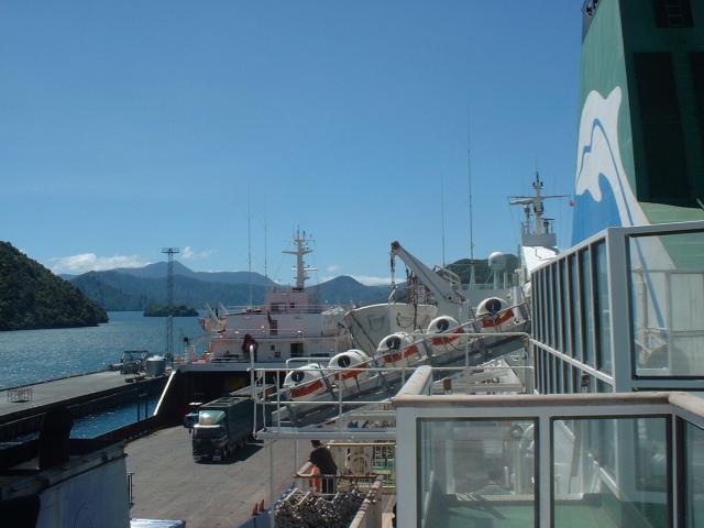 |
We took the Interislander ferry from the terminal in Picton, on the south island, to the terminal in Wellington, on the north island. Most of the trip, we sat on the open top deck, taking in the views. The ship had a movie theater on board, but we chose to enjoy the scenery instead. |
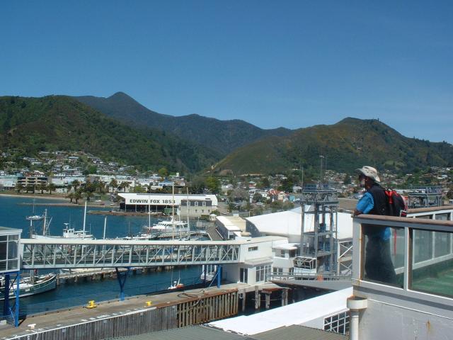 |
The town of Picton is remarkably small for such a critical transportation hub. |
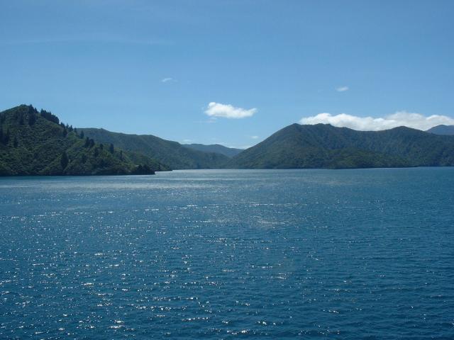 |
The ferry travels much of the length of Queen Charlotte Sound before hitting the Cook Strait. We had a really sunny afternoon with very calm conditions. |
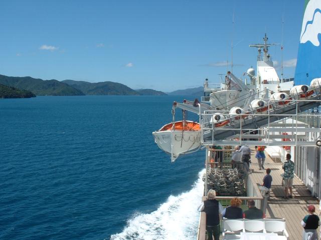 |
Right after departing Picton, the crew begins to lower the lifeboats... |
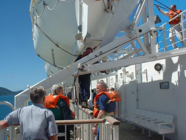 |
...but it turns out that it was only a drill. The crew members are the ones wearing life vests. Should it concern anyone that they are all grey-haired old men? |
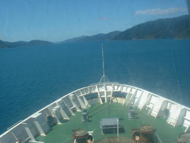 |
The view from this window was as close as you could get to the front of the ship. |
 |
A view of the stern. The ship was easily the largest ferry I've ever been on. It had at least one deck for rail cars, a deck for automobiles, and three passenger decks. In total, it had eight decks. |
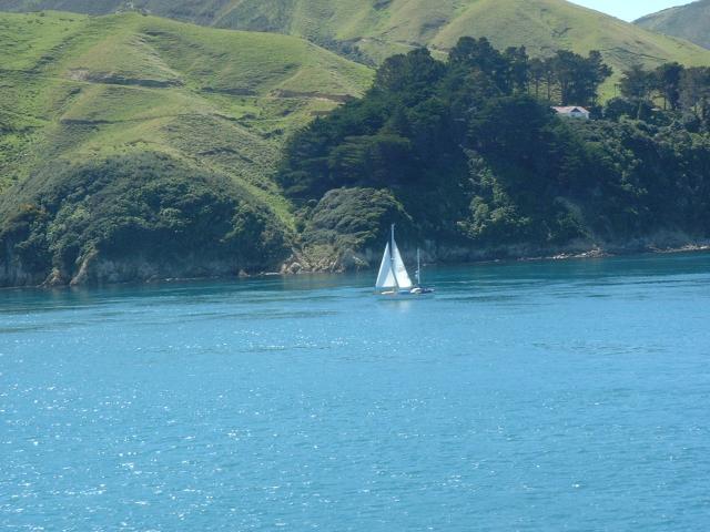 |
There are sailboats everywhere in New Zealand. |
 |
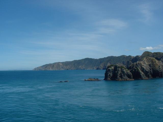
Just passing the point of land that separates Queen Charlotte Sound from the Cook Strait. |
 |
The view south along the east coast of the south island and Cloudy Bay. Cloudy Bay is where the city of Blenheim is located. We stayed the previous night in Blenheim. It is also the name of one of the Marlborough wineries we visited. |
 |
The north island, as viewed from the mouth of Queen Charlotte Sound. There was no point on the ferry trip that we were beyond sight of land. |
 |
Another Interislander ferry, the Aratere ("Quick Path,") heading from Wellington to Picton. It was a slightly different design than our ship, but the same general size. Our ship was the Arahura ("Pathway to Dawn.") |
 |
A view of Wellington as we entered the harbor area. We arrived a little under three hours after departure from Picton. |
It took us a few more days to get back to Auckland from Wellington.
Wellington, as a city, wasn't especially fun. The streets are hideously narrow, far too many people were dressed far too formally and seemed far too serious. We did enjoy the Museum of New Zealand Te Papa Tongarewa. Ken spent all his time going through the Maori and British historical exhibits, and Jen spent much of her time in the art galleries. Since we spent most of our time in the museum, we didn't take any photos.
We also visited two other regions of New Zealand between Wellington and Auckland. In Wanganui, we each entered an orienteering meet that took place in the Harakeke forest, mostly pine trees in a very sandy soil, with lots of ferns (we even bought southern hemisphere compasses for the event!) We briefly visited Taranaki and New Plymouth, but because it was raining the whole time, we didn't take any photos. The highlight of the day there was watching the NPC finals on television. The drive to Auckland the next day took us through the Waikato, where we visited the Waitomo Glowworm Caves. We also got stuck in traffic.
We spent several days in central Auckland. Auckland is about one quarter of the entire population of New Zealand, and actually has a downtown area slightly bigger than Austin. We did a lot of souvenir shopping, ate at some nice restaurants, and checked out the America's Cup venues. We also had dinner at Orbit, the revolving restaurant atop the Sky Tower, which had a nice evening view.
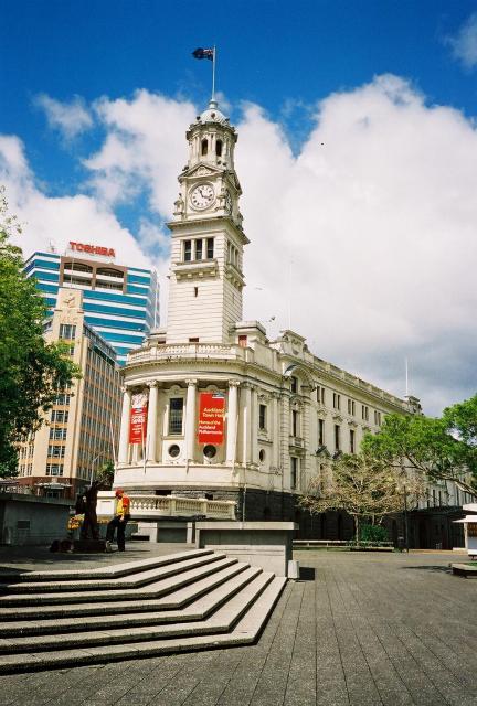 |
The Town Hall of Auckland, the largest city in New Zealand and once the capital city of New Zealand (today, the capital city of New Zealand is Wellington.) |
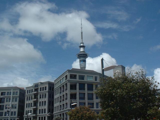 |
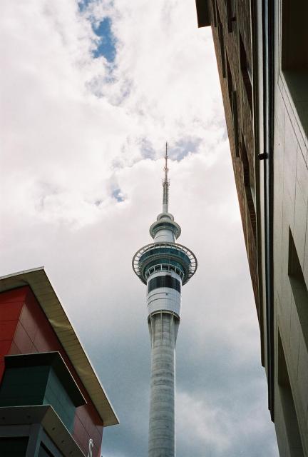
A view of the Sky Tower in Auckland, the tallest structure in the southern hemisphere, as seen from the Viaduct Harbour waterfront area. |
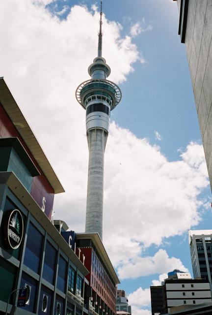 |
The Sky City complex includes the Sky Tower plus a casino, several restaurants, gift shops, and a hotel. |
 |
It's basically impossible to tell, but in this photo Ken is hanging out with another tourist and two Vertigo tour guides in the crow's nest on the mast of the Sky Tower at just over 1,000 feet above street level. |
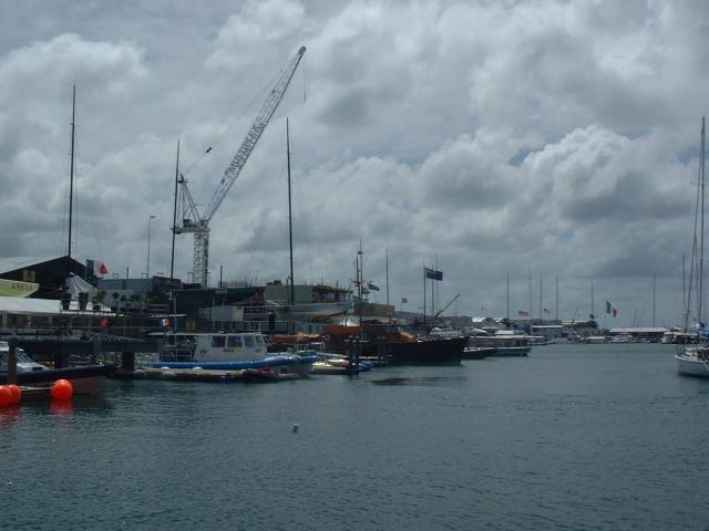 |
The row of warehouses and docks used by the teams competing for the Louis Vuitton Cup and the right to challenge Team New Zealand for the America's Cup in February, 2003. |
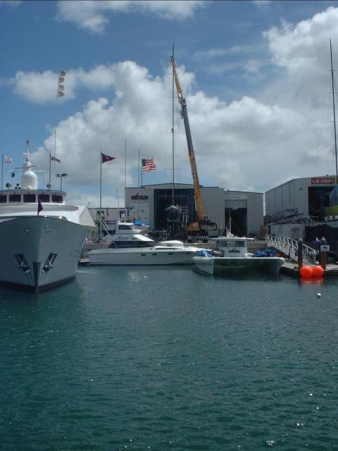 |
Oracle Racing, one of the three American challengers at this America's Cup. |
 |
The Team New Zealand shed. |
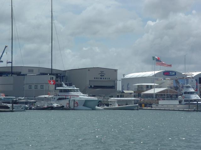 |
The One World Challenge (USA) shed, right next to a Swiss team, the Alinghi Challenge. We wonder what happens if the Swiss actually win the America's Cup - does it get held the next time around in mountainous, land-locked Switzerland? |
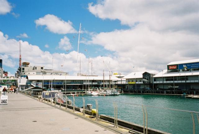 |
The Auckland waterfront near Prince's Wharf. |
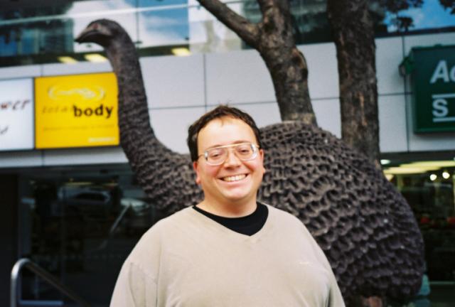 |
Ken, standing in front of a statue of a moa, a large flight-less bird that was hunted to extinction about 500 years ago. |
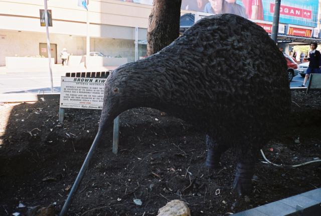 |
A statue of the New Zealand brown kiwi. |
| Last Updated 18 December 2025 |