These photos are copyright © 2009 Kenneth E. Harker. All rights reserved.
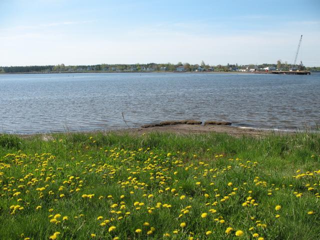
Our base of operations for the week was a small cottage on the waterfront in the village of Cocagne, New Brunswick. Cocagne is about 20 minutes northeast of the city of Moncton, where the Rivière Cocagne drains into the Northumberland Strait. Cocagne is located in the Acadian country of eastern New Brunswick, where most of the local population speaks French. Most of the village was on the south side of the river, across from where our cottage was. Our cottage was right at the mouth of the river, where a small protected bay is formed by Cocagne Island. We really enjoyed the cottage. When the bridge work wasn't making noise, it was a very relaxing place to stay.
|
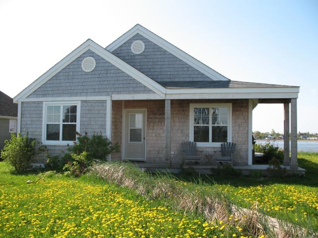
The front of the cottage, as seen from the gravel road, on a sunny day. All of the yards in New Brunswick had a lot of dandelions in them at this time of year. |
|
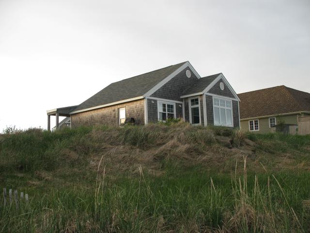
The cottage as seen from the beach near dusk. The building to the right was the neighbors' cottage next door. About half of the cottages on the street were rentals, but I think that neighbor was a full-time resident. |
|
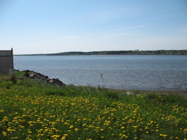
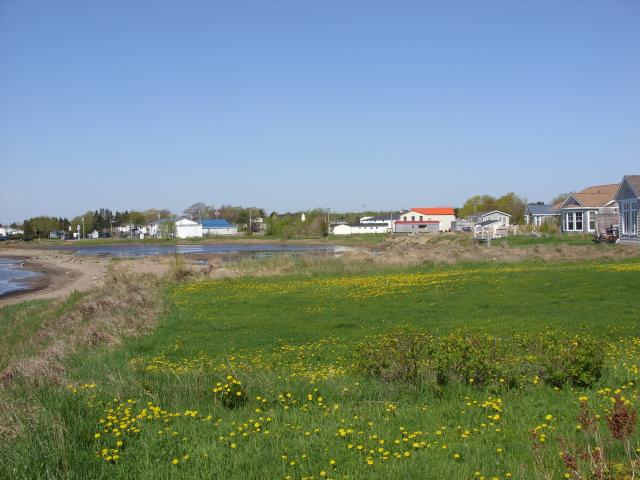
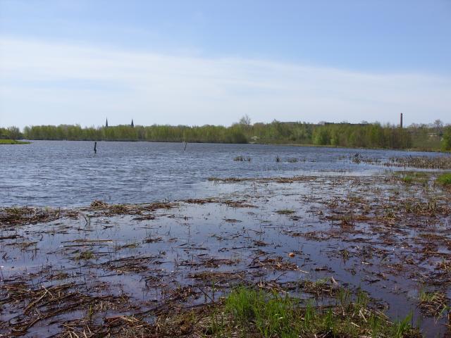
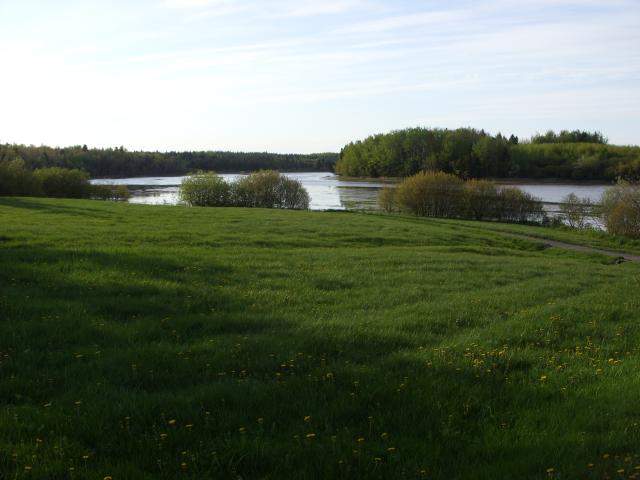
A view of the backyard and the bay on one of the sunny days. This was near high-tide, and there's not much of a beach beyond the grass. |
|
The view a little bit closer to the water. The stairs belong to the cottage next door. |
|
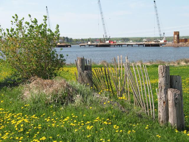
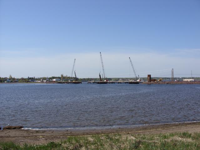
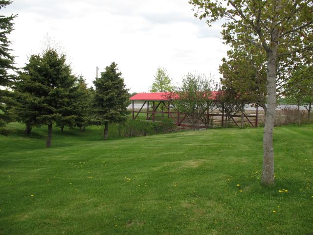
Looking southwest, back toward the river, you can see the bridge that was under construction while we were there. They were replacing the old bridge with a new concrete and steel bridge, and it looked like they would probably be working on it all summer. |
|
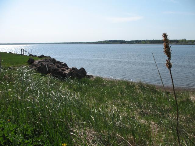
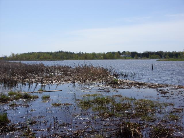
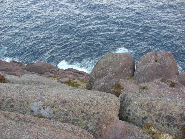
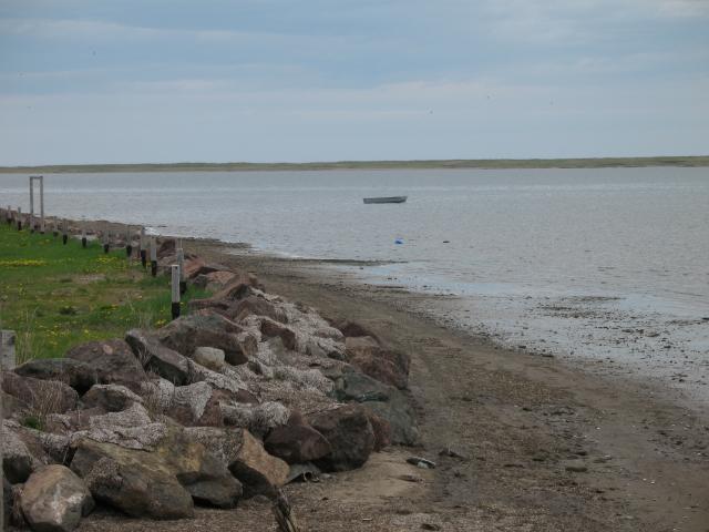
At very high tide, those rocks near shore would be underwater. |
|
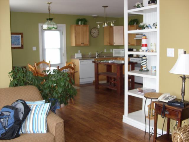
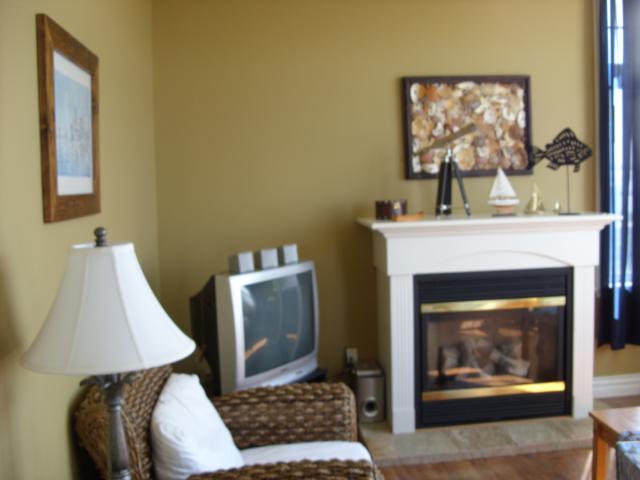
The two main rooms in the cottage were a small kitchen and dining room and a nice sitting room with a couch and a couple of chairs. The cottage had hardwood floors throughout, except in the bathroom where it was tile. |
|
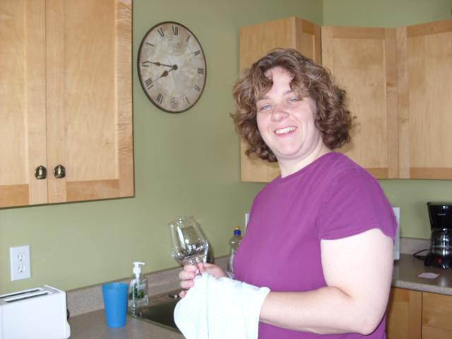
Jen, washing glasses in the kitchen. |
|
This was the sitting room. The gas fireplace had a nice on-off switch on the side, which was so pleasant in the evenings. The small television got your basic cable TV - about one third of the stations were in French. We watched part of an NHL playoff game on RDS (the French-Canadian sports network operated by ESPN) just for the experience. |
|
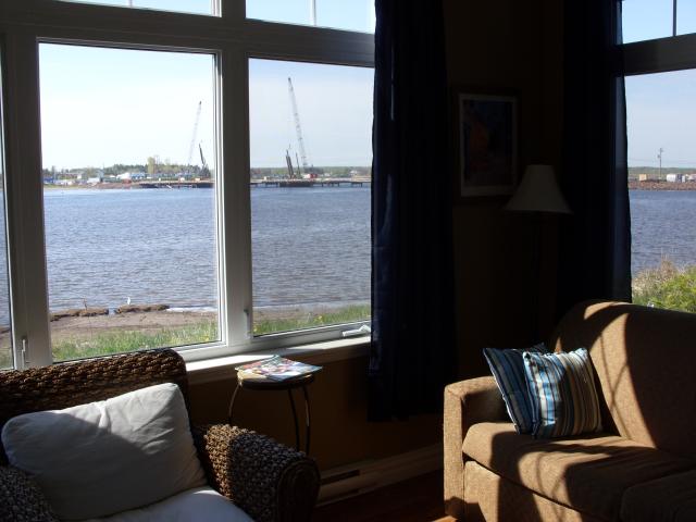
The cottage had nice, big windows looking out over the water. When the weather was nice, we would open the windows for a nice breeze. |
|
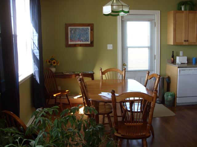
A comfortable dining table right next to the kitchen. It was great to eat breakfast looking out over the water. |
|
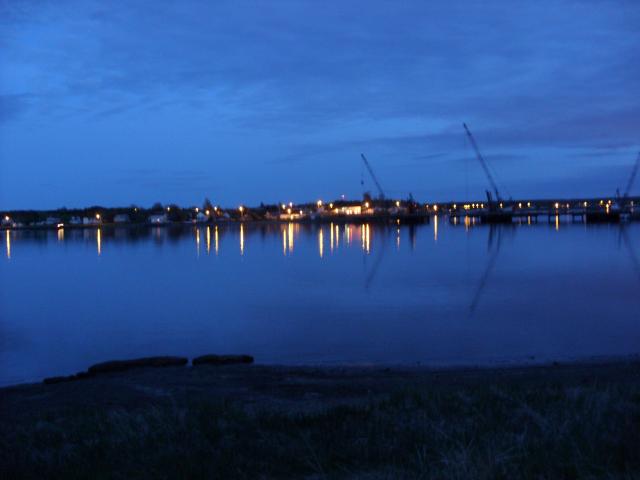
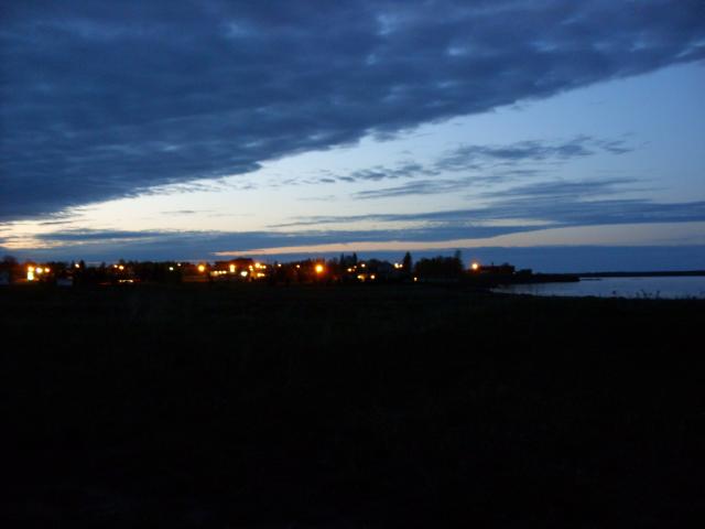
A view across the water at sunset. Most of the village of Cocagne was on the other side of the bay. |
|
The gravel road our cottage was on was a cul-de-sac, and at the very end there were some empty lots where homes have not yet been built. This is looking up the coast to the north from one of those lots during sunset. |
|
The view from the same lot, looking north up the coast, in the morning. |
|
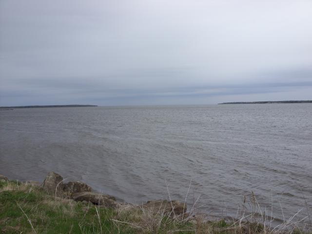
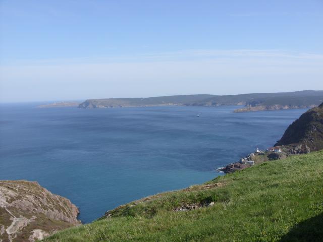
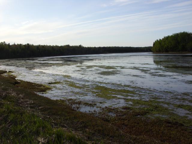
This is the view due east from the end of the gravel road looking at the entrance of the harbor. The land to the right is the main coastline south of the Rivière Cocagne, while the land to the left is part of Cocagne Island (uninhabited). This was taken early in the week, on an overcast and cold day. The harbor and river were always very calm on the days we were there. |
|
Right on the beach in front of the cabin, looking southeast across the water on one of the overcast and cold days. This is about halfway between high and low tide. |
|
Some sort of pier on the other side of the river from our cottage. |
|
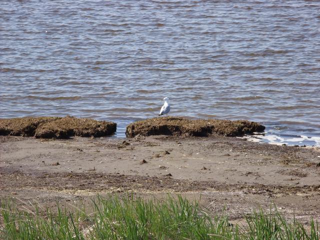
A seagull, perched on the big rocks right in front of our cottage. |
|
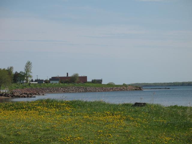
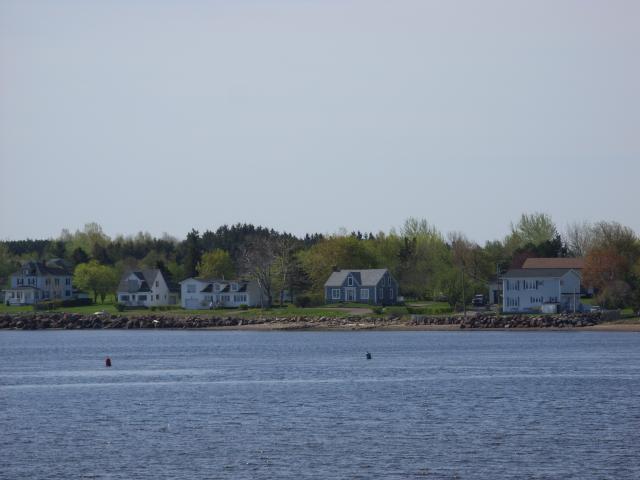
Some houses on the far side of the river from our cottage. |
|
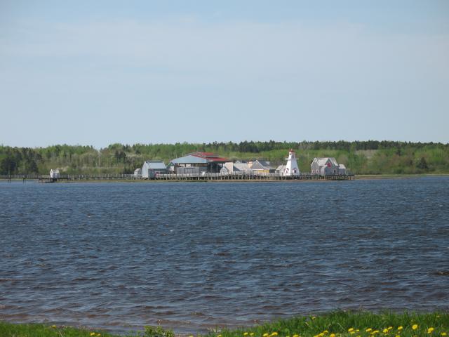
This was the view back toward the main road (NB 134). On the other side of one of the neighbors' yards was a tidal pool that would fill up at high tide and almost completely drain during low tide. The big white building on the other side of the pool was a gas station and convenience store. |
|
A view of the Cocagne Bridge, under construction. There was a large gap in the bridge when we were there. Unfortunately, because the bridge cut us off from most of the village, we did not explore Cocagne as thoroughly as we would have liked to. |
|
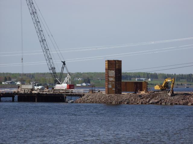
A closer view of the bridge construction. The bridge crew began work every weekday morning, around 7:30 AM. |
|
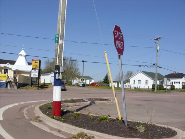
The main intersection on our side of the Cocagne Bridge (NB 535 and NB 134) included this power pole. A lot of poles in the Acadian part of New Brunswick have a blue, white, and red color scheme painted on them. The stop signs all over the province are bilingual. The white building to the left of the power pole is Anchor's Point Cafe, where we had breakfast one morning. |
|
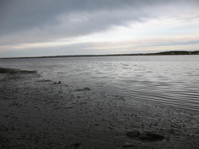
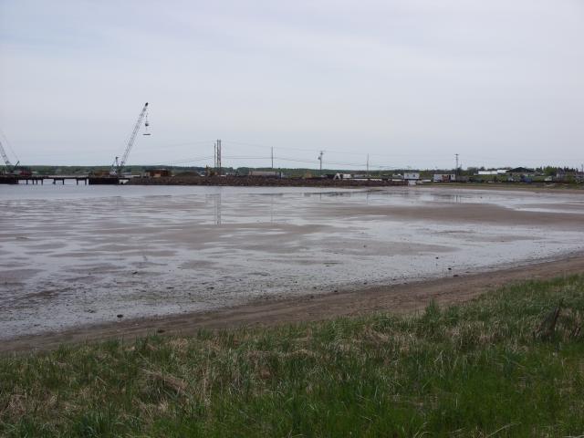
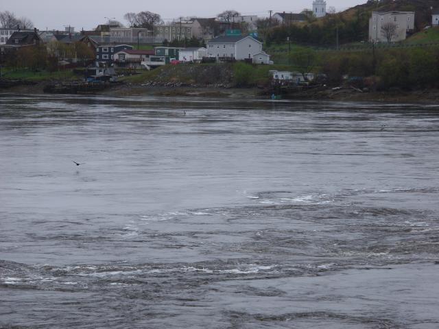
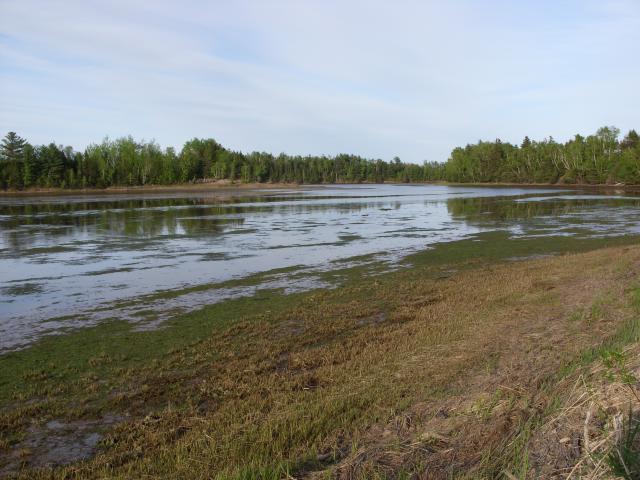
The river during low tide, looking west toward the bridge. |
|
Low tide, looking south across the river. |
I visited Saint John, New Brunswick as a day trip. In order to reduce the confusion between Saint John, New Brunswick and St. John's, Newfoundland, the city in Newfoundland uses an apostrophe and the city in New Brunswick does not. The city in New Brunswick spells out the word "Saint" whereas the city in Newfoundland abbreviates it. Saint John is the most populous city in New Brunswick, and the only one with a metropolitan area of more than 100,000 people. It is the oldest incorporated city in Canada. On the south coast of New Brunswick, the city is located on a peninsula between Grand Bay to the north and the Bay of Fundy to the south. I did not really have a lot of time to see the city (most of which was closed, being a Sunday), and was only able to spend a few minutes visiting the Reversing Falls.
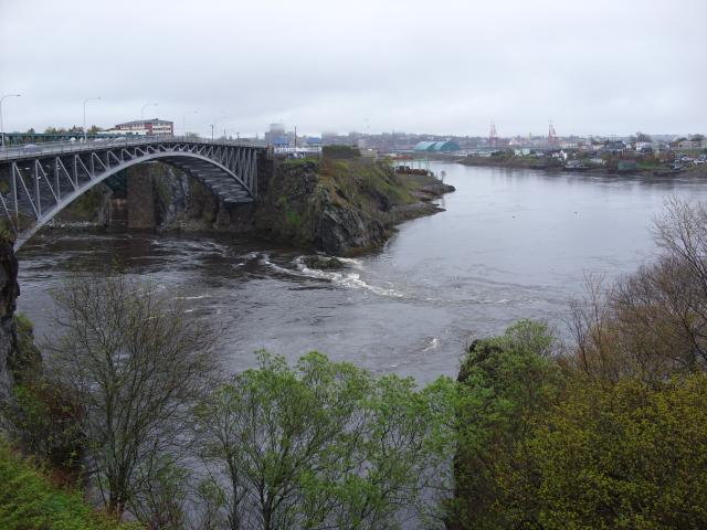 |
Reversing Falls is actually a series of rapids where the Saint John River takes a sharp bend on the west side of the city. Upstream (to the left of this photo) is Grand Bay, and downstream (straight ahead and around a bend to the right in this photo) is the Bay of Fundy. Depending on the state of the tides, the water underneath this bridge can either be flowing downstream or upstream. |
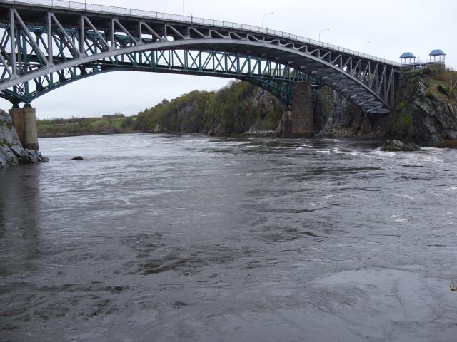 |
Of course, when I had time to visit, the water was flowing downstream. A long series of stairs takes you down to an observation platform closer to the water. |
 |
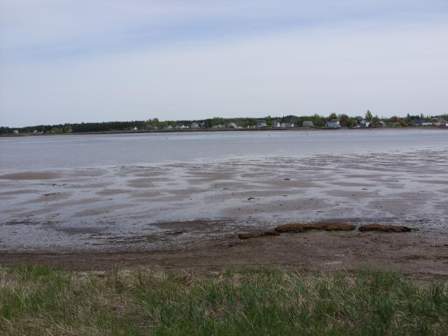
There were plenty of seabirds flying around. |
 |
Some buildings on the far shore. |
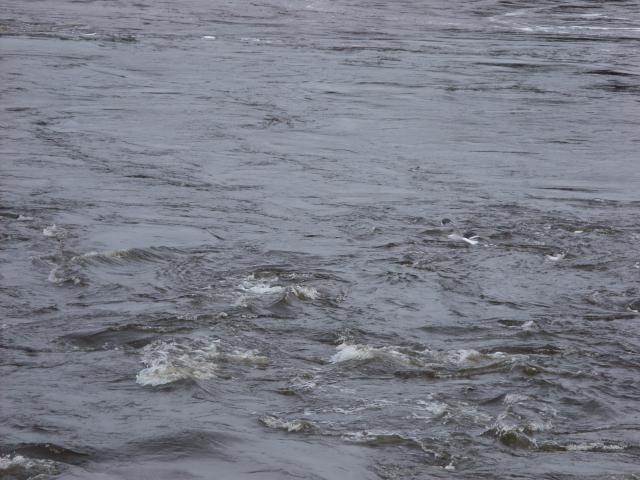 |
This was about as turbulent as the water got when I was there. This might count as rapids, but it doesn't count as a waterfall in my opinion. |
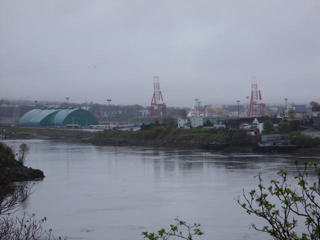 |
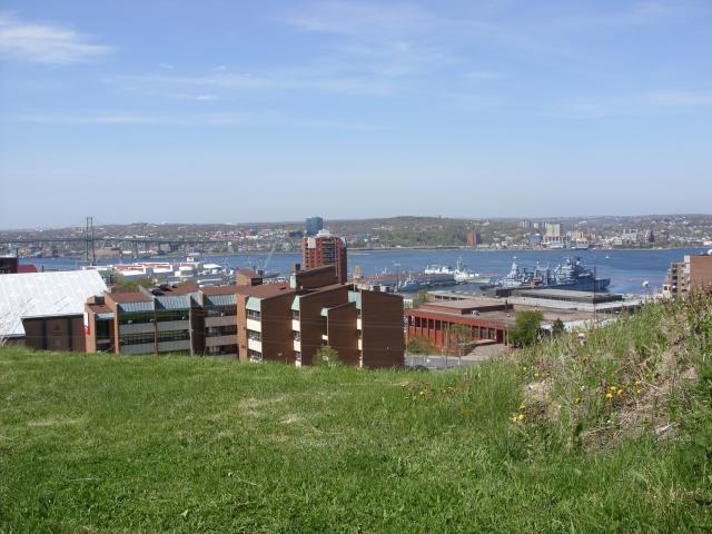
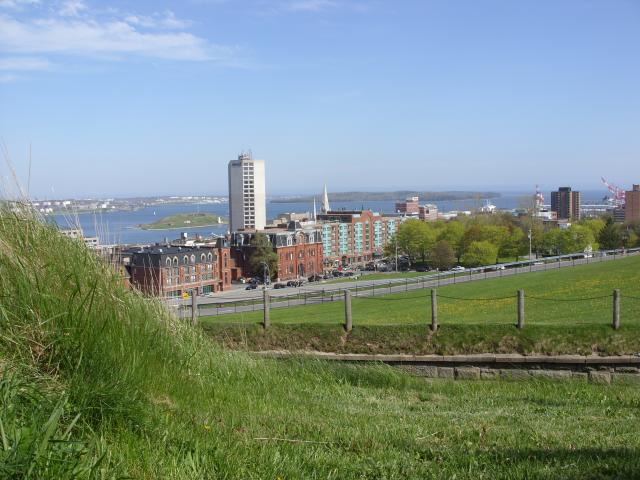
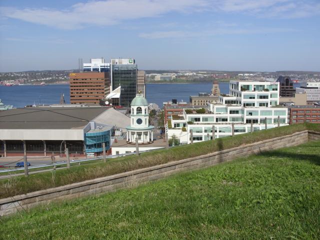
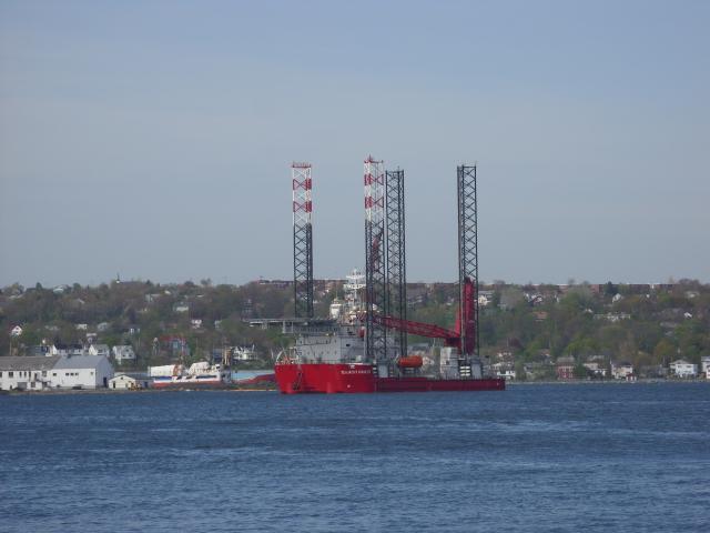
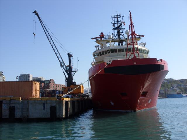
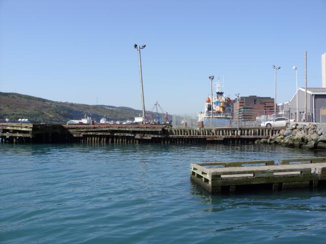
From back up on top of the hill, this is a view of some of the working port of Saint John. Saint John Harbor would be on the far side of the giant red and white cranes. |
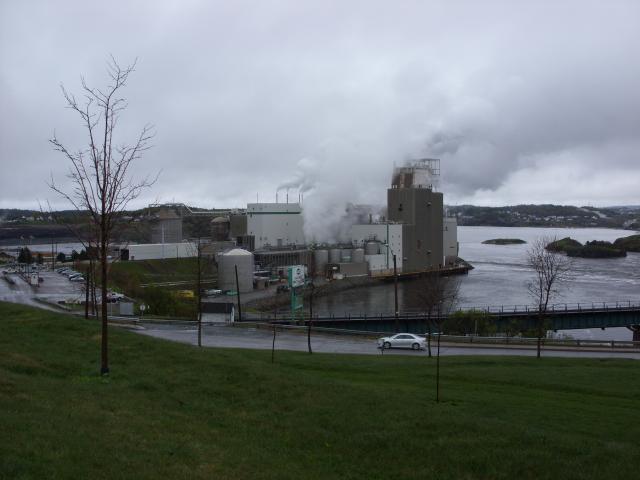 |
Near the bridge was a J.D. Irving paper processing plant. The paper industry is a major employer in New Brunswick, and J.D. Irving Limited is one of the largest privately-held corporations in Canada. |
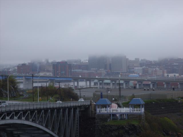 |
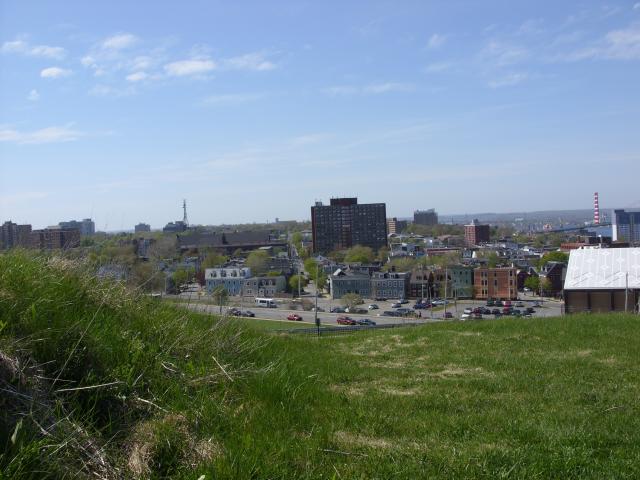
Downtown Saint John, as seen through rain and fog on a Sunday afternoon. |
About ten minutes south of our cottage in eastern New Brunswick was the town of Shediac. Shediac is the self-proclaimed lobster capital of the world. The town has about 5,000 permanent residents. It is a major tourist destination in the summer, and the gateway city to Parlee Beach Provincial Park.
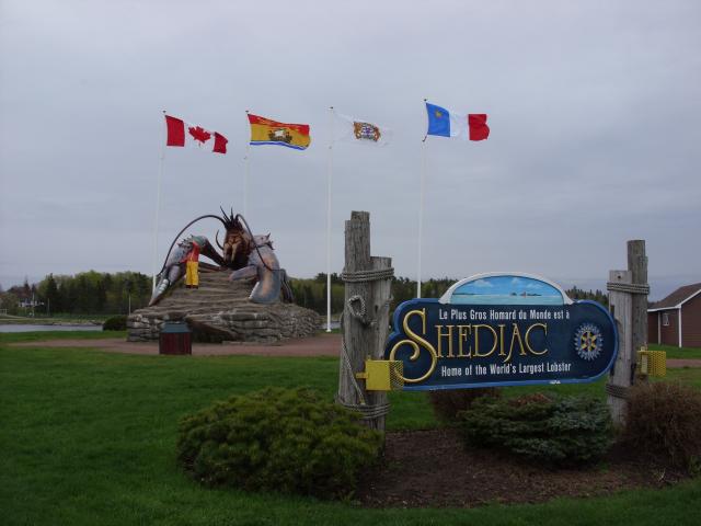 |
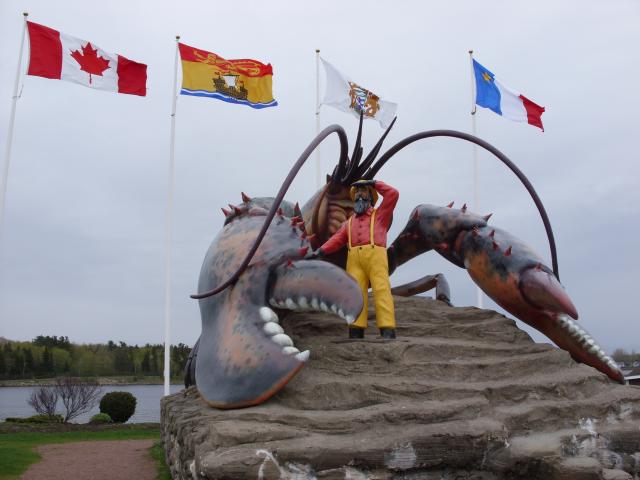
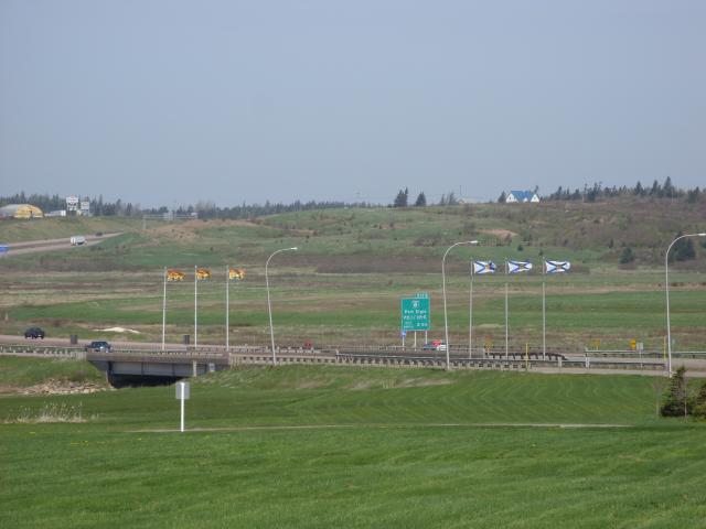
Where the Shediac River drains into Shediac Bay, the town has built a visitor's center and unique landmark public art. The flags flying behind "the world's largest lobster" are, from left to right, the flags of Canada, New Brunswick, Shediac, and Acadia. |
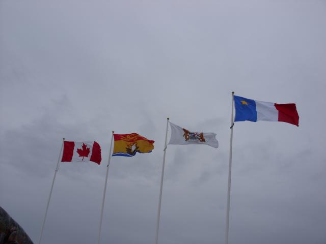 |
The Acadian flag was designed in 1884 by Father Marcel-Francois Richard, a Catholic priest from Saint-Louis-de-Kent, New Brunswick, as a symbol for the Acadian population in northeastern North America. It is basically a French flag with a yellow star. The star was chosen because of its religious and maritime symbolism. |
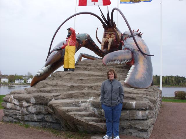 |
Jen, in front of the world's largest lobster. |
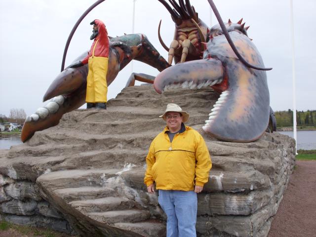 |
Ken, in front of the world's largest lobster. |
 |
The sculpture includes a life-size lobster fisherman. The sculpture is about 35 feet long and 16 feet high. |
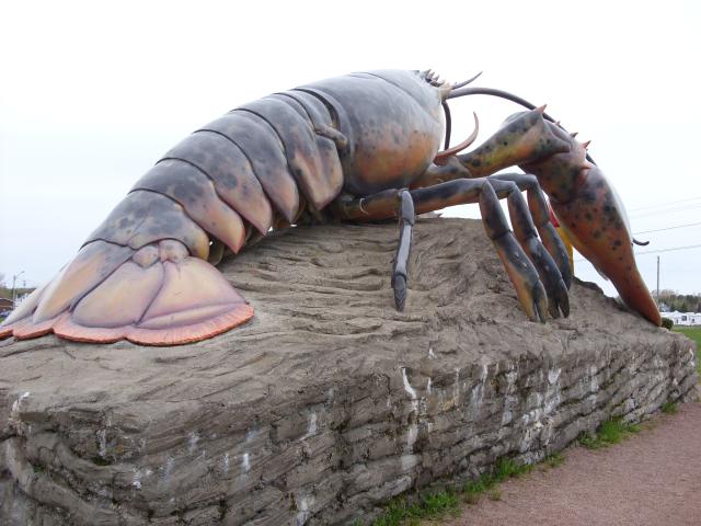 |
The back side of the lobster. |
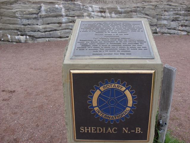 |
A plaque at the statue explaining its origins. Commissioned by the town's Rotary Club, it was created by sculptor Winston Bronnum of Penobsquis, New Brunswick. It took three years to make, and was unveiled in 1990. |
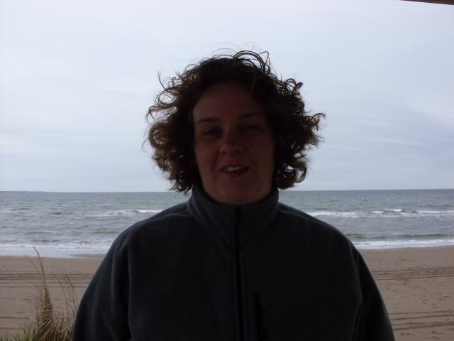 |
Jen and I briefly visited Parlee Beach Provincial Park. In May, there's no entrance fee to the park, and you can easily park right next to the boardwalk entrance. Of course, it was only about 45° Fahrenheit outside. Even with her fleece, Jen was cold. I couldn't figure out how to force the flash to work on my camera for this picture. |
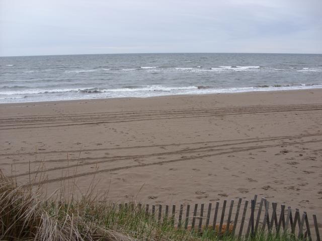 |
It was a nice beach, with good sand and gentle waves. The beach is on the Northumberland Strait, which supposedly has some of the warmest water on the Atlantic coast north of Virginia. I walked down to the water and dipped my hand in - it wasn't as cold as I expected. But it wasn't really warm, either. |
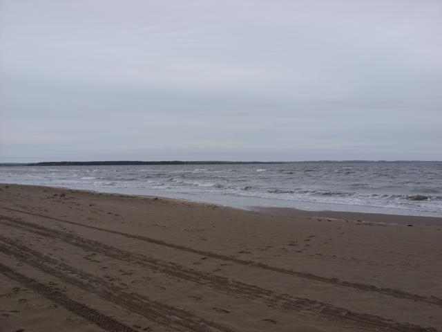 |
On July weekends, this beach will be covered in thousands of tourists. On a cold, overcast, and rainy day in May, you get it practically to yourself. |
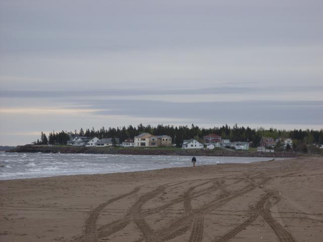 |
There was one other beachcomber there at the same time as us. |
We decided to visit Prince Edward Island, even if only for an evening. After all, when else are we likely to be by this way again? The easiest way to get there from New Brunswick is to drive over the Confederation Bridge. We stopped just before crossing the bridge at the visitors center for Cape Jourimain Nature Centre.
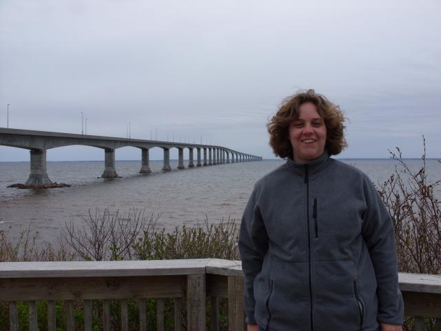 |
Constructed in 1997, the bridge spans the Abegweit Passage of Northumberland Strait, and is nearly 13 miles long. |
 |
It was a cold and overcast day. Cape Jourimain Nature Centre, behind me, was a nature preserve located on Jourimain Island. It was mostly wetlands and salt marsh and a gift shop. |
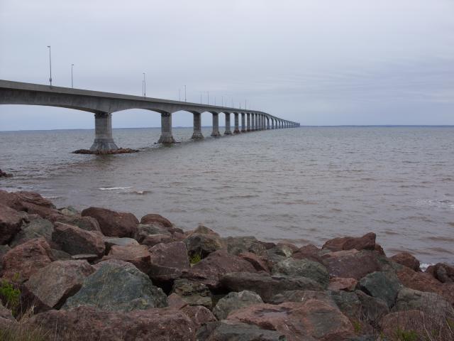 |
If you look off in the distance, you can see Prince Edward Island. Prior to 1997, the only ways to reach the island were by ferry or by airplane. |
Charlottetown is the provincial capital city of Prince Edward Island. The city has a population of about 32,000 (the largest in the province), and was incorporated in 1855. The city was named after Queen Charlotte, the wife of King George III (the king referred to as a "tyrant" by Thomas Jefferson in the United States' Declaration of Independence). It was rather cold and was raining off and on during the evening we were there.
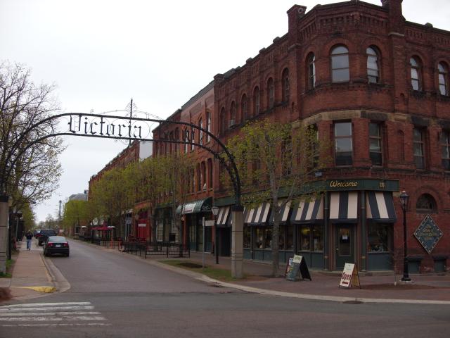 |
Some of the old buildings in downtown Charlottetown. The iron arch over the street says "Victoria Row", even though the street name is Richmond Street. The store at the corner of the street was the "Anne of Green Gables Store". Anne of Green Gables was a 1908 novel by Canadian author Lucy Maud Montgomery, set on Prince Edward Island. Apparently, a lot of the local island tourist industry is based on the popularity of the novel. |
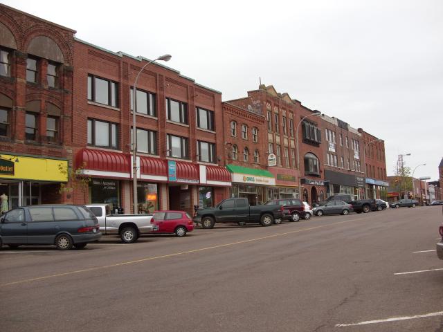 |
Queen Street is one of the main roads in downtown Charlottetown. Most of these buildings are probably from the early twentieth century. |
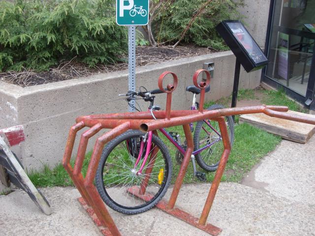 |
This bicycle rack shaped like a crab was in front of the Confederation Centre of the Arts, a building that was so ugly I refused to take a picture of it. This bicycle rack was clever, though. |
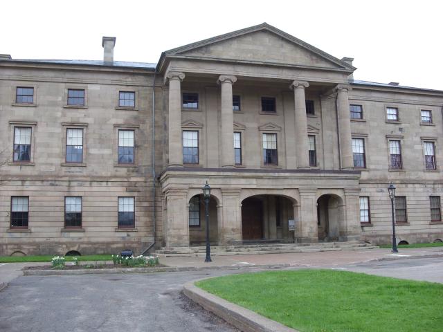 |
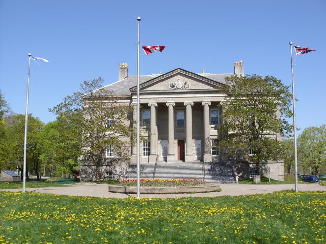
This is Province House in downtown Charlottetown. Built in 1843, Province House is the current seat of the Prince Edward Island provincial legislature, and housed the provincial Supreme Court until 1872. In 1864, Province House was the host venue for the Charlottetown Conference, the first negotiations that led to Canadian Confederation. For all of its historical value, it is not the most attractive building. It was not open for tourists when we showed up. |
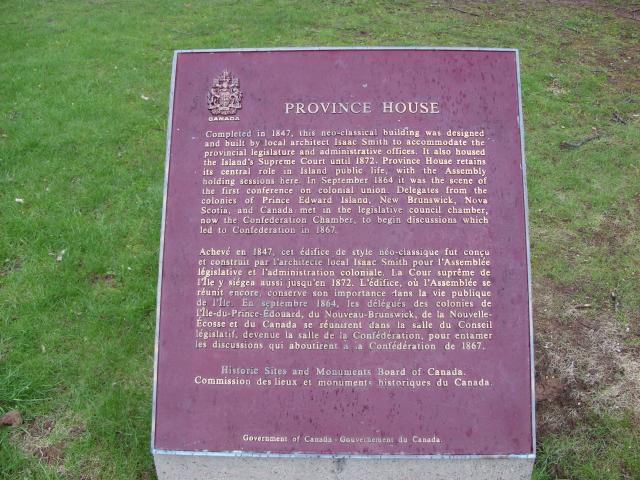 |
A plaque in front of the building explains its historical significance. Province House is sometimes referred to as "the Birthplace of Canada". After Independence Hall in the United States, and Waitangi in New Zealand, this is the third birthplace of a nation that I have visited. |
 |
This statue by Province House honors the soldiers of Prince Edward Island who fought in the Boer War and the first World War to uphold Canada's duty the British homeland and to "support the burdens of Empire." Canada's participation in the Boer War is often cited as one of the defining moments in Canada's gradual evolution from colony to sovereign state. |
 |
Some of the large homes on Great George Street. Most of these appear to be used as businesses or private clubs. |
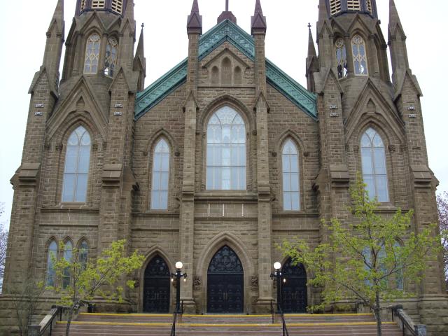 |
The front of St. Dunstan's Basilica, a large Catholic church on Great George Street in downtown Charlottetown. |
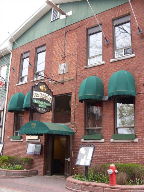 |
Downtown Charlottetown is full of sharp-looking pubs and restaurants in old brick buildings. This one housed the Olde Dublin Pub upstairs and the Claddagh Oyster House downstairs. |
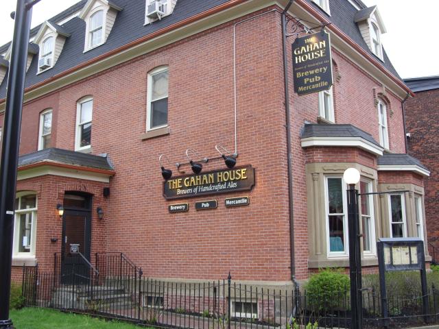 |
This is the Gahan House, a microbrewery with an Irish heritage. Irish immigrants and their descendants account for more than a quarter of the Prince Edward Island population. |
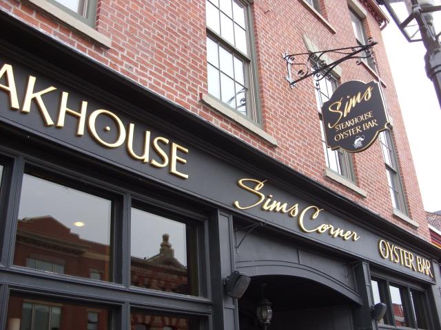 |
This building was the Sims Corner Steakhouse and Oyster Bar. |
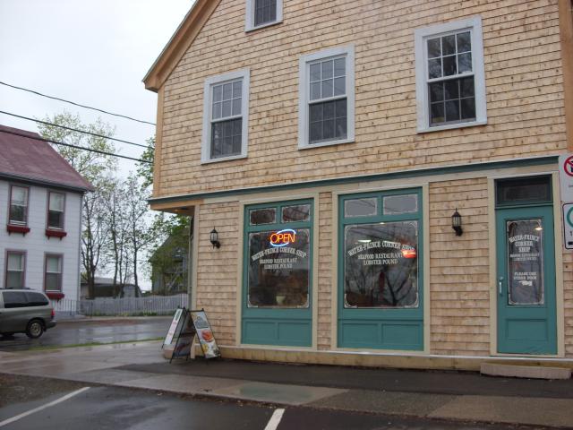 |
We ate dinner at the Water-Prince Corner Shop. A small seafood restaurant at the corner of Water Street and Prince Street, it had the best steamed mussels I've ever had. We also tried two different micro-brews from the Maritimes. |
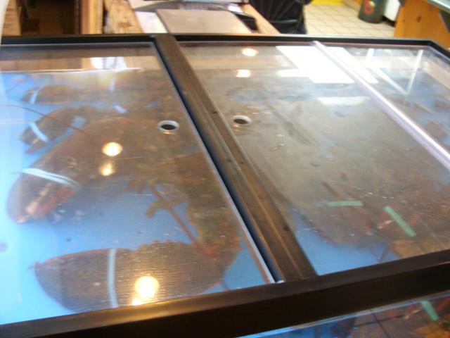 |
It's hard to describe just how large this lobster in the tank by the door really was. It's the largest live lobster I've ever seen. If I had to guess, I'd say it was over 25 pounds. |
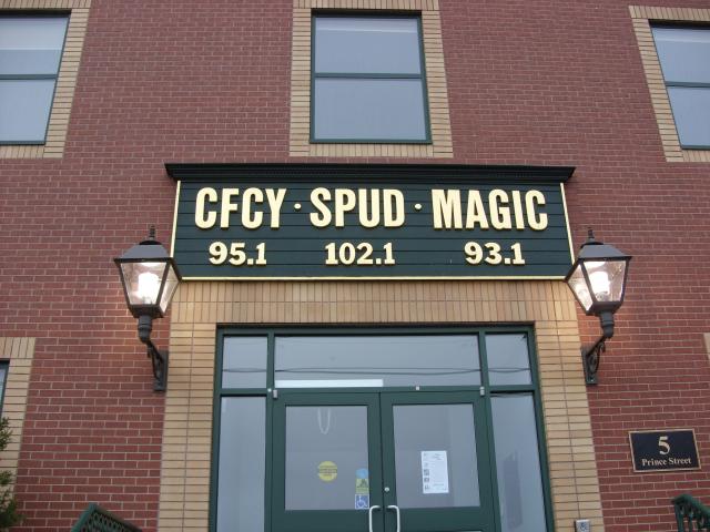 |
This building was home to three radio stations. SPUD 102.1 gets its name from the extensive potato farming on Prince Edward Island. I find this amusing because SPUD would be a valid four-letter call sign for a radio station in Poland (Canadian radio stations' call signs all start with CF through CK, or in rare cases in Newfoundland, VO.) |
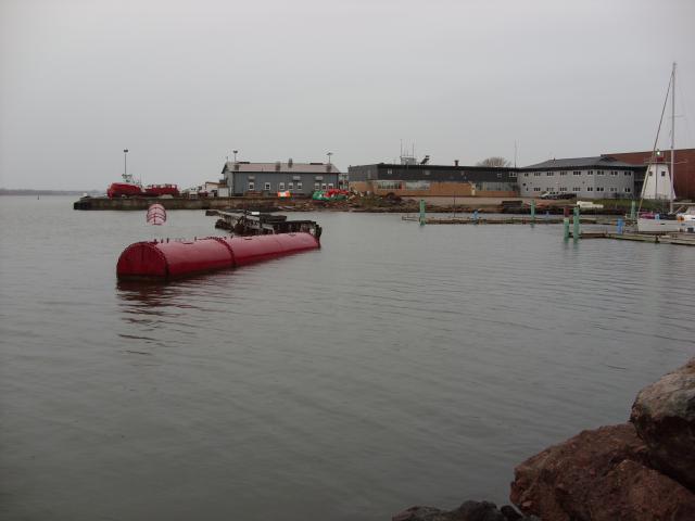 |
In the harbor, these giant metal pipes were used to create a breakwater for a small marina. |
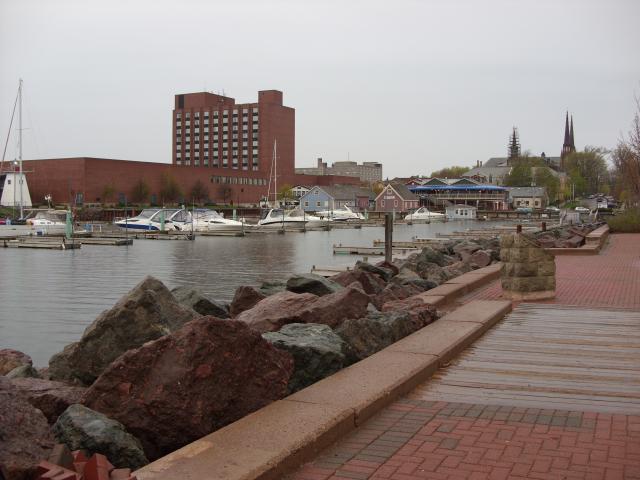 |
We walked through a small park next to the marina. It started raining about the time we were right at the waterfront. |
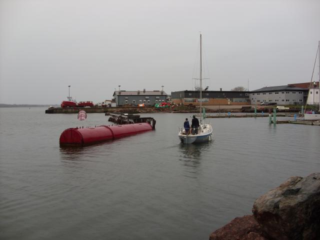 |
This sailboat was motoring into the marina for the evening. |
Sackville, New Brunswick is a small town in the southeastern part of the province, near the border with Nova Scotia. We stopped for a few minutes to visit the Sackville Waterfowl Park.
 |
This shallow lake was 48 acres of prime waterfowl territory. The weather was quite nice and watching the birds was delightful. The park is really close to the main highway, though. |
 |
A boardwalk walking path completely encircled the lake, but we didn't have time to take much of it in. |
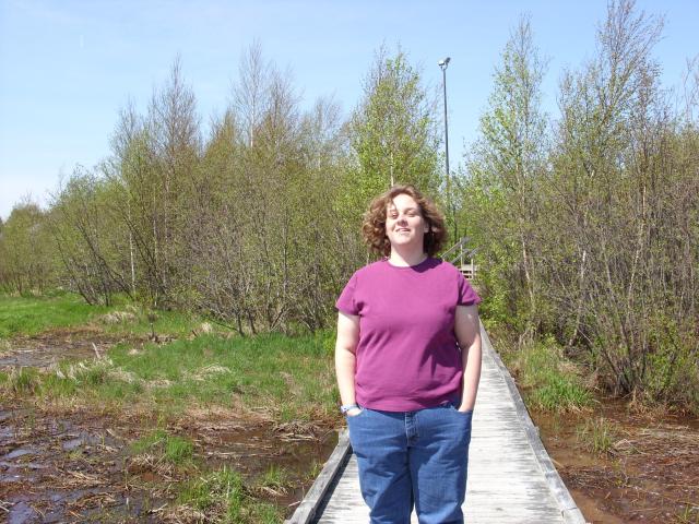 |
Jen, on the boardwalk out over the marsh. Even though it's mid-May, some of the trees behind her were still in the process of greening out for the summer. |
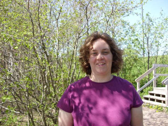 |
Jen, on the walking path. |
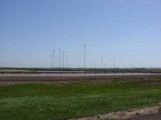 |
Just outside of the town of Sackville was a giant shortwave broadcast radio station owned by Radio Canada International. Its location is on marshy soil that I am certain gives it an excellent earth ground for the antennas. |
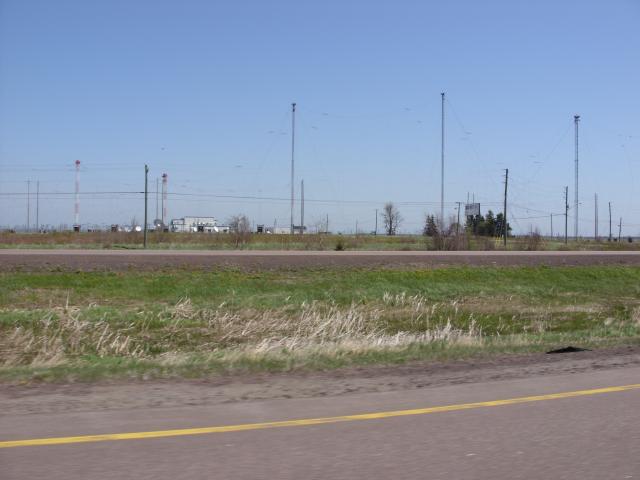 |
The RCI Sackville Relay Station broadcasts programs for Radio Canada International and several other broadcast stations including Radio Japan, China Radio International, Voice of Vietnam, Radio Sweden, BBC World Service, Deutsche Welle, and Radio Korea. |
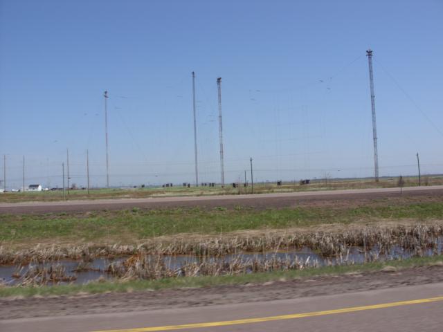 |
The tower support huge cables that form curtains of dipole antennas. By feeding different curtains in different phases, the antennas can be steered to direct more of their energy to Europe or to South America. The antennas are designed to handle transmissions of 500 KW, but the transmitters are limited to 300 KW. |
Beaubassin is the site of an old Acadian farming village. It was founded in 1672 by French settlers. The British had acquired the territory that is now Nova Scotia as a part of the settlement of the Treaty of Utrecht in 1713, and in 1750 a troop of British soldiers forced the French settlers of Beaubassin to move north of the Missaguash River. Today, the site is home to a Nova Scotia welcome center with nice views of the Tantramar Marsh.
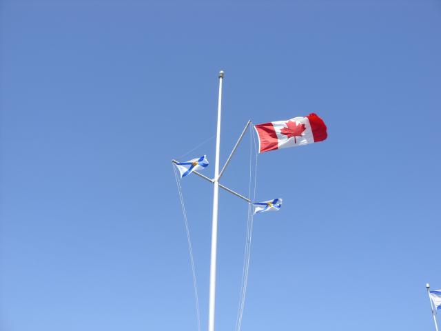 |
The flags at the Nova Scotia welcome center. The Nova Scotia flag was inspired by the Scottish flag, but is blue stripes on a white field rather than white strips on a blue field. It is, in any event, much more sensible than the New Brunswick flag. |
 |
The border crossing at the Missaguash River. |
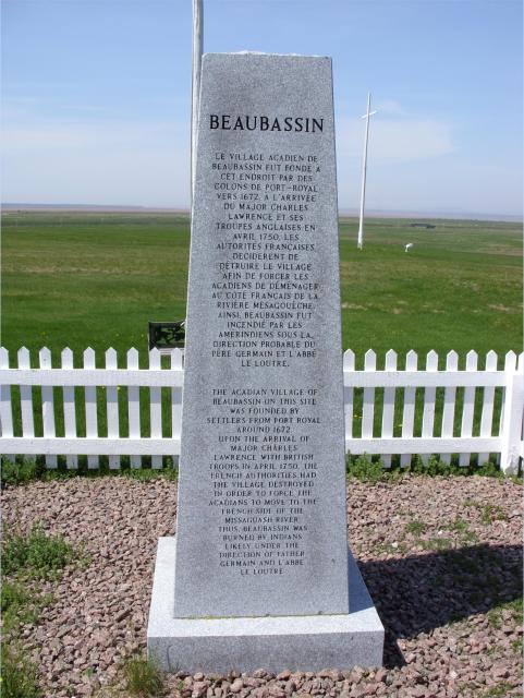 |
An historical marker near the welcome center describes the fate of the Acadian village of Beaubassin. |
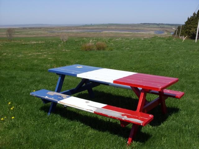 |
A picnic table, painting in the style of the Acadian flag: blue, white, and red with a yellow star. |
 |
This is downtown Truro, Nova Scotia, where we stopped for lunch at a restaurant that claimed to have the best "English-style" fish and chips in North America. |
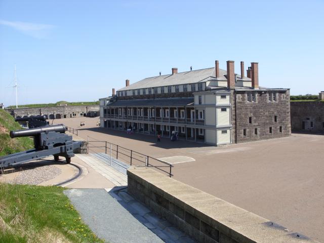
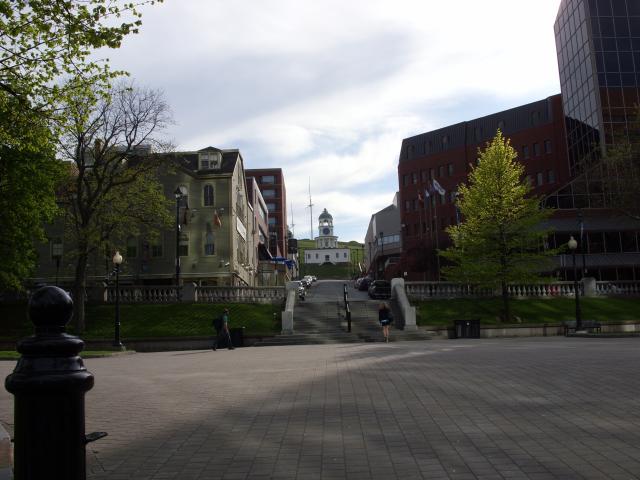
The Halifax Citadel National Historic Site, atop Citadel Hill in central Halifax, is supposedly the most-visited National Historic Site in all of Canada. Citadel Hill rises about 250 feet above one of the best harbors in the Canadian maritime provinces. Four different forts have been built by the British on top of the hill to defend the harbor and town, first from the threat posed by the French and later to defend against a possible attack from the United States. The current fortifications were completed in 1856 and named Fort George. The British Army garrisoned the fort until 1906, followed by the Canadian army until the end of World War II. Today, it is a National Historic Site and has been restored to what it would have looked like in the 1870s. We only had about an hour and a half there - enough to take a tour and explore some of the museums.
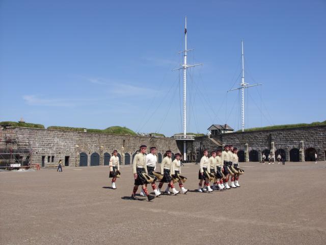 |
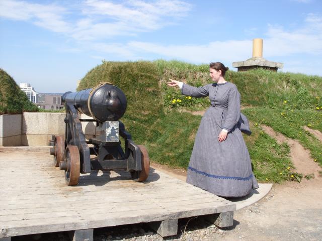
Actors portraying the soldiers of the 78th Highland Regiment, marching in the main yard in the center of the fort. All of the employees at the site wear period costume from the 1870s. |
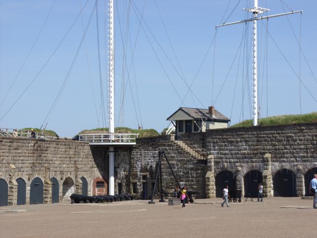 |
The corner of the fort closest to the harbor featured two tall signal masts. Flags could be hoisted on these masts to communicate with ships, or to signal townspeople to the arrival of merchant vessels. One mast was primarily used for military communications and the other for mercantile traffic. |
 |
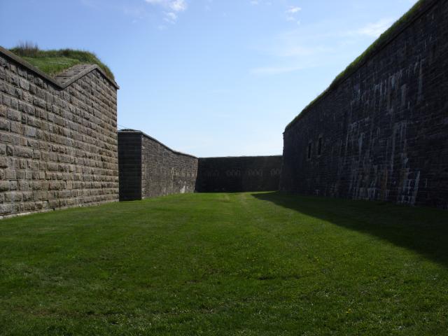
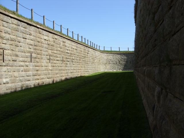
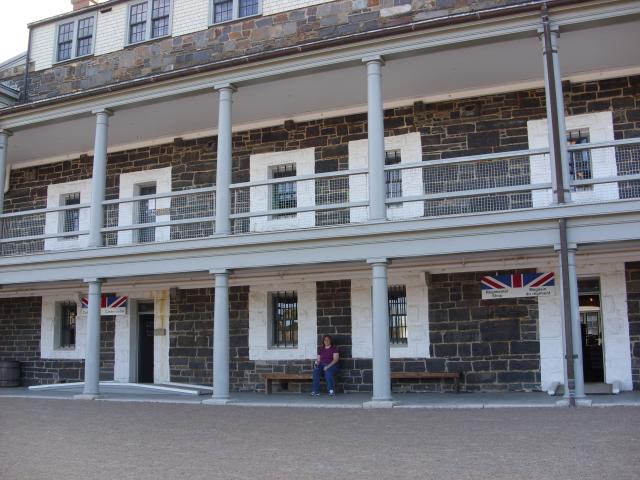
The main courtyard at the center of the fort and the interior walls. The stone used in the construction of the walls was quarried in Nova Scotia, but at some distance from the fort. Construction on the fort began in 1828 and was not completed until 1856, in part because the stone quarries were so far away. |
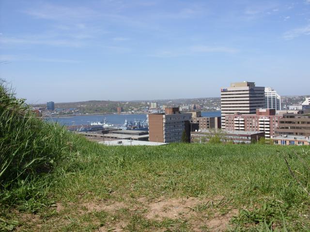 |
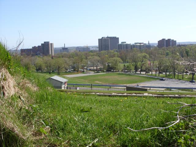
A view of some of downtown Halifax from atop the fort wall. If I were a foot taller, I'd have had a better view. |
 |
A view of some of the harbor. The park rangers were quite vigilant about preventing tourists from getting up on top of the earthworks. The fort was designed with a ditch surrounding the inner walls. Step off the top of this earth wall, and it's a 40 foot drop into the ditch. I think they had one park ranger with a whistle on observation at all times. Down in the harbor, you can see the HMCS Sackville |
 |
This is looking north. This part of the town was the portion that was leveled in the Halifax Explosion of December, 1917 at the height of World War I. The largest man-made explosion until the testing of the first atomic bomb, the explosion of the French munitions ship Mont Blanc obliterated the city's north end, instantly killing 2,000 and wounding 9,000 the day before a blizzard hit the city. Citadel Hill shielded part of the city from the effects of the explosion. |
 |
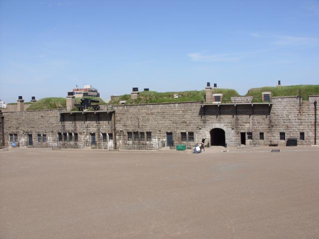
This four-story blockhouse was in the center of the fort. Each floor in the building above the first floor had lower ceilings than one would be accustomed to today. Most of the building houses museum displays of Canadian military history. |
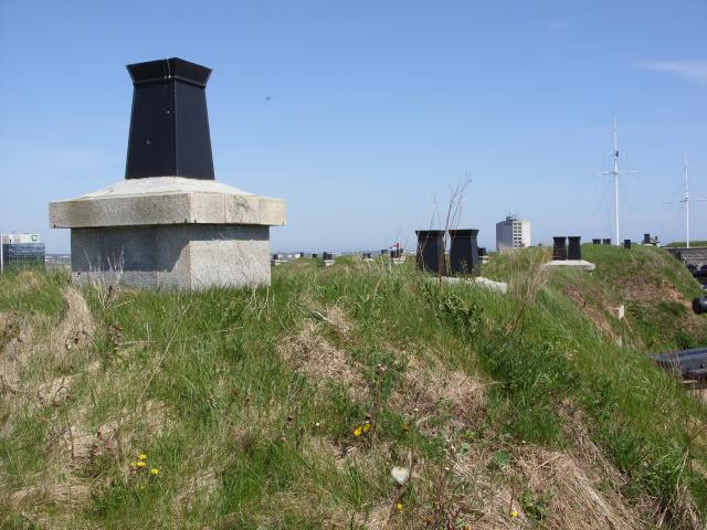 |
Inside the main earthen wall around the perimeter of the fort were barracks and other rooms that needed ventilation. The chimneys were not all one consistent style or height. |
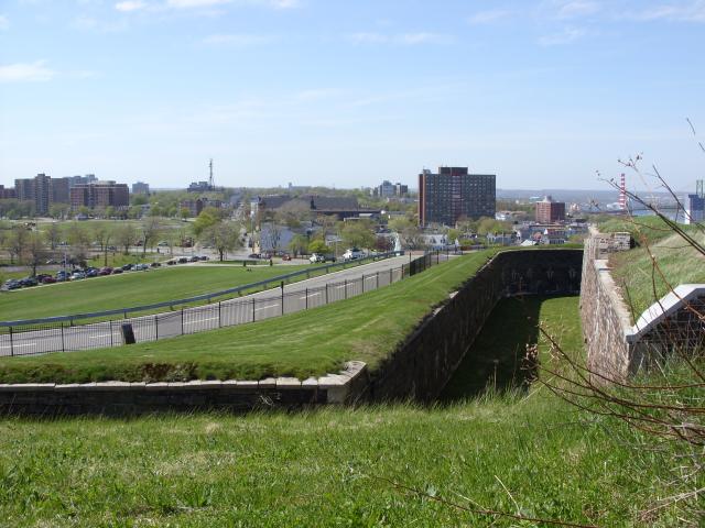 |
A view of part of the ditch that surrounds the inner walls. The wall on the right was about 40 feet tall. |
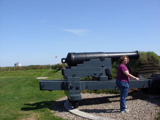 |
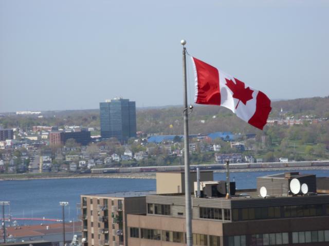
Jen, in front of one of the cannons. The Fort was built in the age of smooth-bore cannon, and all of the historical pieces on display were from that era. In the distance, you can see a Union Jack flying over the fort, as it would have in the 1870s. |
 |
This is the view to the west-northwest. The fort walls were thicker to the west, as the designers anticipated a land attack from the United States Army as the most likely scenario for combat. As it happens, the fort was never attacked by any adversary. |
 |
The tour took us into the ditch that rings the fort. The stone walls on either side were at least thirty, and in some places as much as 40 feet high. |
 |
The stone walls in the ditch had loopholes through which defenders in tunnels could fire muskets at any attacker who happened to get as far as the ditch. The eight-sided star shape of the fort meant that any place in ditch was covered by multiple lines of fire. |
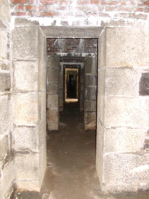 |
Underneath the outer wall of the fortress were tunnels that completely ringed the ditch, but were not connected to the inner fortifications in any way. The total length of the tunnels was over a mile. In the event of an attack on the fort, musketeers would man the tunnels with enough supplies to survive up to six weeks without any support from the inner fort. |
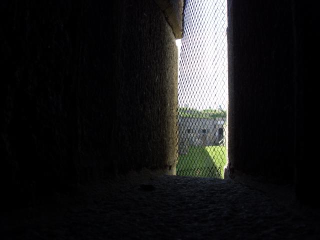 |
This is the view out one of the loopholes. Because the tunnel was a contiguous loop, the defenders could have kept up a running battle wherever attackers arrived inside the ditch. |
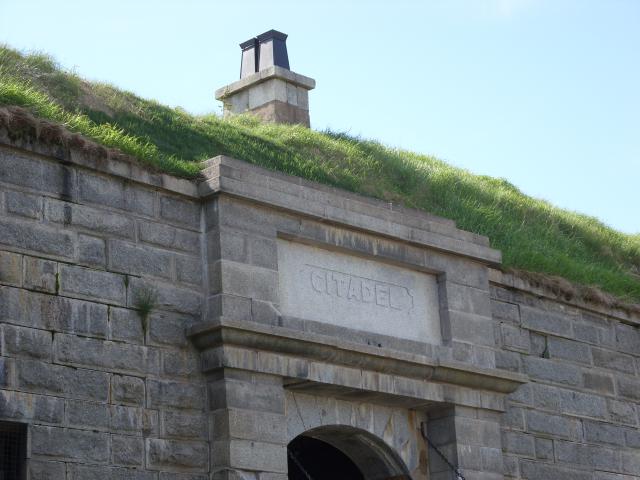 |
"Citadel" engraved in stone over a doorway arch in the interior wall of the fort. |
 |
This is the view to the southeast from the top of the inner wall. The small island to the left of the high-rise apartment building is George's Island, which was also fortified for most of the same time period as the forts atop Citadel Hill. The larger island in the distance is McNabs Island, which was also fortified against attack. |
 |
Looking due east into the heart of downtown Halifax. Directly in front of the fort is the Old Town Clock. The tower was built under the direction of Prince Edward, then commander-in-chief of all British forces in North America. It began keeping time for the garrison and the town in 1803. |
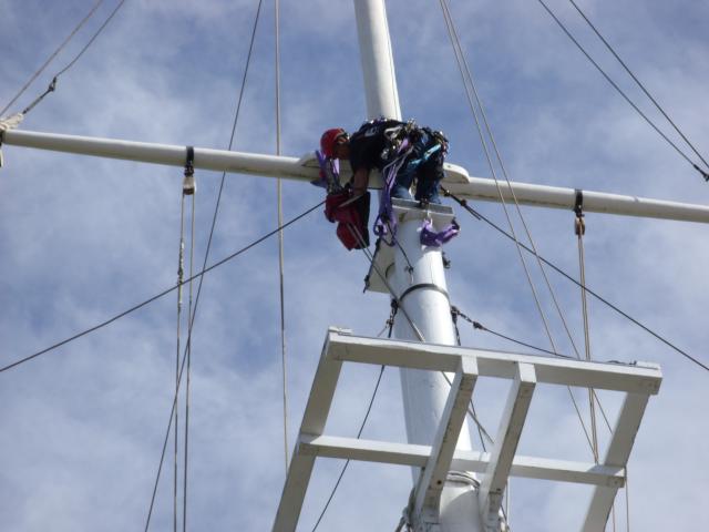 |
A worker was making repairs to the signal mast while we were there. It was fantastic weather to be doing that kind of work. |
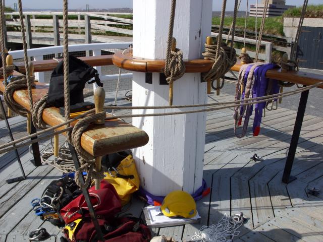 |
At the base of the signal tower, you can see how the lines are tied off. You can also see some of the modern equipment used by the linesmen climbing the masts. |
 |
The town on the far side of the harbor was Dartmouth, Nova Scotia. In 1996, Dartmouth, Halifax, Bedford, and other surrounding towns were all amalgamated into the Halifax Regional Municipality (HRM). |
 |
Our tour guide was explaining how this cannon, known as the Noon Gun, has been fired every day at noon since 1749. Initially, the gun was loaded with a full charge of powder, but complaints about broken windows caused the fort to use reduced powder charges. This is the original gun that has been in use for over 250 years. |
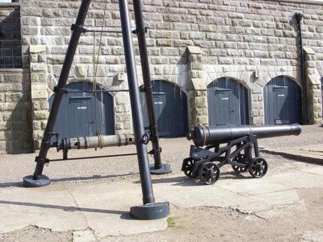 |
This large tripod was used for servicing cannon when their carriages needed repair or replacement. |
 |
The four story blockhouse at the center of the fort is used today for museum rooms, an information center, and the gift shop. |
After visiting the Halifax Citadel National Historic Site, we went into downtown Halifax for a quick dinner before going to the airport. Halifax is the largest city in Atlantic Canada. Since 1996, it has been part of a larger Halifax Regional Municipality (HRM) that has an urban population of about 280,000. We explored very little of the city.
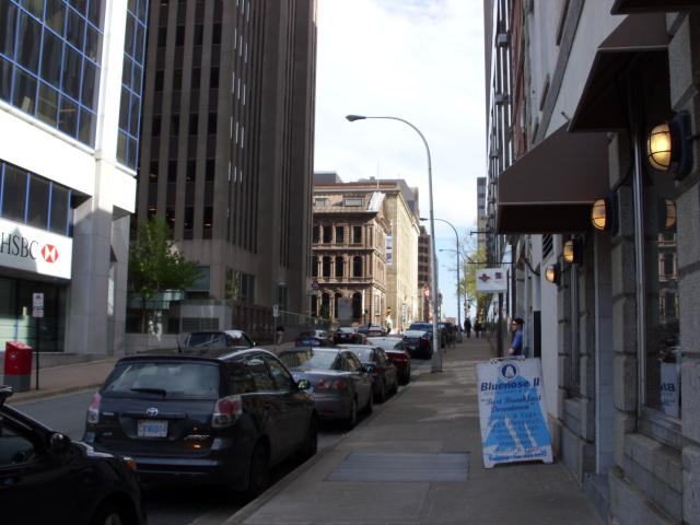 |
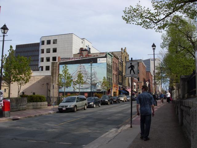
One of the streets in downtown Halifax. Halifax had a relatively higher proportion of late twentieth century architecture than the other cities and towns we visited in the maritime provinces. |
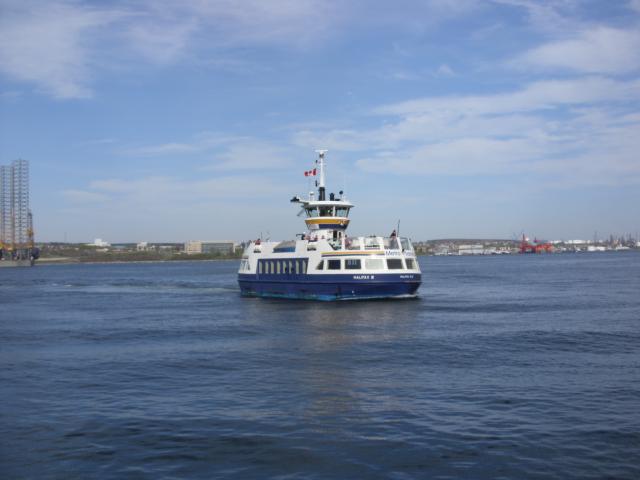 |
This Metro Transit ferry was arriving at Halifax from Dartmouth, across the harbor. The harbor is especially narrow between Halifax and Dartmouth, and there are two toll bridges that connect the two neighborhoods in addition to the municipal pedestrian ferry. |
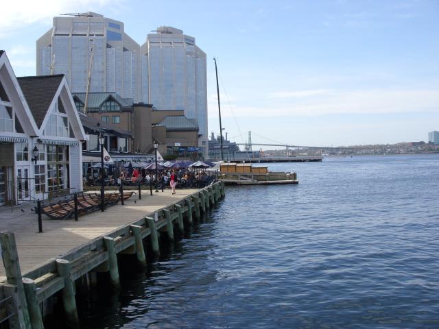 |
A view of the waterfront in downtown Halifax. In the far distance, you can see one of the two toll bridges. |
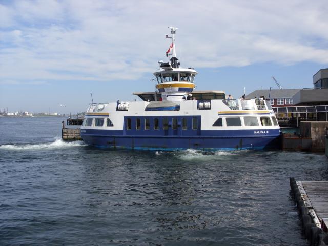 |
The Metro Transit ferry pulling up to the pier in downtown Halifax. |
 |
I think this is an offshore oil rig. |
 |
This is the view of the Old Clock Tower from the Parade Ground on St. Paul's Hill. It was probably a better view before all the tall buildings went in. |
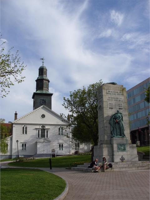 |
St. Paul's Anglican Church in Halifax is the oldest Protestant church building in Canada. The church was founded by proclamation by King George II in 1749 and held its first service in 1750. The church is designed as a copy of St. Peter's Church in London, England. In front of the church is the Halifax Cenotaph, a war memorial for the Nova Scotia veterans of World War I, World War II, and the Korean War. |
 |
I thought this mural of tall-masted sailing ships was very nice. |
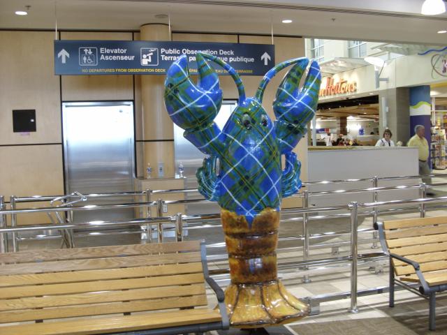 |
A lobster in Scottish plaid in Halifax Stanfield International Airport. YHZ is the largest airport in Atlantic Canada, by far, with even some trans-Atlantic flights. |
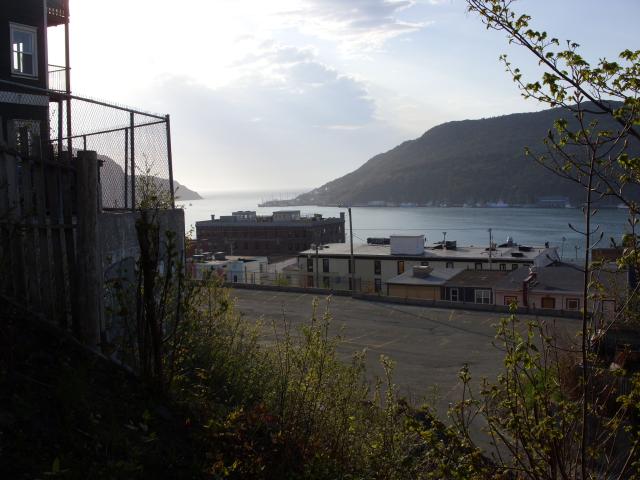
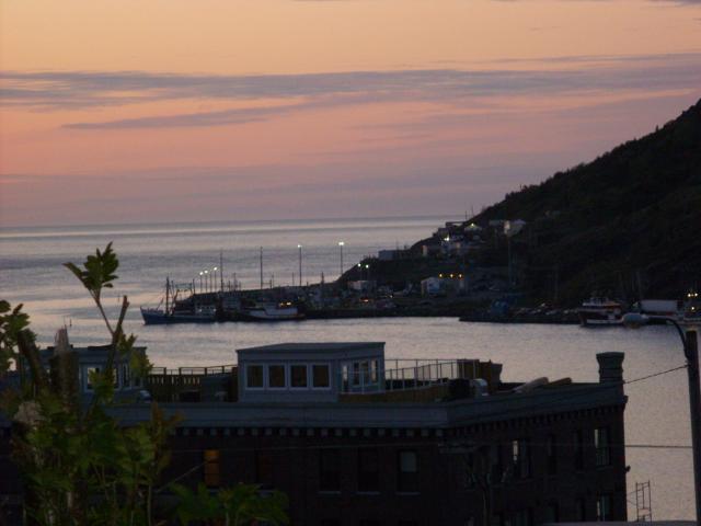
I had about 32 hours in Newfoundland, and it was an absolute joy. I was completely unprepared for how much I would enjoy the place. Downtown St. John's is a gorgeous city that, despite the steep hills, was fantastic to walk around. The city has about 100,000 residents, and the metropolitan area about 180,000. The weather was spectacular - sunny and in the upper 60s to lower 70s Fahrenheit.
 |
This was the view of the harbor form the back deck of the apartment early in the morning. |
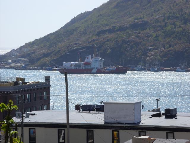 |
A ship coming into port. |
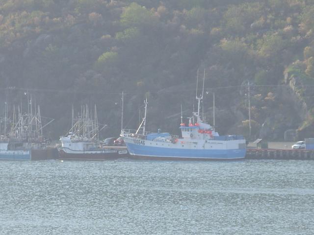 |
Some fishing boats on the far side of the harbor. |
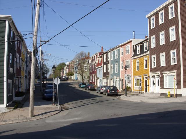 |
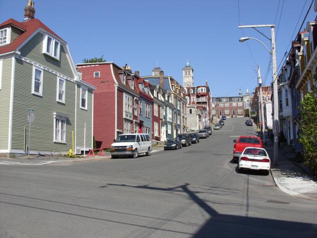
Gower Street in downtown St. John's is full of row houses painted in bright colors. This street was two and a half blocks and about 100 feet in elevation up from the water. |
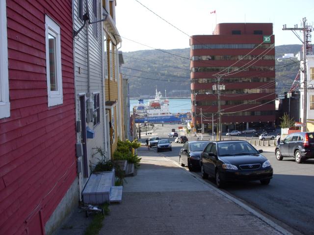 |
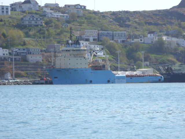
This street was steep enough that the sidewalk on the other side of the street turns into a staircase for a while. The large ship at the pier at the end of the street was a Woodward Group freighter that probably supplies small communities in Labrador and Nunavut with fuel and other supplies. |
 |
Some row buildings on Duckworth Street. Most of the buildings on this street had shops or restaurants in them at street level. I ate a breakfast of fish and brewis (salt fish, bread, onions, and scrunchions) at the Bagel Cafe, about a block to the left down this street. |
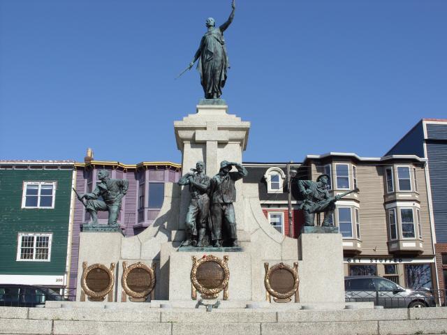 |
The National War Memorial in St. John's was originally unveiled in 1924 to memorialize the veterans from Newfoundland who fought in the first World War. It is called the National War Memorial, as it was dedicated for the veterans of the Dominion of Newfoundland, 25 years before Newfoundland joined Canada. |
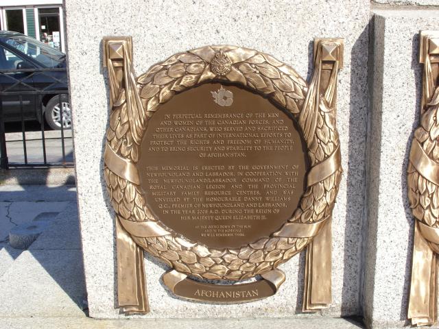 |
Plaques on the monument today recognize the veterans of all the wars fought by Newfoundlanders since the first World War, including the current conflict in Afghanistan. |
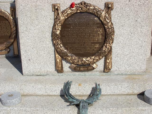 |
The original plaque beneath the statue specifically memorializes the World War I fighting in Egypt, Gallipoli, France, Belgium, and "the Seven Seas". |
 |
This was the largest building on the waterfront. There were several examples of this architectural style in downtown St. John's. |
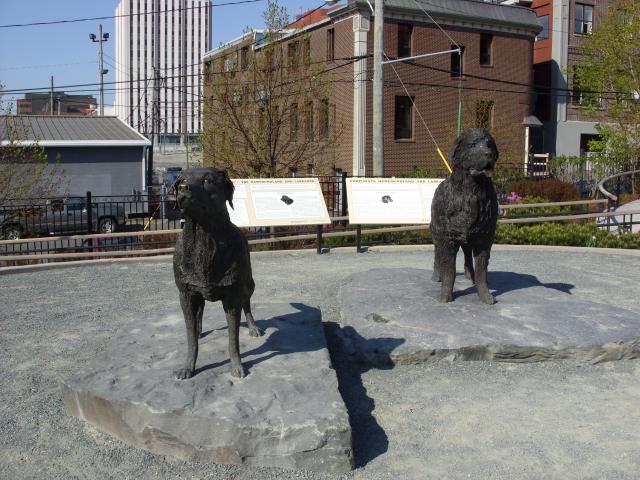 |
In Harbourside Park, there's a famous sculpture entitled Our Dogs. The dog on the right is a Newfoundland and the dog on the left is a Labrador Retriever. The park is located on the spot where Sir Humphrey Gilbert claimed the island of Newfoundland for the English crown in 1583. |
 |
A large ship tied up at the dock. |
 |
Some docks near Harbourside Park. |
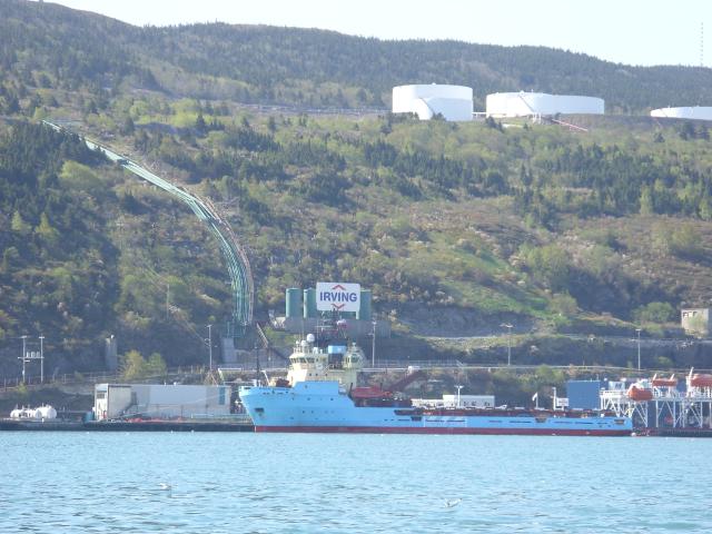 |
Some commercial ships across the harbor. Most of these are oilers. The Irving Oil sign is just to the right of a large pipeline going up the hill to the large white storage tanks. |
 |
Looking out at the mouth of the harbor, where a ship is cruising out to sea. |
 |
Another very large cargo ship on the far side of the harbor from downtown St. John's. |
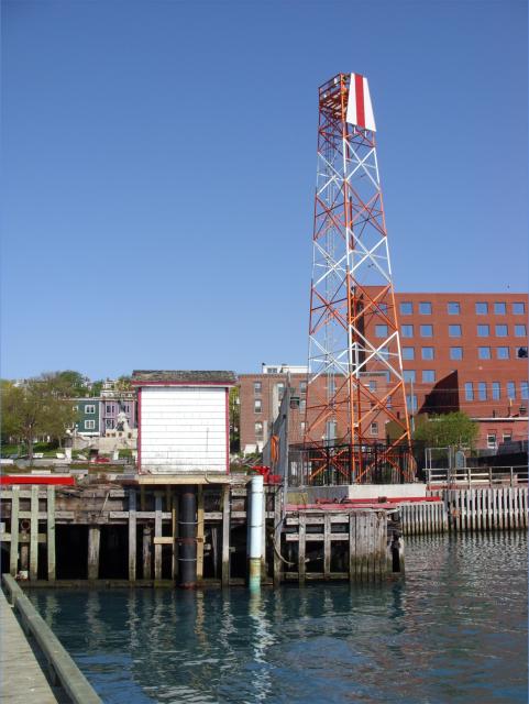 |
A tower next to Harbourside Park. I'm not sure what it's used for, as there were no antennas or lights on it. |
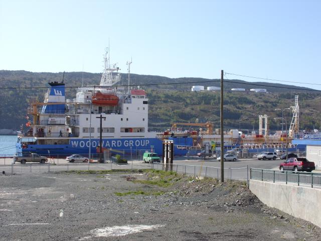 |
A Woodward Group cargo ship. This ship hauls fuel and other supplies north to smaller communities in Newfoundland, Labrador, and Nunavut. |
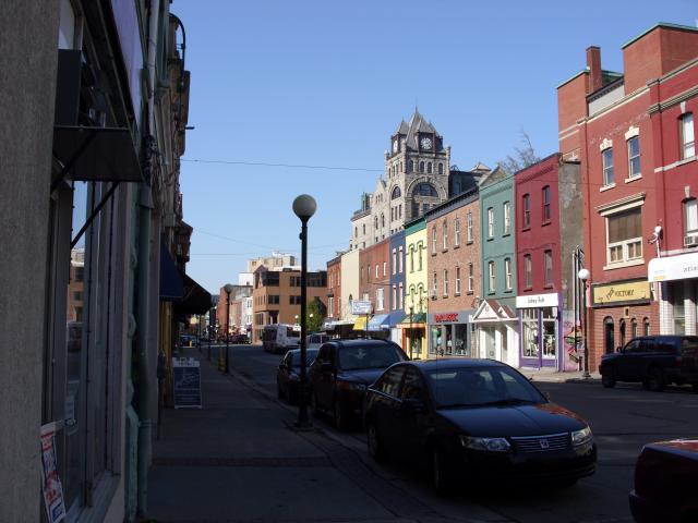 |
Buildings on Water Street in St. John's. This was around 9:00 AM on a Friday. |
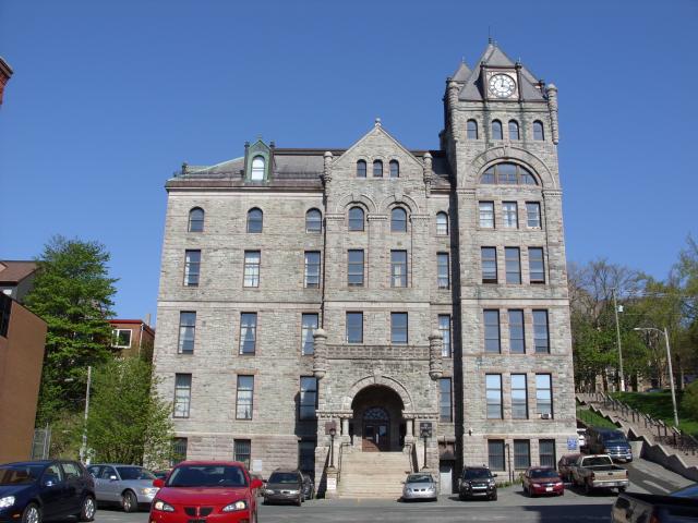 |
The Supreme Court of Newfoundland and Labrador was located in an old building between Water Street and Duckworth Street. The staircase on the right of the building gives you a sense of how steep the hill is on which downtown St. John's is located. |
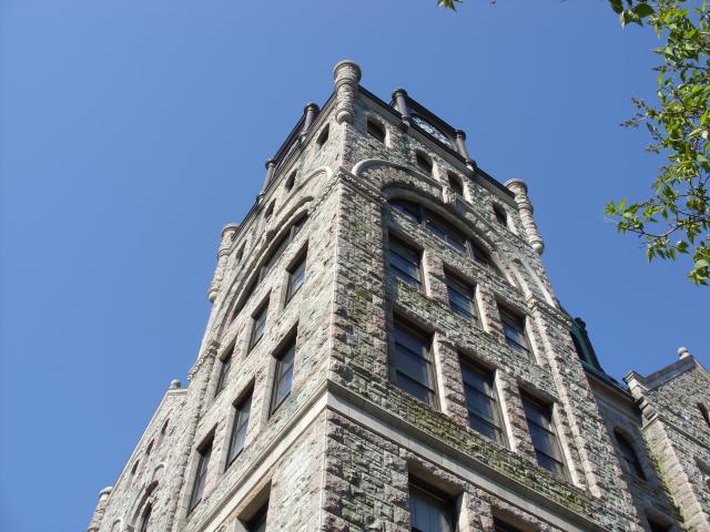 |
A closeup of the tower on the northeast corner of the Supreme Court building. |
 |
The Masonic Temple |
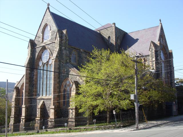 |
This is the Cathedral of St. John the Baptist. This Anglican church was founded in 1699, three years after the town of St. John's was burned to the ground by the French army. It was the first stone church built in the city. |
 |
A typical downtown residential street in St. John's, Newfoundland. Some of the hills were pretty steep. |
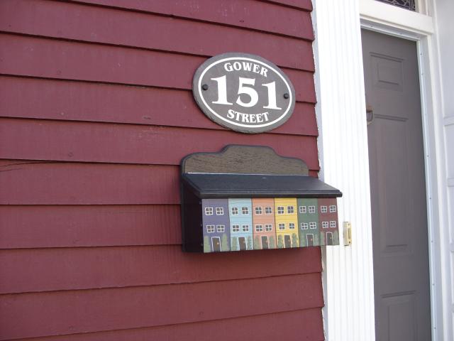 |
Just down the street from where I was staying was this house with a great mailbox designed to look like all the houses on the street. |
 |
The Colonial Building was the first permanent seat of Newfoundland government. The building construction was completed in 1850 and was the site of the National Conventions first held in 1946 that eventually led to the confederation of Newfoundland with Canada in 1949. From 1949 to 1958, the building housed the Newfoundland and Labrador House of Assembly. Today it is a Provincial Historic Site. It was interesting, in the same week, to see the buildings where a nation was formed (Province House in Charlottetown, Prince Edward Island) and the building where a nation came to an end. |
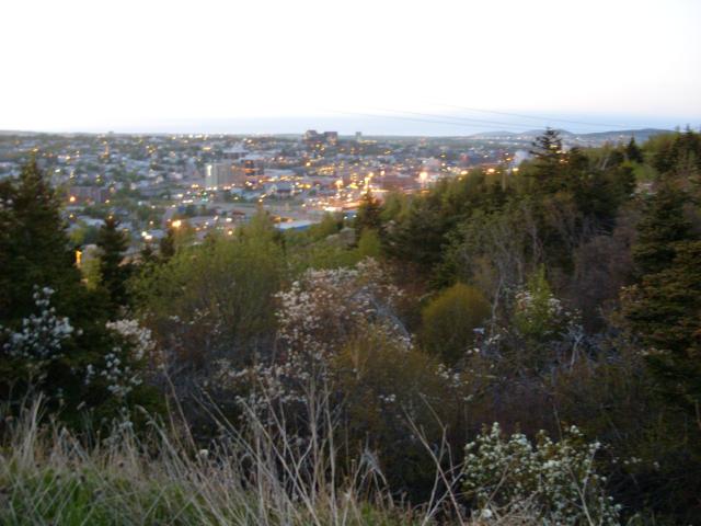 |
The city of St. John's at night, as seen from Blackhead Road, south of the city center. |
 |
A view of the harbor at 5:00 AM on a Saturday morning. |
 |
The morning light just before sunrise was spectacular. |
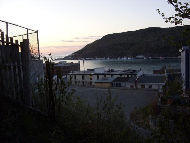
Signal Hill is a strategic hill overlooking the mouth of St. John's harbor. It has been fortified by the British since the mid-1600s. The hill, along with the town of St. John's, was seized by the French in the June, 1762. A British counterattack in September captured the hill and the town, the final battle in the French and Indian Wars. Signal Hill was the site from which Guglielmo Marconi received the first trans-Atlantic radio transmissions (from Poldhu, Cornwall) in 1901. The hill served as a point for ship-to-shore flag communications until 1960. Today, the site is an incredibly popular National Historic Site. 97% of all tourists who visit St. John's visit Signal Hill.
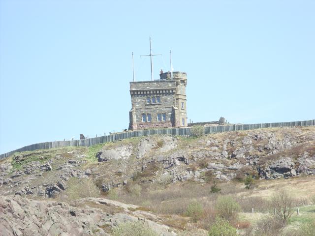 |
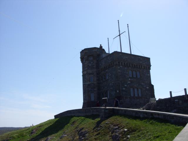
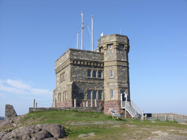
At the top of Signal Hill is Cabot Tower. Cabot Tower was built in 1897 to commemorate the 400th anniversary of John Cabot's discovery of Newfoundland. It is about 50' tall and was the first stone tower built on Signal Hill; previous signal towers had been built from wood. |
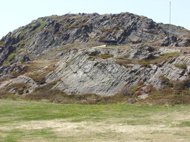 |
Some of the exposed rock on the hill. |
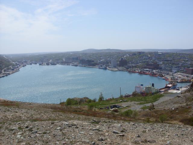 |
A view of St. John's harbor from the visitor center. |
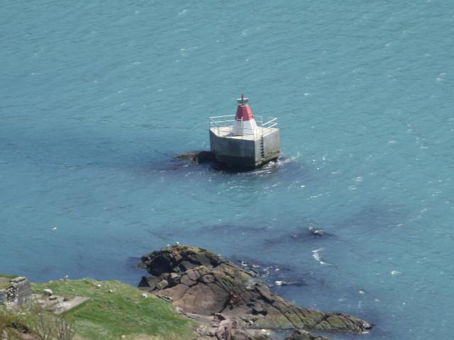 |
A lighted marker point on some rocks in the water just off the base of Signal Hill. |
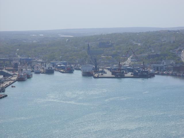 |
The far end of the harbor, to the southwest, where the really large cargo ships dock right next to the rail yard. |
 |
Cabot Tower has several signaling masts from which flags would have been flown for communications between ships outside the harbor and the city below. Shipping companies paid the garrison on the hill to hoist their company flags and the direction of their arrival so that merchants could prepare to receive them. |
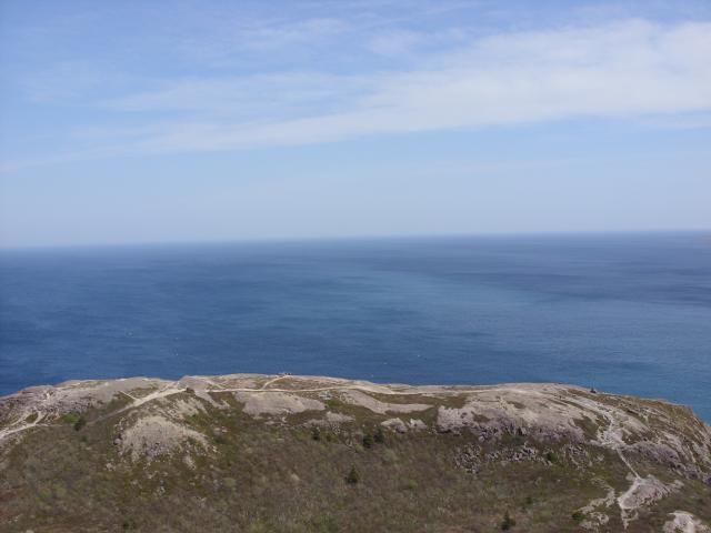 |
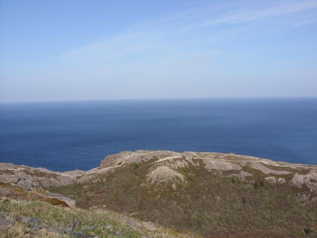
The Atlantic Ocean, looking east toward Europe. |
 |
Another view of the ocean. What surprised me was how the color of the water was not uniform. There were definitely lighter and darker blues, I guess because of wind and maybe temperature variations. |
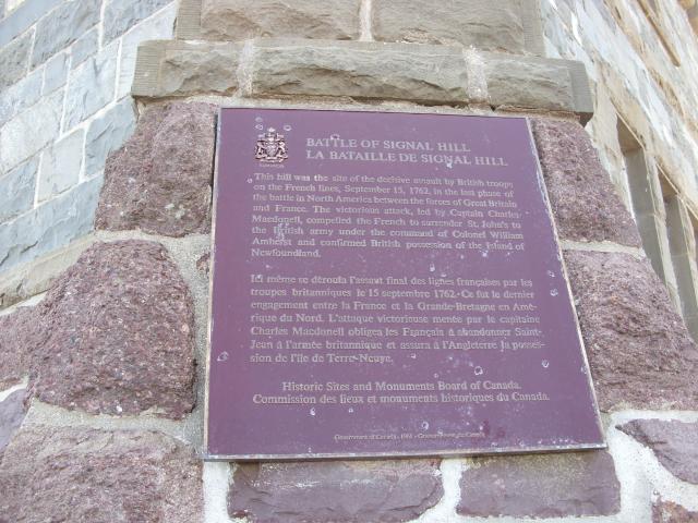 |
A plaque commemorating he Battle of Signal Hill, one of the final battles in the French and Indian Wars of 1754-1763. French forces had seized St. John's and Signal Hill in June, 1762. British forces arrived in September, 1762 and stormed the hill, capturing it with very light casualties. The result of the battle compelled the French to surrender the town below and effectively ended their bid to take Newfoundland from the British. |
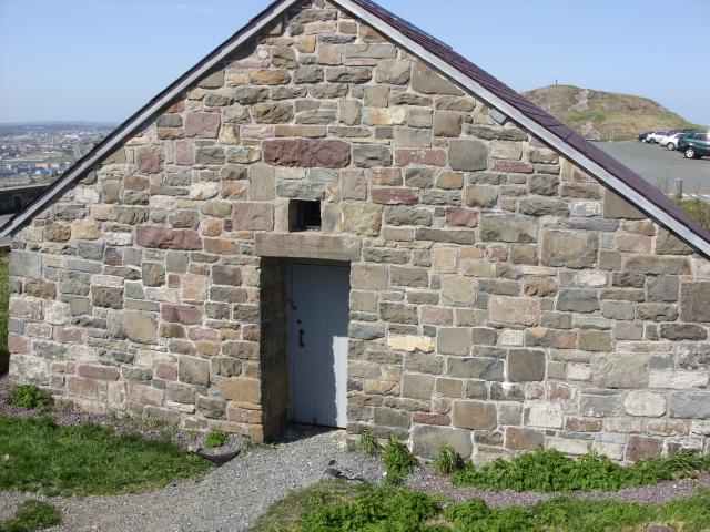 |
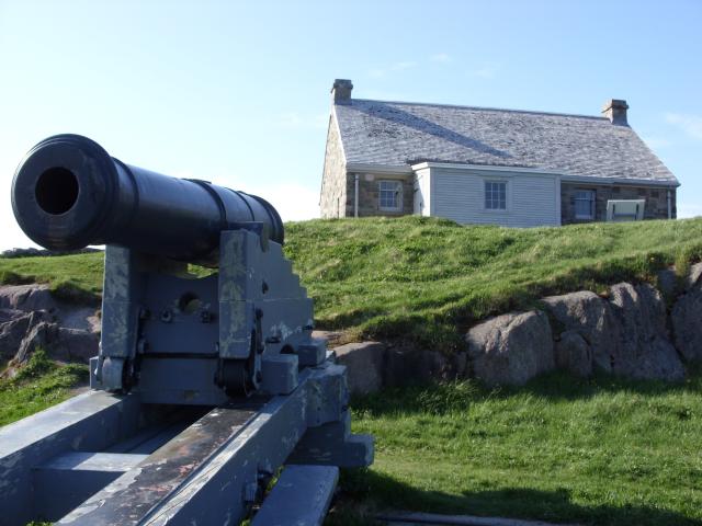
A stone building next the Cabot Tower at the top of the hill. |
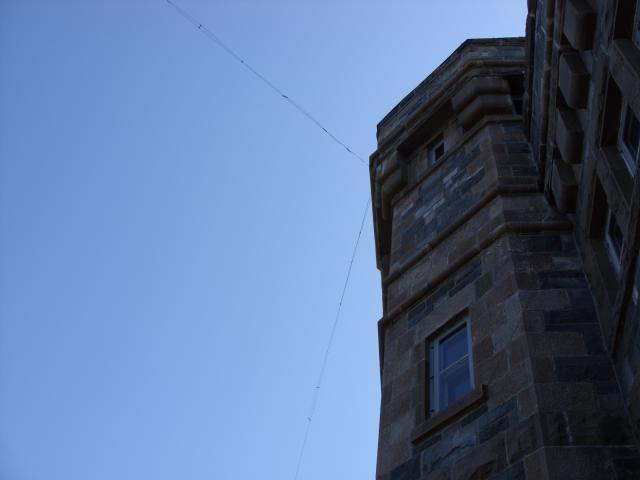 |
The Society of Newfoundland Radio Amateurs (SONRA) maintains and operates an amateur radio station inside Cabot Tower, as part of the site's tribute to the radio history of Signal Hill. Sensitive to the park rangers' concerns about maintaining the historic appearance of the tower, the station uses modest wire antennas that are hard to see if you don't know where to look for them. |
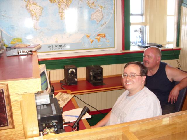 |
Doug Mercer, VO1DTM, a local amateur radio operator who is active with the amateur radio station on Signal Hill met me there and enabled me to get on the air and make some radio contacts from this historic location. |
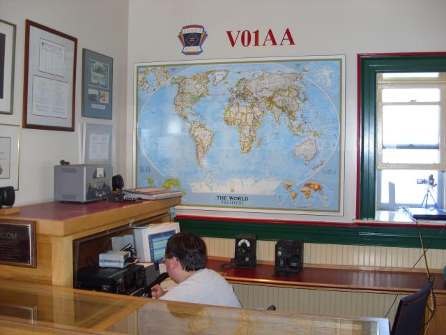 |
The VO1AA station occupies about a quarter of the second floor of the tower, and had a display case, just below the frame of this photo, displaying antique radio equipment and explaining the 1901 wireless experiments conducted by Marconi on Signal Hill. |
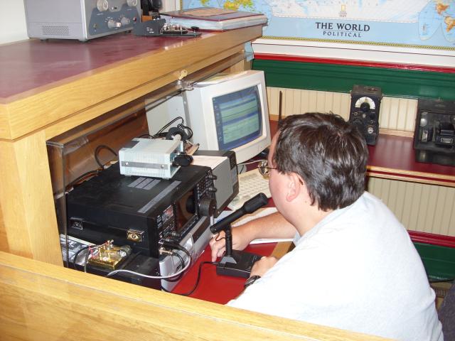 |
The station equipment was fairly modest, but thanks to a donation by Icom America |
 |
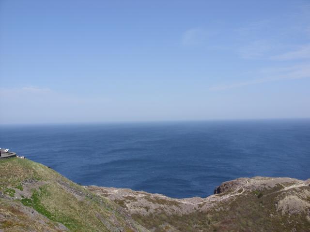
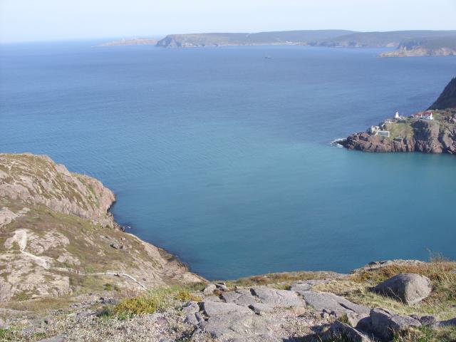
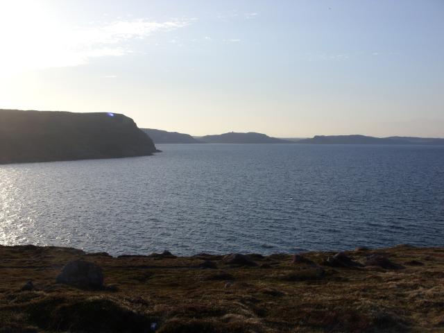
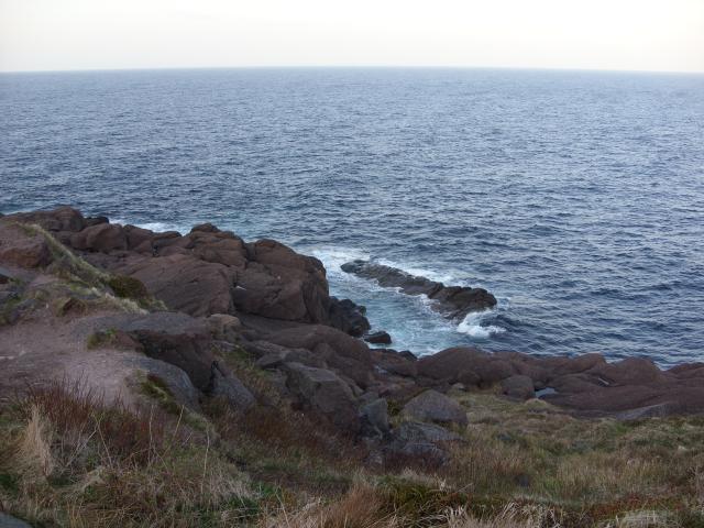
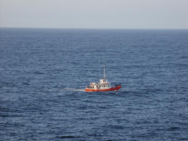
Looking across the mouth of the harbor to the south. The leftmost point of land in the distance is Cape Spear, where you can just make out two white lighthouse buildings. |
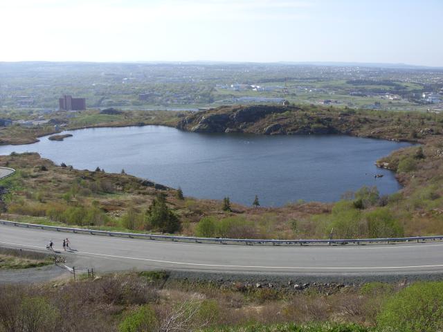 |
George's Pond, a freshwater pond close to the top of Signal Hill. |
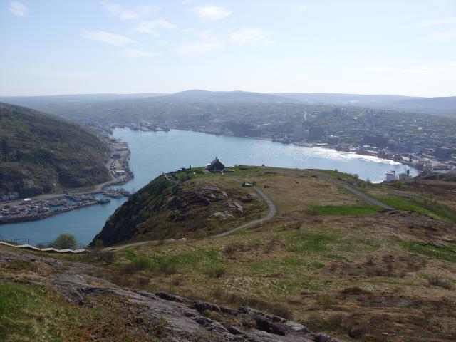 |
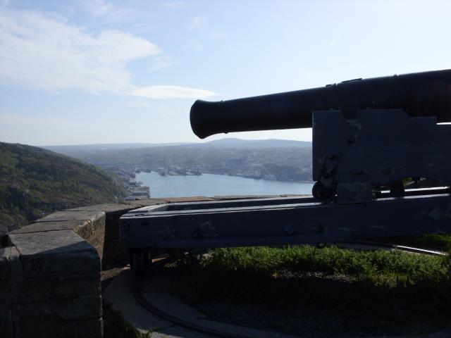
Looking back at the harbor from Cabot Tower. The stone building in the center of the photo was what remains or has been rebuilt of the Queen's Battery. |
 |
Cabot Tower, at about 5:00 PM. Because of high winds, the observation deck at the top of the tower was closed the day I was there. |
 |
The mouth of the harbor. |
 |
Another view of the North Atlantic. The weather was spectacular. The temperature was right around 70°F. According to Doug, it stood a chance of being the nicest day of the year. |
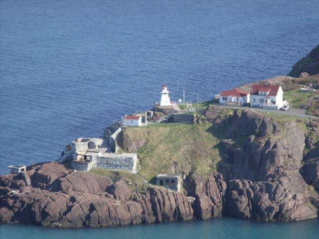 |
Fort Amherst, on the southern side of the harbor opening has a lighthouse. I did not have time to visit that historic site. |
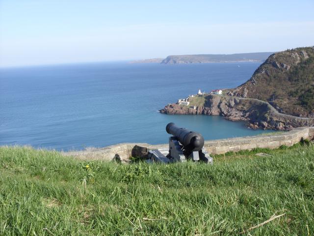 |
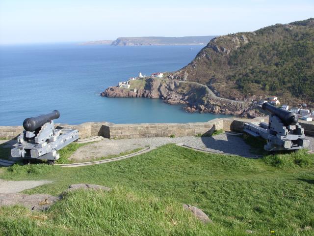
One of the historic cannons at the Queen's Battery. The Queen's Battery was downhill from the top of Signal Hill, commanding a view over the narrow harbor entrance. |
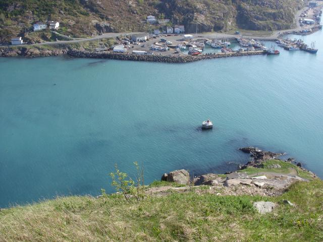 |
The battery was still about 300 feet above the water. |
 |
Only a part of one of the original stone buildings of Queen's Battery has been preserved and restored. |
 |
One of the cannon, with St. John's harbor in the background. |
 |
Queen's Battery was named after Queen Charlotte, the wife of King George III, and was an important part of the defense of Newfoundland throughout the nineteenth century. |
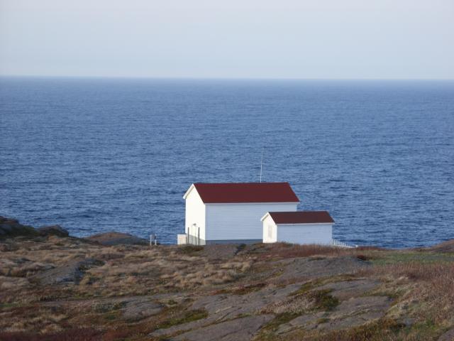
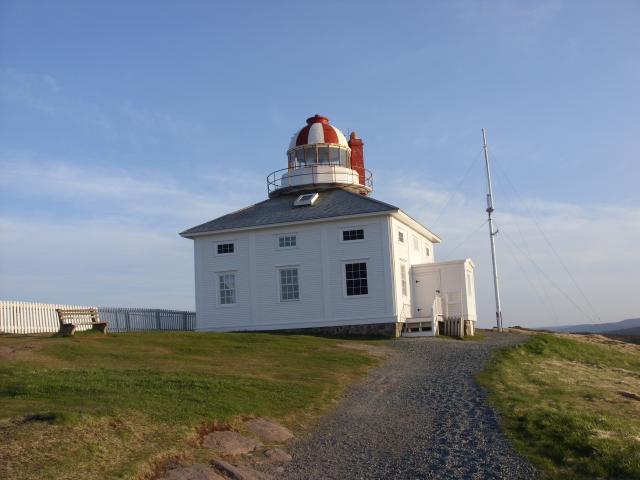
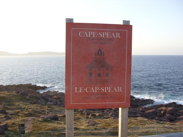
Cape Spear National Historic Site is located on the Avalon Peninsula east-southeast of St. John's, Newfoundland. It is the easternmost point of land in Canada. The cape was original named "Cabo da Esperança" in Portuguese, a name that came to be mogrified into Cape Spear in English. The Cape has the oldest surviving lighthouse in Newfoundland, built from 1834 to 1836 and retired from service in 1955 when a new lighthouse was built at the site. The old lighthouse and the light keeper's house have been restored and today are operated as a national Historic Site. As I was arriving close to sunset, after dinner, the buildings were all closed, but I was free to walk around the site and enjoy the spectacular views.
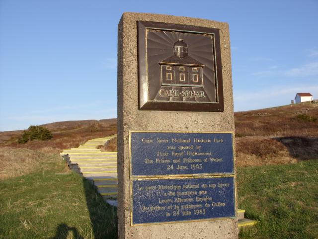 |
The plaque designating Cape Spear as a National Historic Site. |
 |
A view of the Atlantic Ocean coastline, looking north back toward St. John's. You can barely make out Cabot Tower in the distance. |
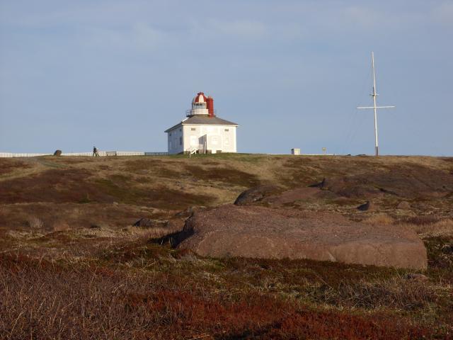 |
The 1836 lighthouse at Cape Spear is a rectangular wooden building with the light on top. A signal mast would have been used for flag communications with ships at sea. |
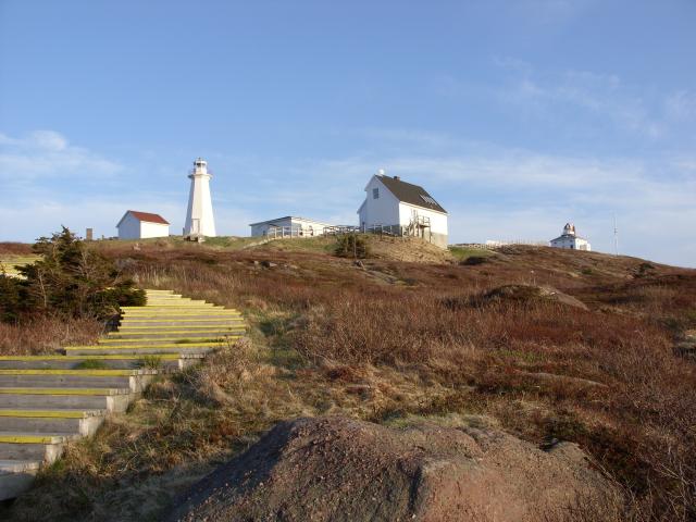 |
The current 1955 lighthouse is the tall, white building on the left side of this photo. It is made primarily from concrete. You can see the boardwalk stairs that lead from the parking lot to the historic buildings. |
 |
Two buildings at Cape Spear are typical of the coastal architecture in eastern Newfoundland. |
 |
The 1836 lighthouse. I believe the radio mast on the right side of the building is connected to a meteorological station. |
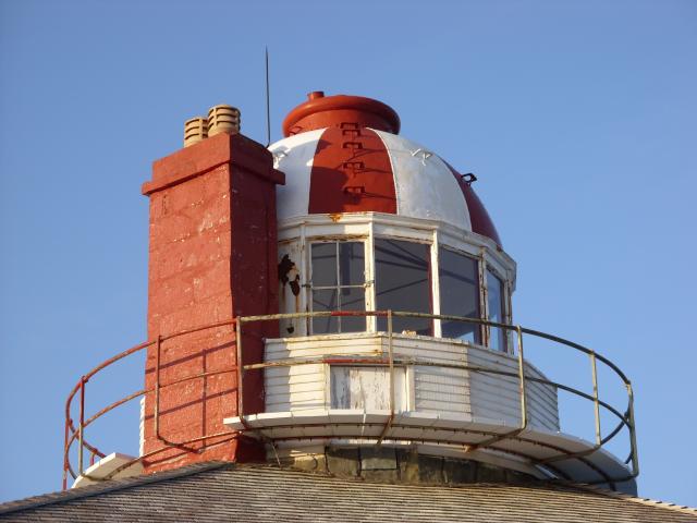 |
The top of the 1836 lighthouse. The chimney is on the inland side of the light. |
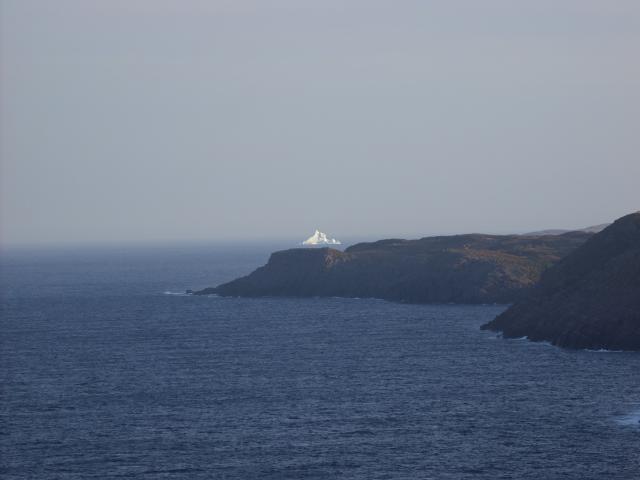 |
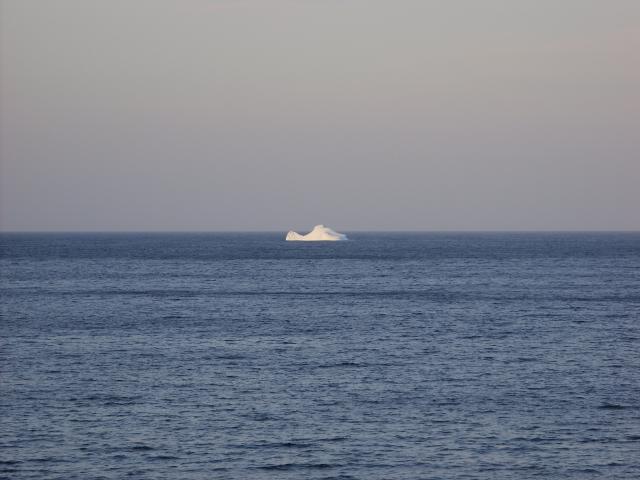
Way off to the south was a small iceberg. May is prime iceberg sighting season in St. John's. This was the first iceberg I've seen in real life. |
 |
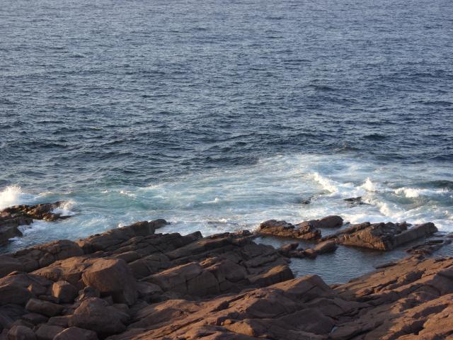
A view of the rocks at the base of the cliff on top of which the lighthouses are located. The steepest portions of the shoreline was fenced off. |
 |
The 1955 lighthouse is a concrete structure, painted white. Today, the light is fully automated and no light keeper lives at the site. One of the white buildings houses a visitors center and another houses an art gallery. None of them were open when I was there. |
 |
The granite rocks at Cape Spear were worn smooth by the constant wind blowing in from the Atlantic Ocean. In the far distance, you can see the small iceberg. |
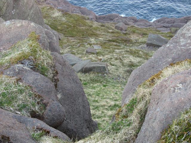 |
Boulders and grass at Cape Spear. |
 |
The ocean was relatively calm on the evening I was there. |
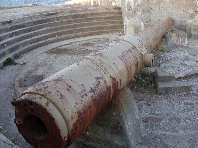 |
A gun battery was built at Cape Spear by the United States military to protect the harbor from potential German attacks. This gun is rusting in its mount, and has been badly vandalized over the years. |
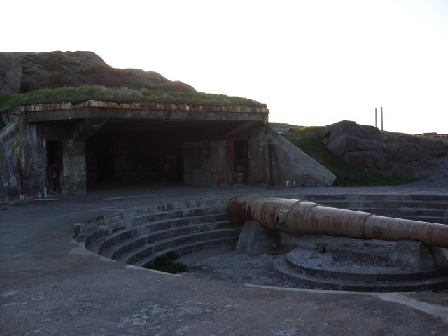 |
Behind the gun is an entrance to one of the bunkers built into the side of the hill. |
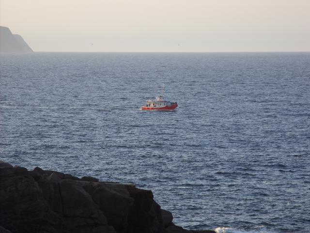 |
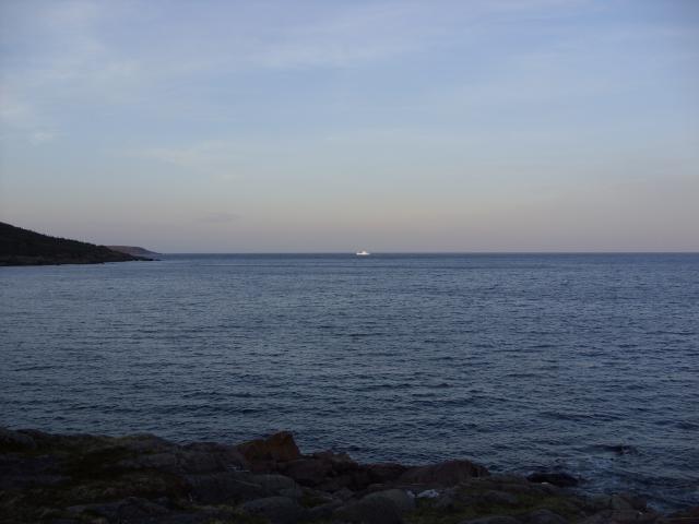
I think this was a tourist boat departing from St. John's. Boats like this offer cruises for both whale watching and iceberg watching. |
 |
When the boat rounded the cape and came into a position to see the small iceberg to the south, the passengers let up a big cheer. They sounded like they were having a good time. |
 |
This is the easternmost point of Canada. |
 |
The sign right at the point of Cape Spear proclaims it to be "the most easterly point in North America". This is a matter of debate, as it assumes that Greenland is not a part of North America. |
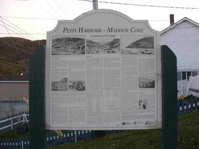
Petty Harbour is a small fishing village about 15 miles south of St. John's. The location of the town has been permanently inhabited since 1598, making it one of the oldest European settlements in North America. The population of Petty Harbour and nearby Maddox Cove together is just under 1,000. Petty Harbour is a picturesque little town built around a narrow harbor at the western end of Motion Bay. The harbor was full of small fishing boats, mostly lobster boats. I came to Petty Harbour just after sunset, chasing the iceberg I saw from Cape Spear.
 |
Looking out to Motion Bay from a parking area next to the road. The iceberg I saw from Cape Spear was directly outside the bay. |
 |
The small iceberg had a different profile from this direction than it did from Cape Spear. |
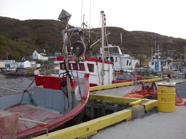 |
Some of the boats in the harbor. Petty Harbour is one of the oldest fishing communities in North America. Historically, most of the fishing was done from dories using hand-lines, fishing for cod. |
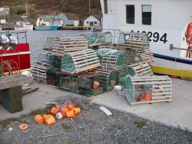 |
A stack of lobster traps. Unlike cod, there is no moratorium on lobster fishing in Newfoundland waters. |
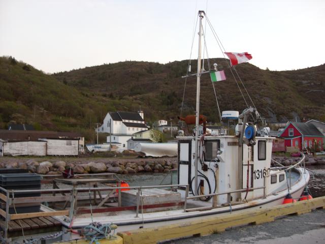 |
This boat has both a Canadian flag and the Newfoundland tricolor flag. The Newfoundland tricolor (pink, white, and green). Legend has it that the Newfoundland tricolor was designed in 1843 as an effort to unite English Protestants (represented by the Tudor rose color) and Irish Catholics (represented by the green) in the community together. The flag has been used by the Newfoundland Natives' Society, and recently has been popular with those who support an independent Newfoundland. |
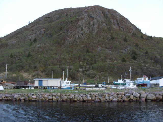 |
Some boats out of the water. The hill behind the town was about 400' high. |
 |
A small boat from St. John's. |
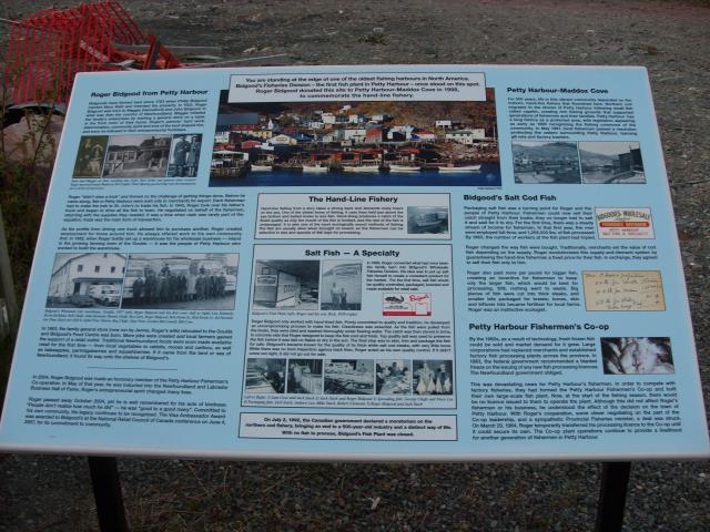 |
This sign near the harbor wharf tells the story of the hand-line fishing industry and the now-closed Bidgood's salt fish processing plant in the town. |
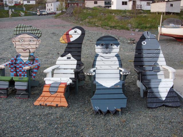 |
Some chairs near the fishing boats at the harbor wharf. From left to right, we have a fisherman, a puffin, a seal, and a fish. |
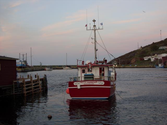 |
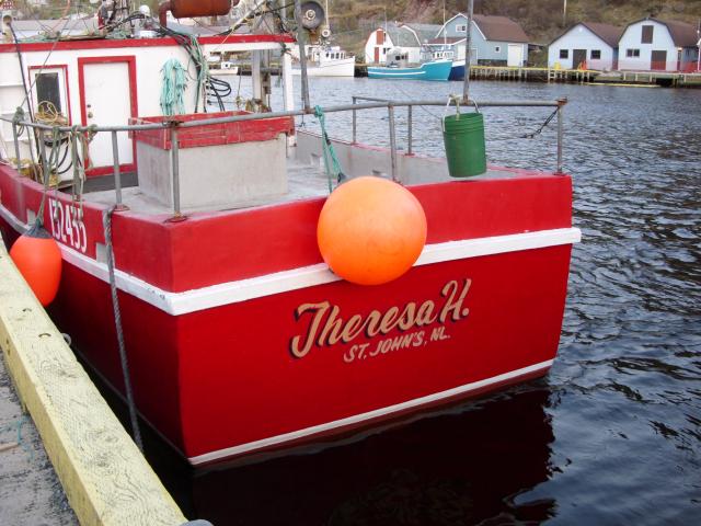
One of the better looking small fishing boats in the harbor. This boat has a block on the starboard rail that is used to haul up traps for shellfish like lobster or crab. The two flags flying from the mast are the Canadian flag and the provincial flag of Newfoundland. |
 |
A "historyboard" near the center of town tells some of the history of Petty Harbour. |
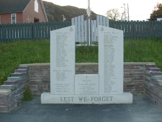 |
The town war memorial. Dedicated in 1998, it memorializes those from Petty Harbour who served in World War I, World War II, Korea, and the Persian Gulf. |
Bouctouche is an Acadian town about ten miles north of our waterfront cottage in Cocagne. The town was founded by French settlers in 1785, where the Bouctouche River flows into the Northumberland Strait. The town has a population of about 2,300 people.
 |
The St. Jean Baptist Cathedral in downtown Bouctouche. Built in the neo-Gothic style, it was constructed in the 1950s. |
 |
A park next to the Bouctouche River had some nice lawns and this covered bridge on a footpath. |
 |
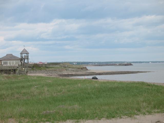
Bouctouche Bay. |
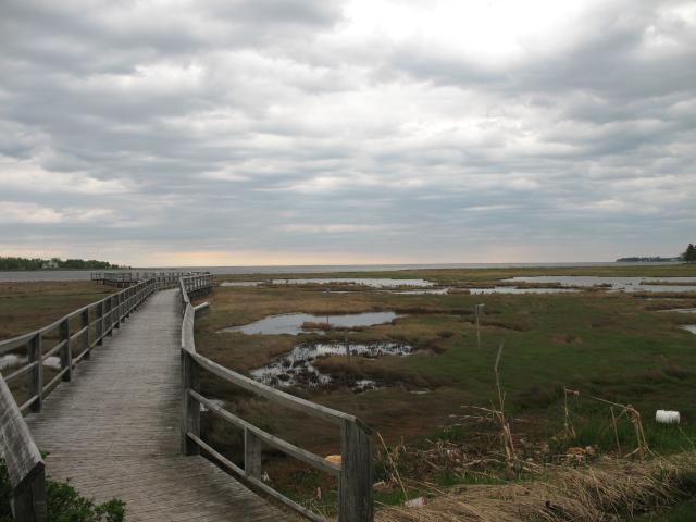 |
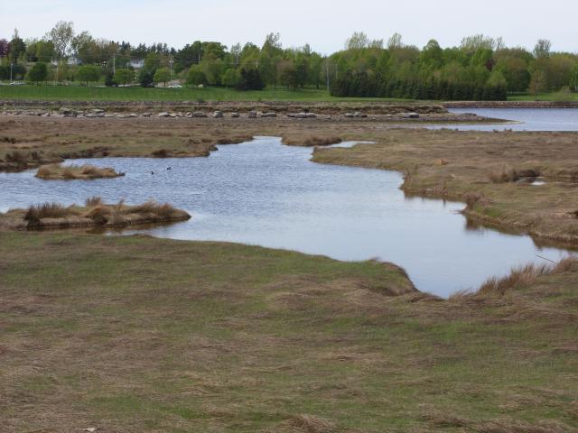
The coastline south of the river mouth is a salt marsh. The town maintains a park with a boardwalk into the marsh that has a lot of educational signs explaining the ecology of the marsh and its benefits to the local environment. |
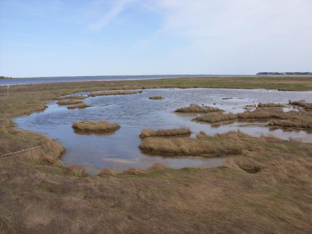 |
The salt marsh. |
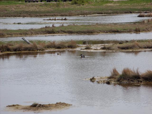 |
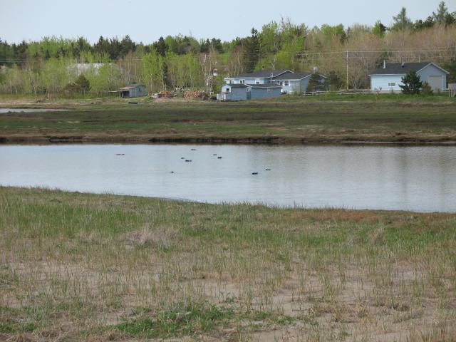
Some ducks in the marsh. |
 |
A lot of the marsh looks like solid, grass-covered ground, but if you were to step on it, you'd fall through into the water. |
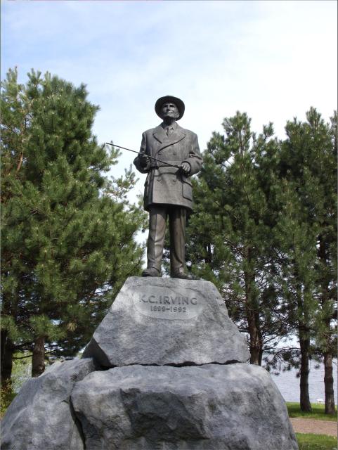 |
Billionaire industrialist K.C. Irving was born in Bouctouche, and there is a statue of him in a park downtown. The J.D. Irving company was founded by K.C. Irving's father, but it was this man who built it into the business it became. The Irving family have supported a lot of philanthropic projects in the town. |
 |
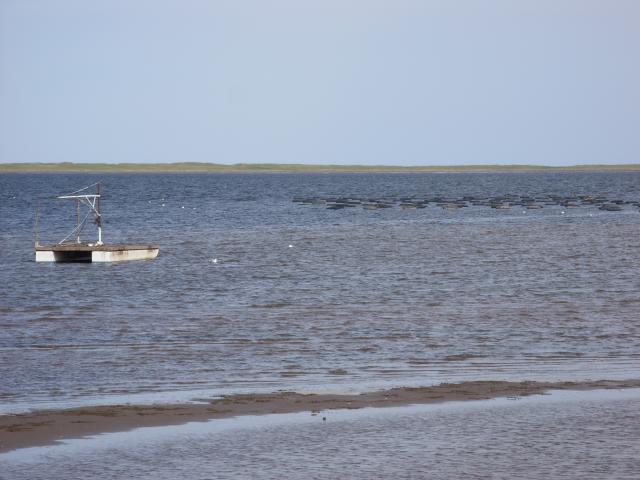
North of Bouctouche is a shallow bay protected from the Northumberland Strait by the Bouctouche Dune. I was driving by it at low tide. |
 |
These floats out in the water support mussel beds. |
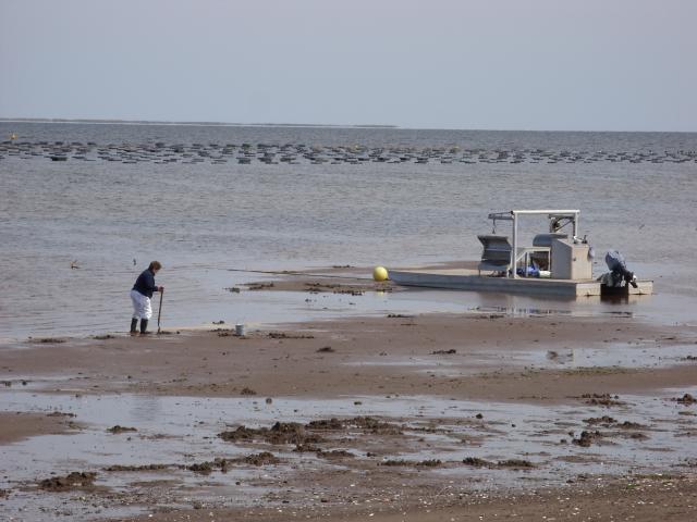 |
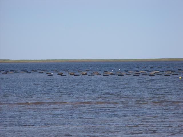
Fishermen out harvesting oysters in the mud flats. |
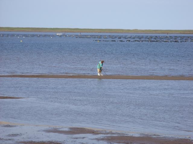 |
Another oyster farmer. In the distance are mussel beds and behind them, the Bouctouche Dune. |
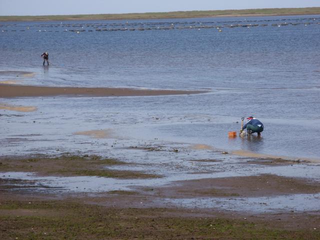 |
More oyster farmers. |
 |
I don't think this was so much a boat as a permanently-moored floating platform. |
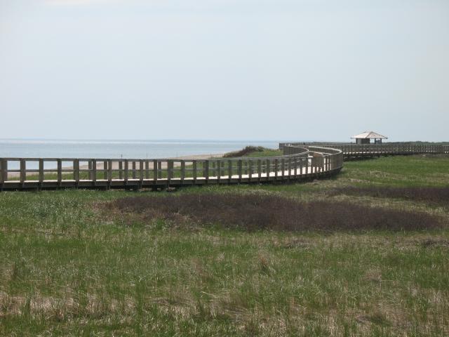
A few miles north of the town of Bouctouche is the Irving Eco-Centre La Dune de Bouctouche. The sand dune extends over ten miles out into the Northumberland Strait. It creates a shallow, protected bay for the town of Bouctouche. It is also a natural environment for many birds and small mammals. The entire dune is maintained as a park funded by the J.D. Irving Company. It includes an interpretive center, an 1800 meter long boardwalk, and is a popular beach destination.
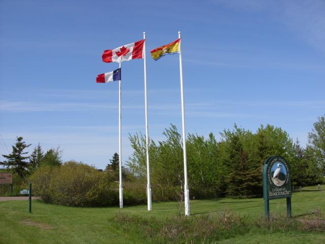 |
The entrance to the park featured three flag poles with the Canadian, New Brunswick, and Acadian flags. |
 |
The entrance sign features a heron. |
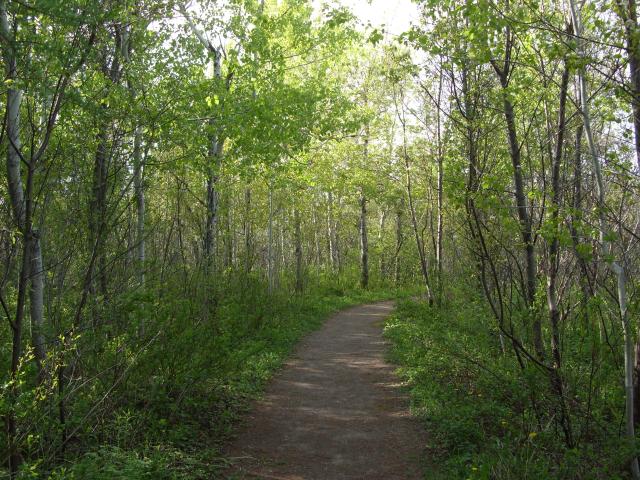 |
A walking path near the interpretive center went through a small wooded area next to the salt marsh. |
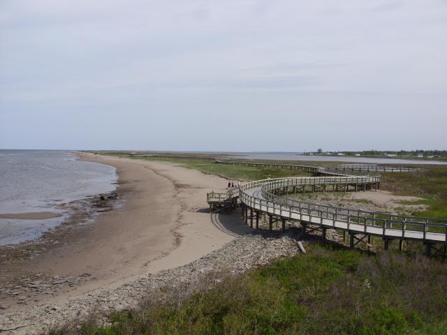 |
A view of the dune from an observation deck at the interpretive center. The boardwalk winds along the high point of the dune, closer to the ocean side of the dune than the bay side of the dune. |
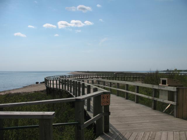 |
The entrance to the boardwalk. |
 |
The dune is mostly covered in grasses and other vegetation. |
 |
The interpretive center had a two-story observation deck. |
 |
Some homes on the far side of the salt marsh at the very northern end of the bay. |
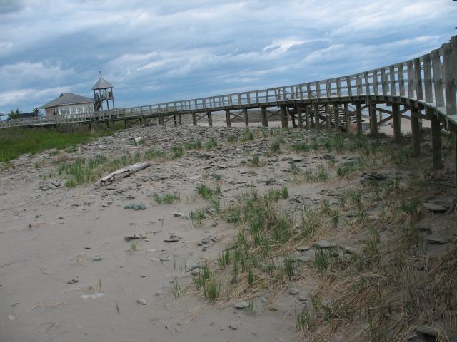 |
The boardwalk was built on pilings generally 2 to 4 feet above the sand. |
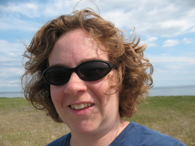 |
Jen, on the boardwalk. |
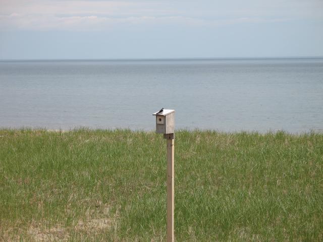 |
A birdhouse. |
 |
The boardwalk periodically has sun shelters and even chemical toilets. |
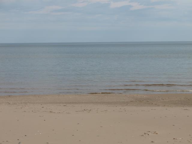 |
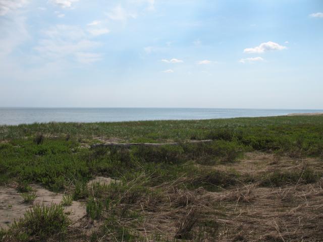
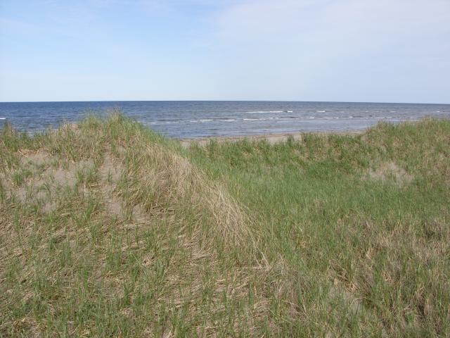
The beach on the Northumberland Strait side of the dune. |
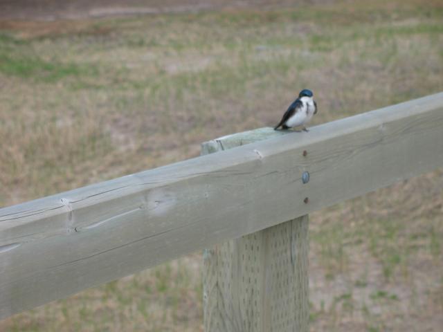 |
A small bird sitting on the railing of the boardwalk. |
 |
Dune grasses. |
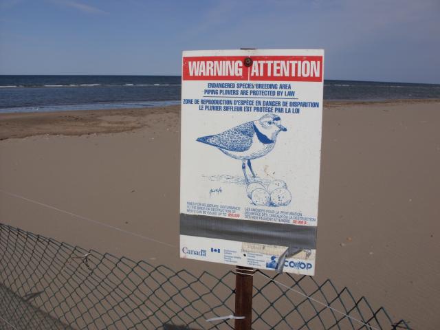 |
Portions of the beach were fenced off with signs like this one. Piping Plovers are a a "near threatened" species in eastern North America, and are protected as an Endangered Species in New Brunswick. The birds nest in the dunes, and each season experts identify the locations of nests and fence off those portions of the beach to protect the birds and their nests. |
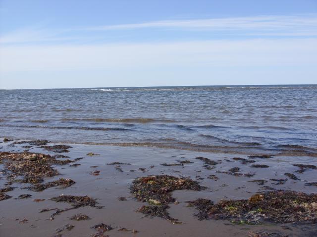 |
The seaweed was nowhere near as bad as we are used to on the Gulf of Mexico beaches. |
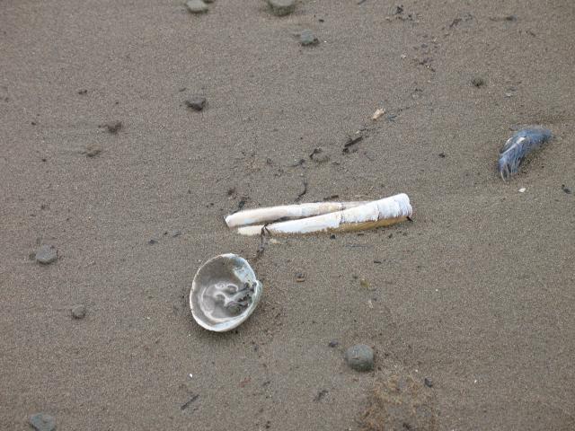 |
Some shells on the beach. |
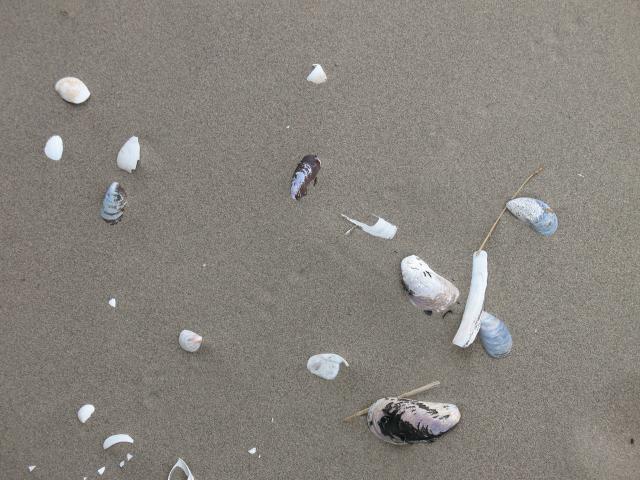 |
Some more shells. These are a mix of mussel shells, oyster shells, and razor clam shells. |
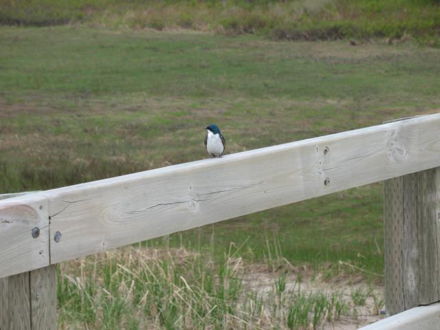 |
The blue bird on another part of the boardwalk. |
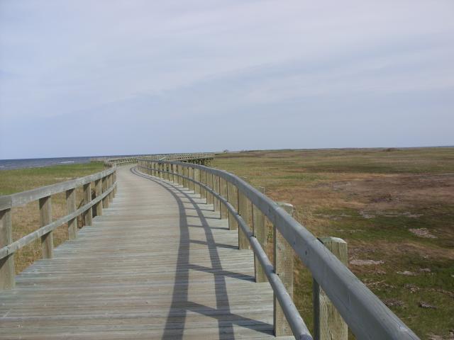 |
The boardwalk was 1.8 kilometers long, and was mostly deserted when we were there. |
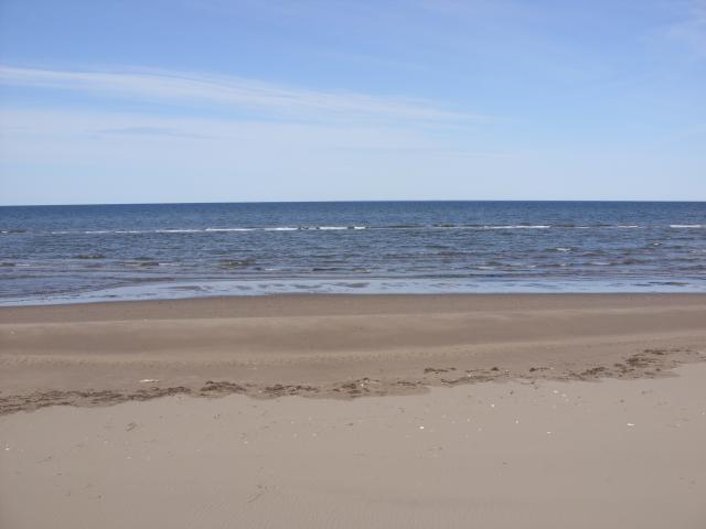 |
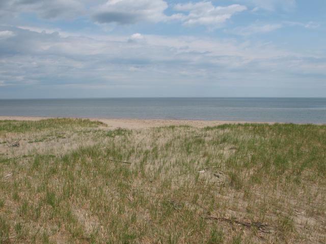
Another nice section of beach. |
 |
A dead crab. |
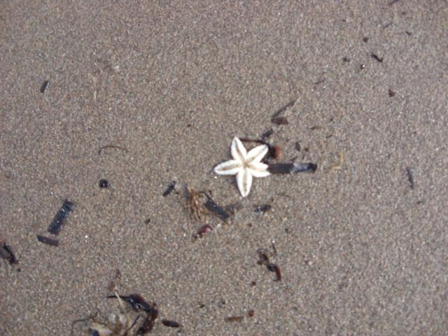 |
A very small starfish. |
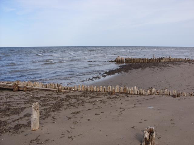 |
At the far end of the boardwalk are the remains of a failed channel. The fishermen of Bouctouche tried on two occasions to dredge a navigable channel through the northern part of the dune so that fishing boats in the Northumberland Strait would not need to sail another nine miles to the south to get to the entrance of the bay. All that remains today are these pilings. |
 |
Beyond the end of the boardwalk, the dune continues for another nine miles. The entire dune is open to the public, but is only accessible by foot or by boat. |
 |
A view of the Northumberland Strait through the dunes. |
 |
This kind of environment is ideal for small foxes that hunt birds and small rodents. |
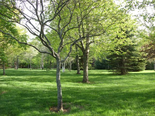
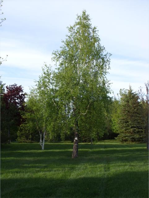
The park ranger at the Dunes suggested a visit to this place, which I would have never found on my own. It is not listed in the guidebook we had, and it doesn't feature on almost any of the tourist information about the area on the web. The plantation was the project of Jean Irving, the wife of local industrialist K.C. Irving. It has over 5,000 trees and shrubs of species native to New Brunswick, and is fertilized with compost created from recycled organic matter collected at the nearby Irving Eco-Centre.
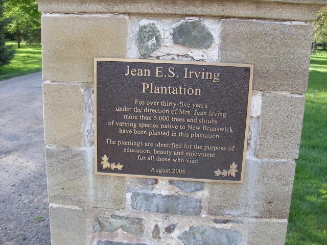 |
The sign near the main parking area. An identical sign on the other side of the gravel drive said the same thing in French. |
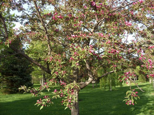 |
A sign declares this to be a "flowering crab" tree. I assume that's shorthand for a flowering crab-apple tree. |
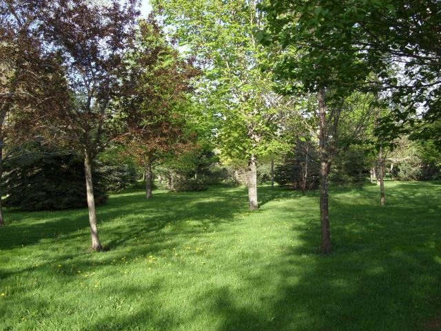 |
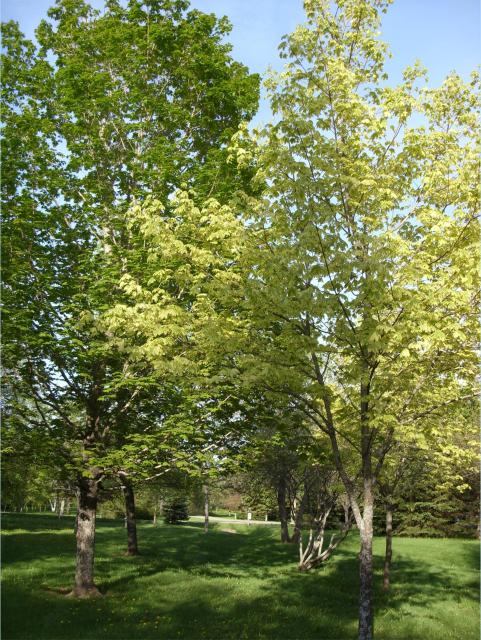
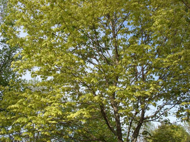
A variety of deciduous trees. All of the trees were planted in a luxurious lawn with many footpaths through it. |
 |
A silver maple. |
 |
A red oak. |
 |
Not all of the trees had signs describing what they were. |
 |
More trees. |
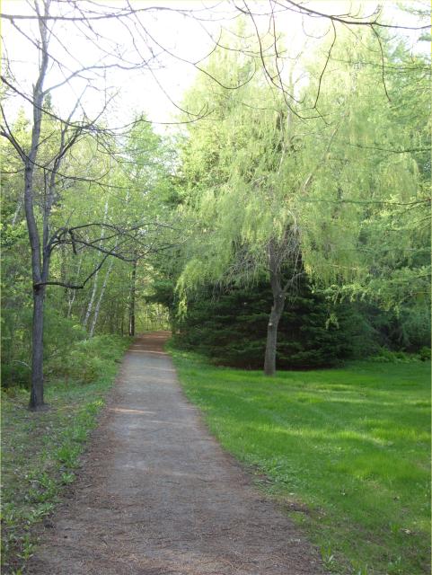 |
One of the footpaths leading into a grove of evergreens. |
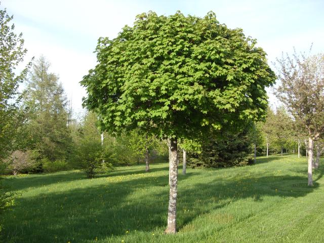 |
I suspect that this tree had to be pruned to look like this. |
 |
This seems like an ideal place for a summer picnic. |
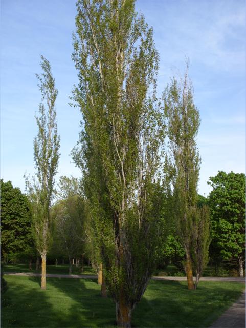 |
Some tall, skinny trees. |
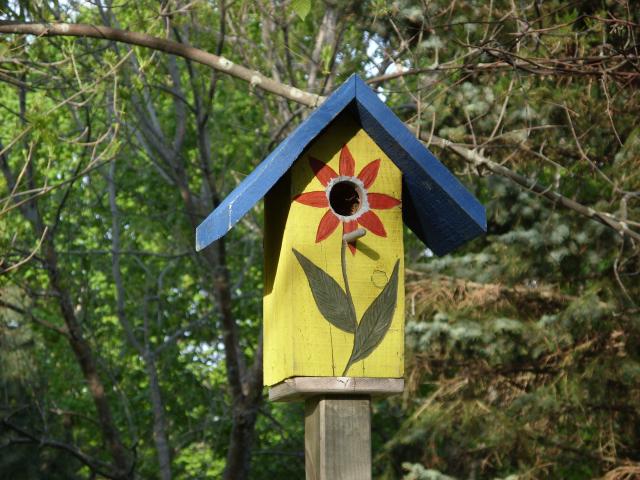 |
A birdhouse in the middle of the trees. |
 |
This tree is a harlequin maple. |
 |
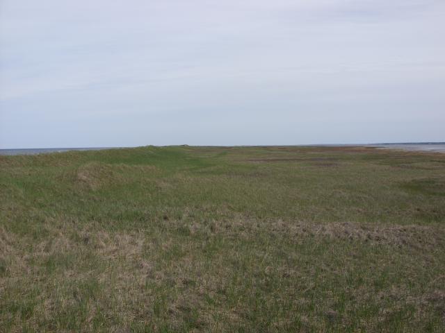
The northern end of the plantation ends in an expansive lawn leading to a nice creek. |
 |
The creek flows into the Northumberland Strait about a half mile away, and is clearly impacted by the low tide. |
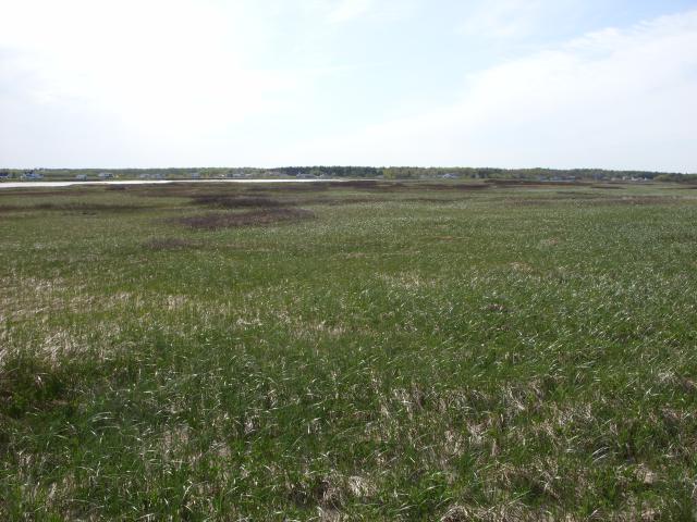
 |
The view upstream. |
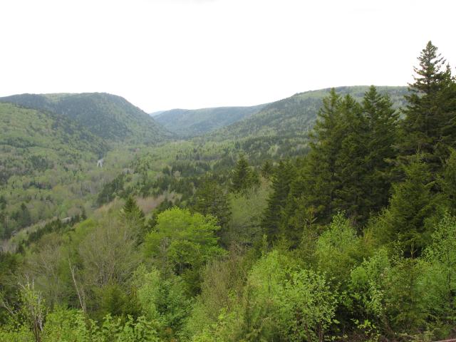
Crooked Creek Lookout Park is located near the village of Riverside-Albert and New Horton Lake on the Bay of Fundy coast. It was a scenic park with a short hiking trail.
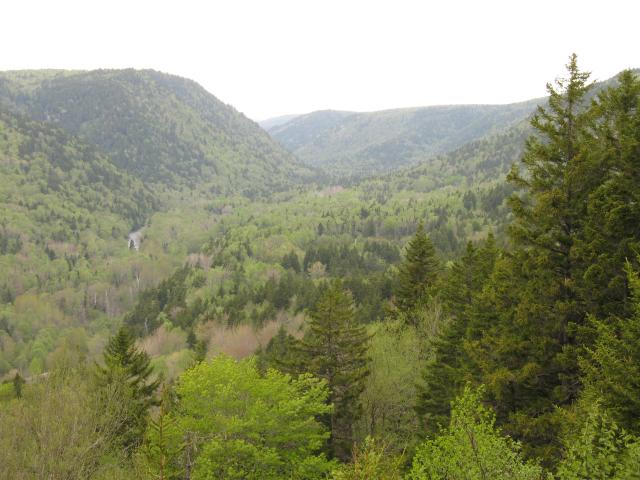 |
The small valley in which Crooked Creek flows. |
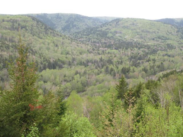 |
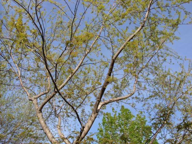
The forest had a few evergreens, but was mostly deciduous trees, many of which were still leafing out for the summer season. |
 |
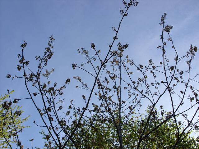
You can see some of the trees in the foreground still have sparse leaf cover. |
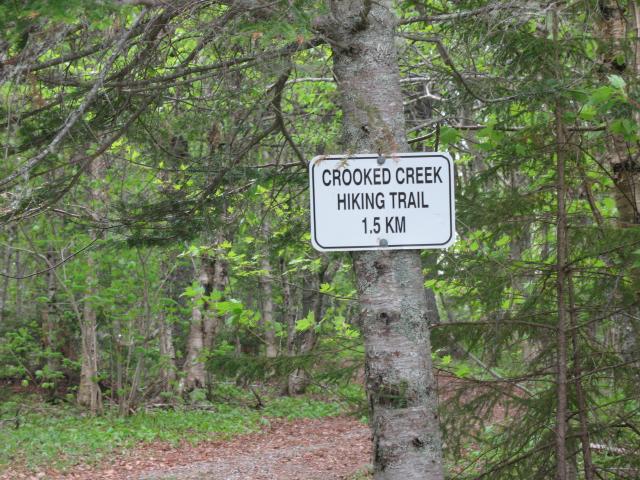 |
The hiking trail was almost one mile long. |
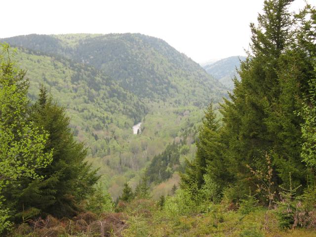 |
Some of the dramatic views of the valley. |
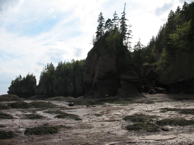
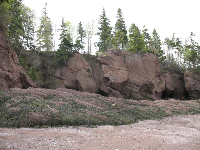
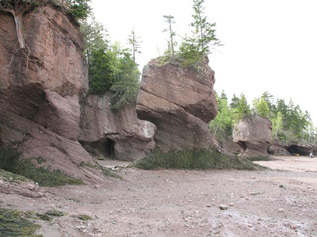
The Hopewell Rocks Park on the Bay of Fundy features unique rock formations that have unusual shapes. The rocks are sedimentary sandstone and have been separated from the shoreline by surface water erosion. Sea water coming in and going out on the extreme tides of the Bay of Fundy have eroded the rocks at the bottom more than at the top, creating their unusual shape.
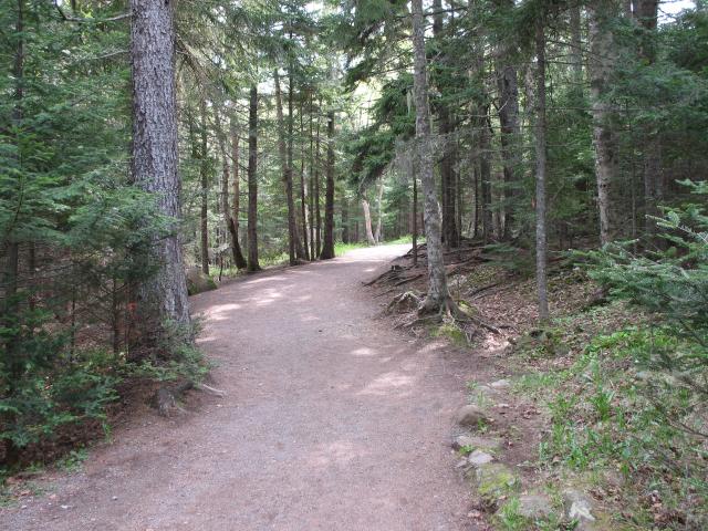 |
The path through the trees down to the shore and the rocks. |
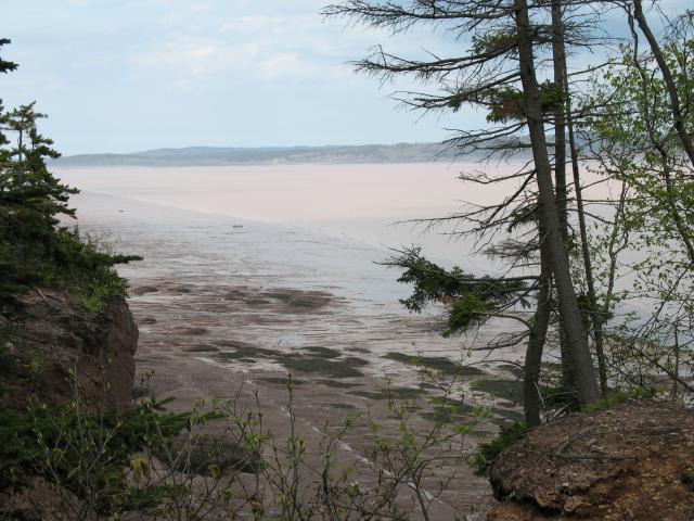 |
The beach and the Bay of Fundy, as seen from the trail. |
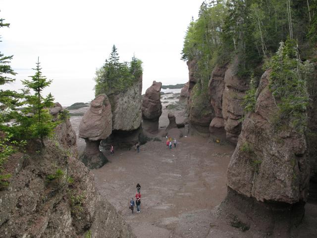 |
At low tide, you can go down onto the sand and walk around the base of the rocks. |
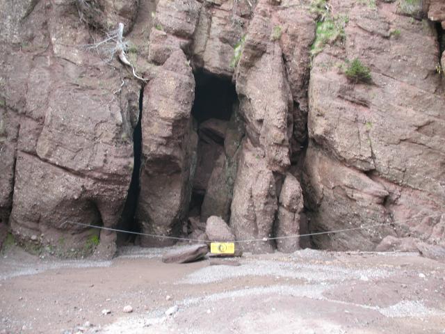 |
There are lots of caves and fissures in the sandstone cliffs. This one is roped off from tourist access. |
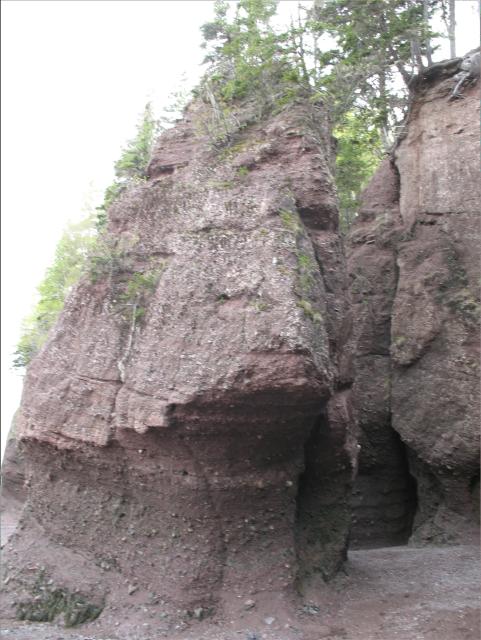 |
You can see the erosion of the rocks caused by the tides. |
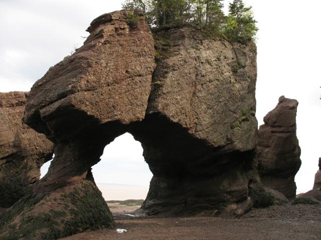 |
These two rocks form a kind of arch. |
 |
Even at low tide, the sand is very muddy. There are a lot of tidal pools. |
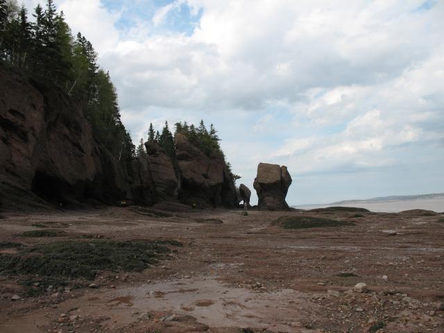 |
More rocks. |
 |
At high tide, you would want to be on top of the cliff. |
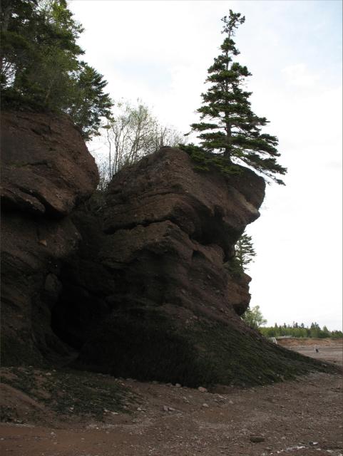 |
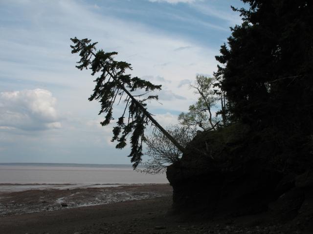
An evergreen tree growing straight out of the top of one of the rocks. |
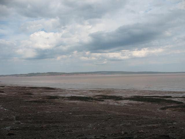 |
The Bay of Fundy at low tide. |
 |
The shape of the rocks has led them to also be called Flowerpot Rocks. |
 |
A tree growing at a severe angle out from the cliff. |
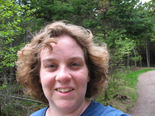 |
Jen, on the trail back to the car. |
| Last Updated 18 December 2025 |